Geodiversity and Geoheritage: Building a Case Study for Cilfái

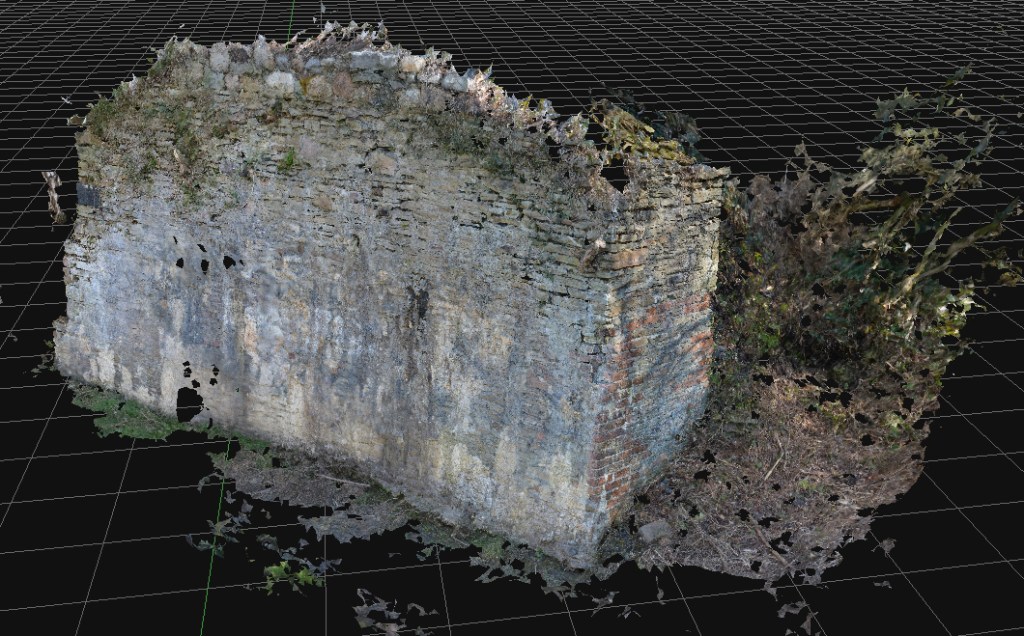
In the autumn of 2022, the local Council announced their plans to remodel the ancient Kilvey Hill landscape for a new tourism development, which would destroy the traces of thousands of years of human habitation and endeavour. The impending destruction led me to do what I could to record the history, ecology, biodiversity and Geoheritage of what is a significantly under-recorded landscape with considerable potential for education, well-being and climate change management.

Documenting the history and biodiversity was relatively straightforward, albeit a challenge to perceptions regarding a large area of land that many people see but few have experienced and even fewer understand. I remember one comment from the local authority about ‘there is nothing up there’.  A comment I later understood as a self-serving phrase to make the destruction and loss more comfortable for planning permissions.

Above: The thinly bedded sandstones of sandstone on Kilvey are part of a broad range of types of structure on Kilvey, along with massive beds heavily used for building stone and the bituminous coal seams that were so important to early Medieval Swansea.

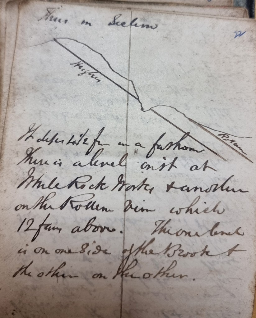
I suppose my perceptions were different, having had the advantage of a geological education at school and undergraduate level, including a hectic month of field mapping coastal regions of the Isle of Wight back in the day. I hadn’t appreciated how much of that had stuck with me until I needed to explore the Geodiversity of the Hill through documents, fieldwork and the wonderful archive of the British Geological Survey.

The fact that the natural heritage of any country includes its geological heritage is now slipping away from us. The wonderful naturalists’ clubs of the early twentieth century, such as the Swansea Scientific and Field Naturalists’ Society, were a broad church to all aspects of nature, including geology.  But they have disappeared in the swing towards wildlife rather than general nature conservation, which has permanently obfuscated much of our wonderful Welsh geological heritage. The process accelerated as Naturalists’ Societies changed their names to Wildlife Trusts.

The collapse of geology as a subject deemed worthy of learning and the dissolution of the geological part of the National Museum for Wales have meant that describing the significance of geological sites has become challenging, as basic literacy in the nature of rocks and the landscape is in freefall.

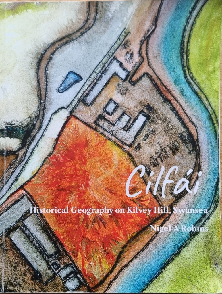
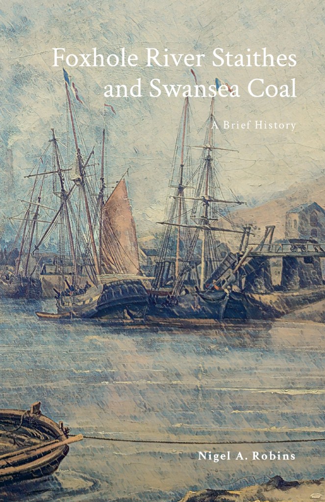
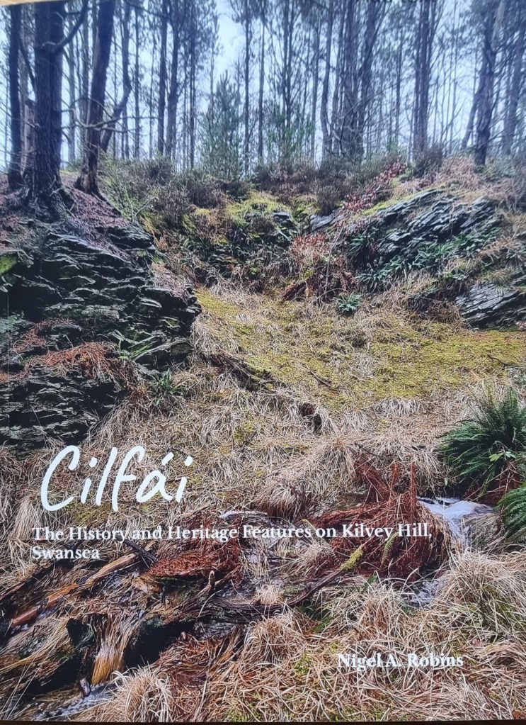
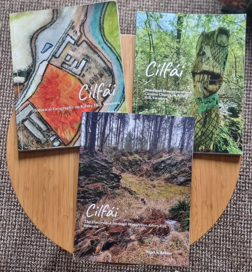
Geoheritage and Geodiversity featured strongly in my first book on the history of Cilfái, not least because it was good history as well as good geology (Robins 2023a). I sought to highlight the significance to local heritage of the geology by separating ecology, biodiversity and climate change into the second Cilfái book (Robins 2023b). However, I felt my treatment of Geoheritage in the first book was not enough. I included a more substantial piece on Swansea’s coal history in my book on the Swansea Foxhole Coal Staithes, but the rich history of William Logan, Hendry de La Beche and Aubrey Strahan clearly deserves more (Robins 2025).

‘Every outcrop has the potential to be great’ (Clary, Pyle, and Andrews 2024) was an opening line to a recent special publication from the Geological Society. It’s a great opening line, and it sets a very positive note for a lively discussion on Geoheritage on a landscape scale. It’s a sentiment that is less positively upheld in Wales where our process of listing or recording sites of geological interest is haphazard and starved of interest and funds.

Above: An extract from one of William Logan’s many notebooks from the 1830s. Logan made regular visits to the outcrops above White Rock as he sought to understand stratigraphy and dip of the beds for coal exploration.

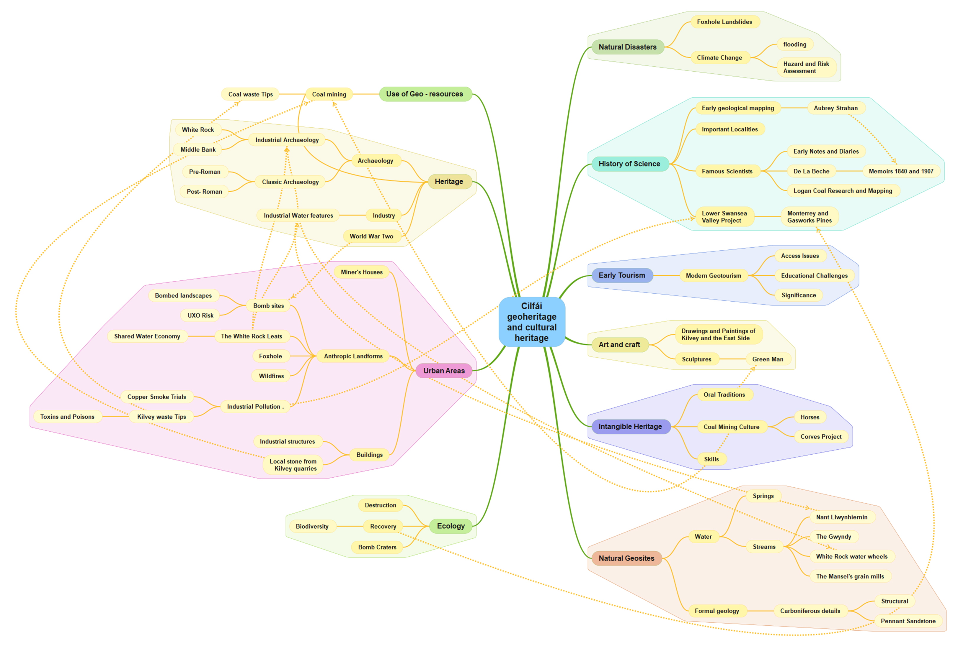
Nevertheless, the listing of a Kilvey site visit on the coming UNESCO International Geodiversity Day is a good opportunity to explore and reassess local Geoheritage. In preparing information for the International Geodiversity Day, I was particularly struck by a recent article linking Geoheritage and Cultural Heritage (Pijet-Migón and Migón 2022). The authors have introduced a model of themes at the Geoheritage-Cultural Heritage ‘interface’. It’s a very useful summary of what to explore or be aware of when revisiting geological sites. It helps move forward from traditional geological guides and texts (Owen 1973), which, although very useful, need to be modernised and broader in scope and engagement for a new generation.

Although the Pijet-Migón model doesn’t fit everything, for example, it can be broadened to explore the link between Biodiversity and Geodiversity, it is very useful. Here’s the Cilfái Geoheritage Landscape filtered through an amended model:

Clary, Renee M., Eric J. Pyle, and William Andrews. 2024. ‘Encompassing Geoheritage’s Multiple Voices, Multiple Venues and Multi-Disciplinarity’, Geology’s Significant Sites and Their Contributions to Geoheritage, no. Special Publication 543, pp. 1–7, doi:10.1144/SP543-2024-34

Owen, T.R. 1973. Geology Explained in South Wales (David & Charles)

Pijet-Migón, Edyta, and Piotr Migón. 2022. ‘Geoheritage and Cultural Heritage – A Review of Recurrent and Interlinked Themes’, Geosciences, 12.98, doi:10.3390/geosciences12020098

Robins, Nigel A. 2023a. Cilfái: Historical Geography on Kilvey Hill, Swansea (Nyddfwch)

——. 2023b. Cilfái: Woodland Management and Climate Change on Kilvey Hill, Swansea (Nyddfwch)

——. 2025. Foxhole River Staithes and Swansea Coal (Nyddfwch)

The Foxhole Coal Staithes, Swansea

The Foxhole River Staithes are a set of enigmatic structures on the banks of the River Tawe near the remains of the White Rick Copper Works. Although now hidden by trees and slowly deteriorating, they were once the centre of the incredible coal industry that dominated Kilvey and Foxhole in Swansea. This book describes the history of coal in early Swansea and explains the significance of the last remaining structures of the coal industry of early Swansea before the arrival of copper smelting in the 1730s

I completed my cheap photography project last month, and added it to my early Swansea coal history book.

The history of Swansea coal is being lost amongst all the noise and gravy train funding for the Hafod/Morfa Copperopolis story. My work on Swansea coal is meant to redress some of that imbalance and cast new light on a part of the Lower Swansea Valley that isn’t considered important.

The photogrammetry was a great success, completed for a few hundred pounds rather than the thousands claimed by local firms. The constraints were to use second-hand cameras and computers, and to provide imagery of a quality and level of detail that would prove useful. No drones were used as we found that they were adding a layer of costs and complexity that was distorting the value of what should be an extremely cheap and quick process.

After discussing the protocols with a couple of BIM colleagues, I looked at the protocols described in this 2011 paper (listed below). Despite being a little older than the average BIM work these days, the workflows were good, easily replicated, and I could learn how to use simpler, older cameras for the imagery.

There was a series of trials of various landscape and heritage features, ranging from riverside bollards, dock walls, and larger landscape features such as bomb craters and threatened landscapes. The larger subjects needed drone input, and so they were discarded, although some beneficial results were obtained for researching biodiversity and small-scale features which I’ll follow up in a later project.

The study subjects were the Foxhole River Staithes, which were of good size (typically about 8m wide, 3m high) and interesting construction. The photographic survey took just over three days, with about four thousand images collected. Office processing of the imagery took about three days.

Above: An ‘aerial’ view of one of the Staithe Structures reconstituted from ground photogrammetry, no drones, merely ground camera work.
Above: Another view of Foxhole Structure B. A series of stone retaining walls that originally had timber decking, allowing the loading of coal into various-sized river vessels. Built in the early eighteenth century, probably before extensive copper smelting had begun.
Above: Some of the mines and coal veins of early Swansea, discussed in the book.

The photogrammetry was included in a book giving a brief history of coal in Swansea and the significance of the Foxhole area in pre-industrial Swansea.

Fai, Stephen & Graham, Katie & Duckworth, Todd & Wood, Nevil & Attar, Ramtin. (2011). Building Information Modeling and Heritage Documentation.

“The Foxhole River Staithes are a set of enigmatic structures on the banks of the River Tawe near the remains of the White Rick Copper Works. Although now hidden by trees and slowly deteriorating, they were once the centre of the incredible coal industry that dominated Kilvey and Foxhole in Swansea. This book describes the history of coal in early Swansea and explains the significance of the last remaining structures of the coal industry of early Swansea before the arrival of copper smelting in the 1730s. The story of the coal mines of Swansea, the coal export trade and the ships that visited eighteenth-century Swansea are all described. The book also includes the results of photogrammetric surveys of the surviving structures to give the story of the true significance of the Foxhole Staithes and their place in Welsh history.”

Foxhole River Staithes and Swansea Coal 1300-1840https://www.lulu.com/shop/nigel-a-robins/foxhole-river-staithes-and-swansea-coal-1300-1840/paperback/product-656z44z.html?page=1&pageSize=4

Details

Publication Date Apr 19, 2025

Language English

ISBN9781739353353

Category History

CopyrightAll Rights Reserved – Standard Copyright License Contributors

By (author): Nigel A Robins

Specifications

Pages 104, Binding Type Paperback, Perfect Bound, Interior Color Color

Dimensions US Trade (6 x 9 in / 152 x 229 mm)

More on Swansea Valley photogrammetry

For many projects in restoration and landscape, there has been a tendency to overemphasise gee-whiz graphics at the cost of scholarly historical analysis. The project here puts the technology back where it belongs, in the background of support for investigation and analysis.

The rapid development and delivery of this project is almost complete. The proof of concept of quick and cheap photogrammetry is complete, and we explored various features of various sizes. Budget constraints in the broader London-based programme meant that the planned exploitation phase won’t take place there. The plan was to explore some large, immoveable sculptures and statues at risk of damage by surrounding building renovation. Instead, I’ll work in South Wales on a series of local history and geography projects.

Costs were remarkably low (which we believed they would be). It is satisfying to use new technologies to reduce costs and fight against the gradual cost inflation and scope creep of using these types of technologies in small history or geography projects. In researching the business case for this, I learned of several local authority projects where high costs for archaeological surveys, often incorporating expensive drone surveys and extraordinary labour costs, skewed project delivery budgets almost to the cancellation of the projects. I experienced the same issues working on the restoration of the Palace of Westminster, where incredible finances and resources were expended on expensive lidar and photogrammetry products that were who;;y unsuitable for the problems and frequently misled managers into thinking that such products were essential elements of the restoration at RIBA Stages 1 and 2 .

For many projects in restoration and landscape, there has been a tendency to overemphasise gee-whiz graphics at the cost of scholarly historical analysis. The project here puts the technology back where it belongs, in the background of support for investigation and analysis.

Above: A test scan of a significant rock exposure on Cilfái Hill in Swansea. Upper Carboniferous Pennant Sandstone with a forty-degree dip north. This is an exposure in an area where William Logan and Henry De la Beche discussed the general stratigraphic layout of the South Wales Coalfield. Some of the exposures have copper nails struck into the rock, which may have been part of Logan’s levelling work in the late 1830s. These exposures are at risk of destruction by Swansea Council’s tourism redevelopment of the area, so it is good to get a good scan of them before they are destroyed.
Above: An old coal loading dock in the Lower Swansea Valley, known as a ‘Staith’. Probably dating from the 1740s, this was built to make loading coal into ships in the river easier. The coal came down the east-side tramways and later the canal. This is a scheduled ancient monument but has been neglected by Swansea Council and is now deteriorating. Ironically, the monument’s destruction has been accelerating because of the encroaching woodland and the dumping of industrial waste. This structure is incredibly rare; there may only be two others in Wales, and they are also in the Lower Swansea Valley. Again, this is a low-cost photogrammetric scan taken as an emergency whilst extensive finances are expended elsewhere in the Valley on Council-led projects.

Costs are kept low by avoiding the use of drone technologies, using older and previously-used professional cameras bought cheaply on Ebay, and new software costing a few hundred Euros.

The next steps are researching the history of coal industry structures in the valley, followed by some investigation of some World War Two remains on Cilfái.

The importance of Referencing in writing

Last week, I spoke with an academic friend who was furious to find that an editor had amended one of his articles by altering the footnotes and referencing. He was understandably annoyed because it was without his permission and wasn’t even notified!

When he mentioned it, I remembered it had been done to me on several occasions. On one occasion, I queried why it had been done without reference back to me and was told it was for space saving. Enquiring further, I realised the reason was primarily that the editors had very little understanding of citations and referencing and eventually admitted that they ‘didn’t actually follow any recognised style or referencing format’. Indeed, when I looked back at a few back copies of their journal, I could see that it was true…woefully so.

In these days of Artificial Intelligence (AI) and countless automated writing tools, detailed referencing is vital. If I can’t explain where I got a piece of information from, how can anyone believe me? Even if barely 2% of my readers look up a reference to read further or verify something I have written, it is always there to be verified.

AI is making belief in the written word much harder. In my work as a consultant, I often saw colleagues prepare reports and presentations, often for considerable cost, and be totally silent on their sources. I know this was to hide the amount of plagiarism, passing off, duplication, and Wikipedia work that was often conducted as ‘serious’ research. I never did this and was often criticised for revealing my sources, usually by the people being fired whilst I retained contracts and the confidence of my employers.

The rise of fake academic papers is alarming.

AI is now being used to write all sorts of technical, legal, and medical reports and articles, and it is smart enough to generate false references and citations to support its arguments. The AI trend is devaluing knowledge and expertise and reducing confidence in what we can rely on, whether that is local history or cancer treatments.

Many others are now declining the opportunity to appear in electronic journals, and everything I research and publish is referenced. From now on, my books and longer-form research will only be published in paper form, and only abstracts will be released online. Of course, this hasn’t stopped people from individually scanning books, and I have seen electronic versions of the Cilfái trilogy already appear.

Equally, AI is an immensely valuable tool for research. I will frequently use AI tools for library searches or organising my thoughts on a topic. They are increasingly powerful and need to be used wisely.

Above: One of my Lit Map citation searches allowing me to quickly locate relevant authorities on the research topic.
Above: AI and Google at work. A report on people (and robots) searching for my writings.