One of the most remarkable items on display in Swansea Museum is the model of the Plas House and the surrounding streets from the 1820s. It was extemely useful to be able to examine the model when I was reconstructing the layout of the streets for the Y Tân book.
It is difficult to create a good quality map of the town streets until the creation of the 1852 Board of Health plans. The model in the museum is topographically corect and I was able, with the help of modern technology, fix an exact position of the Plas House and its relationship to Temple Street. Knowing the positions of these two things makes it easier to understand the construction of Ben Evans and what happened after the war, when it became Castle Gardens.
The model is on the first floor of the museum.
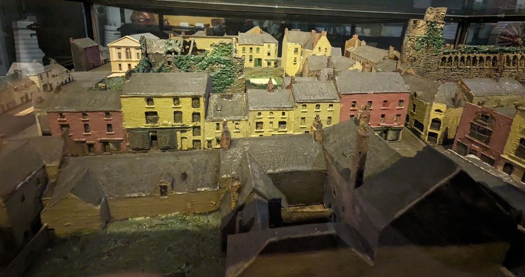
1820s. The model has pride of place in Swansea Museum. The row of houses
coloured yellow and pink are in Caer Street and you can see the castle on the right.
Behind Caer Street you can see the ruins of the Plas House, covered in vegetation.
The types of vegetation covering the ruins are described in chapter 5.
You can but the book online here Y Tân (lulu.com)