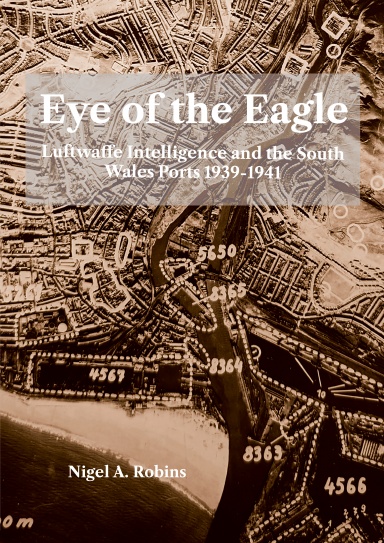
This has now been reissued as a 2025 Second Edition. I’ve also updated the copyright and EU product compliance details.
The first version of Eye of the Eagle was published in 1993. At that time, the research was to look at local landscape history, and British government aerial photographs were prohibitively expensive for such research, whereas, with a bit of effort, the Luftwaffe aerial surveys were freely available albeit via the record offices of the USA. As a geographer, my first instinct was to look for photographs and maps that give a first impression of a landscape before experiencing the land by walking. Since those days, a revolution in information sciences has changed so much. British record offices are far easier to engage with, and online and digital sources provide a wealth of resources and historical riches that were undreamed of in the 1990s. Combining the images with appropriate GIS/GPS systems has provided spectacular insights into ancient woodland and post-industrial recovery of land.
However, what has not changed is the research and writing techniques that underpin our discipline. This book has been written several times, only to be rewritten when new sources become available or are revealed in the improved access or digitisation of various records. Some of the many images and sources you will see here were rescued from rubbish dumps as organisations sought to ‘become digital’ in the early 2000s by throwing away ‘old’ records. Which explains their rather ‘worn’ looks.
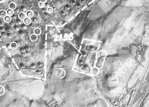
Llandarcy showing destroyed oil tanks and near misses after the 1940 bombing raids.
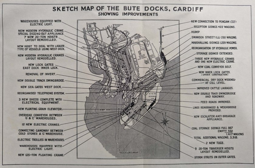
One of the GWR plans of Cardiff used by thew Luftwaffe to plan their air attacks in September 1939.
I’m still working on the history of geological exploration in and around the Swansea area. Some of it was included in the first Cilfái book, where I wrote about the early work history of William Logan, who learned much of his early geology studying the coal veins of Cilfái.
Knowledge of every coal vein in the area was once the lifeblood of the Industrial Revolution. It is hard to believe now when we can walk through the lush green vegetation of Cilfái without seeing any evidence of the past unless we make an effort to dig to find some.
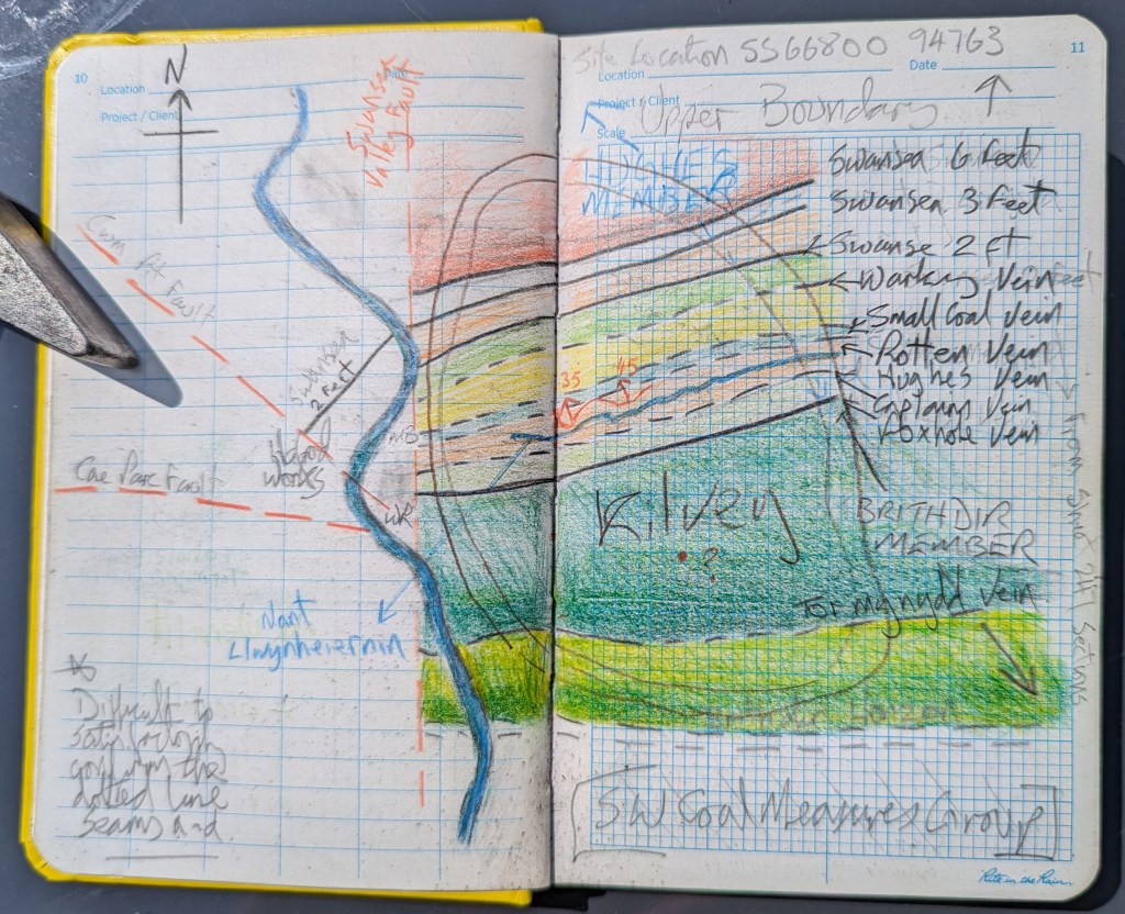
During our ITV filming on Monday, I was asked about the Tormynydd coal seam. This substantial coal layer, which extends from the seaward side of the hill to Neath and Port Talbot, played a pivotal role in the Industrial Revolution. Like all Cilfái coals, it is bituminous or binding coal that can burn with a cloud of thick black smoke and tends to stick in big lumps when it burns down. (Conybeare and Phillips 1822: 426). The Tormynydd vein is at the bottom of the sketch map and is marked today by a line of big quarries and tunnels across the front of the hill.
My sketch map of the coal veins across Cilfái. It has to be in pencil because I keep updating it as I find more sources and information.
Knowledge of the coal veins of Cilfái and wider Swansea was passed from father to son for generations and it wasn’t until the 1790s that people started to think seriously about understanding the nature and relationship of the underground coal veins. The first map of coal in the area is William Smith’s map dated 1815 (but based on considerable local knowledge). There’s an extract of it below (Macfarlane 2020).
My sketch plan is based on diaries and memoirs from various times. It is incredible to think that Cilfái had about 10 coal veins providing coal for White Rock and Middle Bank in the 1790s
Above: This is an extract from the earliest map of the local Geology we have. This is dated 1815, but is based on lots of earlier information from the 1700s. This map pre-dates the Ordnance Survey plans for Swansea so gives us a different view of priorities for understanding the main features of Swansea. William Smith had to devise a set of colours to depict the different types of rock (or ‘Strata’ ) that he found. Smith decided on blue to depict limestone…a convention that we still honour today. The grey shading is the ‘coal measures’, the rocks of sandstone and mudstone that contained the precious coal seams (veins in Smith’s time). The fact that Kilvey has a place name shows how important the hill was as a landmark in Swansea’s coal geography. You can see the crosses that mark the location of Swansea’s biggest coal mines at the time of the Napoleonic Wars.
Conybeare, William Daniel, and William Phillips. 1822. Outlines of the Geology of England and Wales: With an Introductory Compendium of the General Principles of That Science, and Comparative Views of the Structure of Foreign Countries … (W. Phillips)
Macfarlane, Robert. 2020. STRATA: William Smith’s Geological Maps, 1st edition, ed. by Oxford University Museum of Natural History (London: Thames and Hudson Ltd)