More on Swansea Valley photogrammetry

For many projects in restoration and landscape, there has been a tendency to overemphasise gee-whiz graphics at the cost of scholarly historical analysis. The project here puts the technology back where it belongs, in the background of support for investigation and analysis.

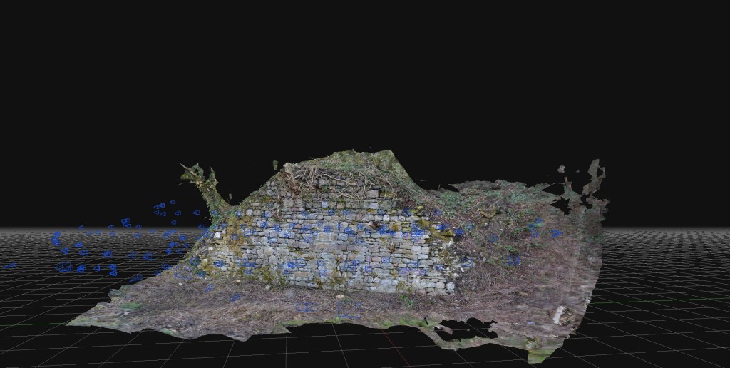
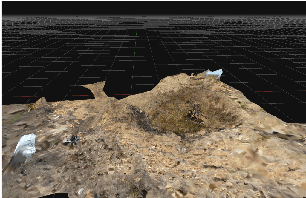
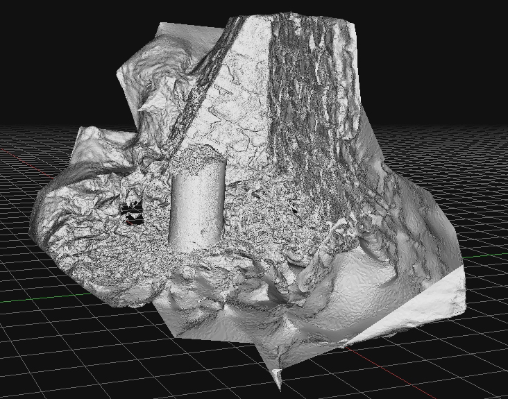
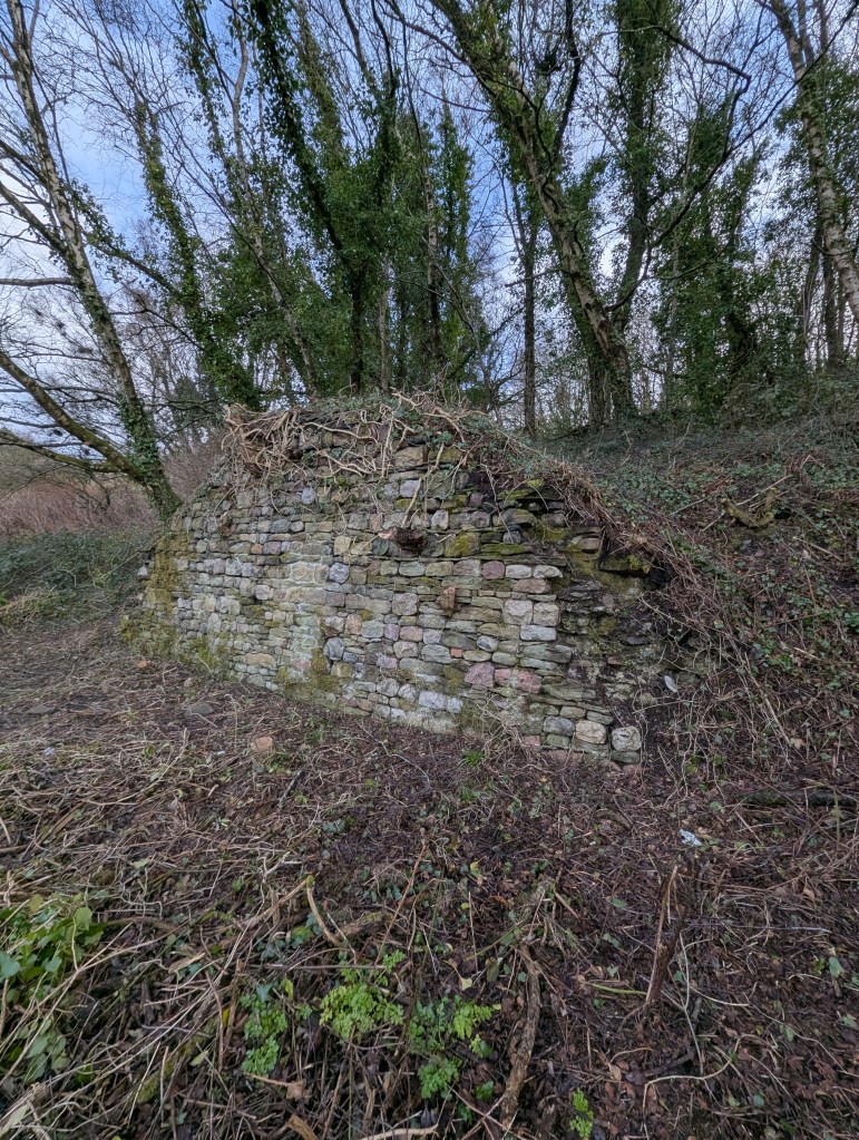
The rapid development and delivery of this project is almost complete. The proof of concept of quick and cheap photogrammetry is complete, and we explored various features of various sizes. Budget constraints in the broader London-based programme meant that the planned exploitation phase won’t take place there. The plan was to explore some large, immoveable sculptures and statues at risk of damage by surrounding building renovation. Instead, I’ll work in South Wales on a series of local history and geography projects.

Costs were remarkably low (which we believed they would be). It is satisfying to use new technologies to reduce costs and fight against the gradual cost inflation and scope creep of using these types of technologies in small history or geography projects. In researching the business case for this, I learned of several local authority projects where high costs for archaeological surveys, often incorporating expensive drone surveys and extraordinary labour costs, skewed project delivery budgets almost to the cancellation of the projects. I experienced the same issues working on the restoration of the Palace of Westminster, where incredible finances and resources were expended on expensive lidar and photogrammetry products that were who;;y unsuitable for the problems and frequently misled managers into thinking that such products were essential elements of the restoration at RIBA Stages 1 and 2 .

For many projects in restoration and landscape, there has been a tendency to overemphasise gee-whiz graphics at the cost of scholarly historical analysis. The project here puts the technology back where it belongs, in the background of support for investigation and analysis.

Above: A test scan of a significant rock exposure on Cilfái Hill in Swansea. Upper Carboniferous Pennant Sandstone with a forty-degree dip north. This is an exposure in an area where William Logan and Henry De la Beche discussed the general stratigraphic layout of the South Wales Coalfield. Some of the exposures have copper nails struck into the rock, which may have been part of Logan’s levelling work in the late 1830s. These exposures are at risk of destruction by Swansea Council’s tourism redevelopment of the area, so it is good to get a good scan of them before they are destroyed.
Above: An old coal loading dock in the Lower Swansea Valley, known as a ‘Staith’. Probably dating from the 1740s, this was built to make loading coal into ships in the river easier. The coal came down the east-side tramways and later the canal. This is a scheduled ancient monument but has been neglected by Swansea Council and is now deteriorating. Ironically, the monument’s destruction has been accelerating because of the encroaching woodland and the dumping of industrial waste. This structure is incredibly rare; there may only be two others in Wales, and they are also in the Lower Swansea Valley. Again, this is a low-cost photogrammetric scan taken as an emergency whilst extensive finances are expended elsewhere in the Valley on Council-led projects.

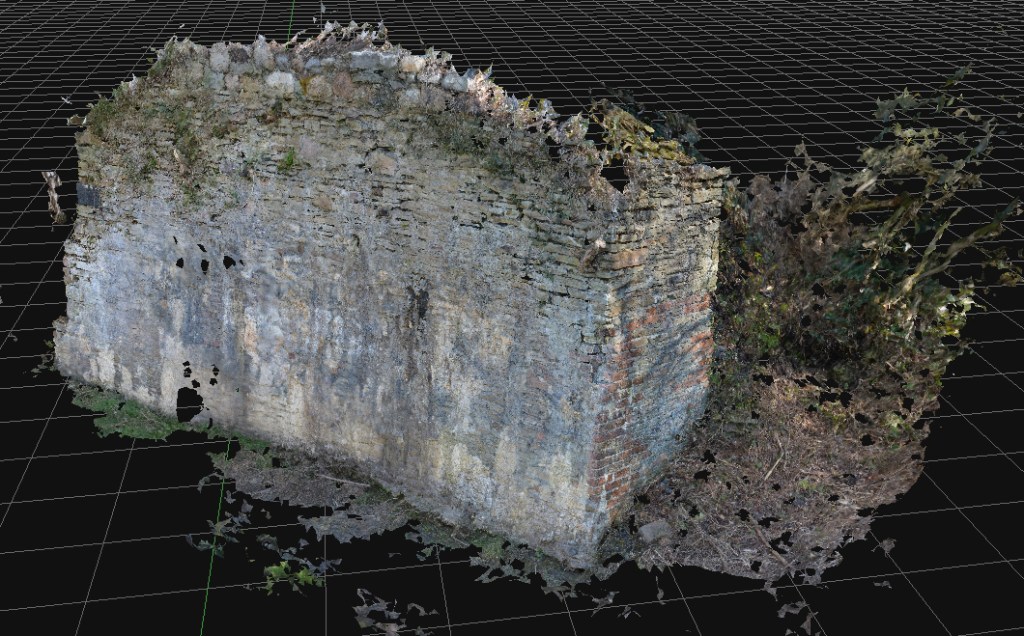
Costs are kept low by avoiding the use of drone technologies, using older and previously-used professional cameras bought cheaply on Ebay, and new software costing a few hundred Euros.

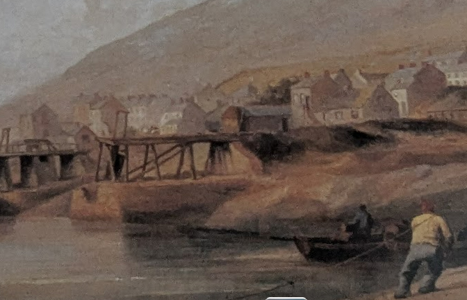
The next steps are researching the history of coal industry structures in the valley, followed by some investigation of some World War Two remains on Cilfái.

Low cost photogrammetry in the Lower Swansea Valley

The work here was added to original surveys carried out in the 1980s, and a comparison with photographic records allowed a visual check of the structure’s deterioration and environmental changes. A review of the geology of the structure’s building materials could also be carried out, which revealed distinctive contrasts between this structure and other post-1737 structures and walls nearby.

I’m really pleased that this small project is now starting to yield results! The first delivery was a series of scans and interpretations of some rare dock structures on the banks of the River Tawe. Some of the structures are scheduled ancient monuments, but the oldest and rarest are not!

The brief for this structure was a cheap and accurate photogrammetric survey at the lowest cost, allowing for interpretation and enhancing the historical information from earlier work and new research. The requirement was cheap, quick and accurate, which meant no expensive drone or landscape surveys.

Above: An early eighteenth-century coal staith remains in the Swansea Valley.

The work here was added to original surveys carried out in the 1980s, and a comparison with photographic records allowed a visual check of the structure’s deterioration and environmental changes. A review of the geology of the structure’s building materials could also be carried out, which revealed distinctive contrasts between this structure and other post-1737 structures and walls nearby.

There is still much to do, including costing the project and leveraging the technology more effectively on little-known structures in the area.

More photogrammetric research on small landscape features

The concept of quick and cheap photogrammetry is now proven, and simple work like this can be comparable to expensive archaeological surveys, which cost far more, often a hundred times more than current archaeological firms charge.

As I said earlier, the purpose of this project was a proof of concept on using photogrammetry as cheaply as possible to allow quick and accurate reconnaissance and survey of small features that generally would not be investigated or be too expensive to survey using current high-cost photogrammetry, drone and lidar techniques.

This example is a bomb crater on Kilvey Hill. The crater was most likely created in the January 1941 attack on the town. The crater is from a large calibre bomb (possibly 250kg) that has penetrated some way into the soft, marshy ground and then detonated.

In the 84 years since the detonation, the crater has softened with the crater lip mostly eroded. The crater frequently fills with water and has a different botanical nature to the surrounding grassland. This crater is a local biodiversity hotspot, allowing moisture to be present all year round and providing better protection from excessive temperatures. A large pine in the centre of the crater has died providing a reservoir of dead wood.

Above an extract from an initial 3D model of one of the Kilvey bomb craters, 2025.

The concept of quick and cheap photogrammetry is now proven, and simple work like this can be comparable to expensive archaeological surveys, which cost far more, often a hundred times more than current archaeological firms charge.

Using Photogrammetry for our local heritage at White Rock

When I worked on the Palace of Westminster Restoration and Repair programme, photogrammetry and point clouds were absurdly expensive, and R&R was very vulnerable to overspending and out-of-control costs in obtaining basic survey imagery. Equally, archaeology drone surveys seem to be moving in the same direction…expensive and complicated.

Making progress with accessible and cheap photogrammetry for small and very small landscape features. This project is to develop cheap workflows for local authorities and heritage groups to quickly obtain helpful heritage survey information.

Above: Basic scan of a very old riverside bollard that may have had a very surprising history.


When I worked on the Palace of Westminster Restoration and Repair programme, photogrammetry and point clouds were absurdly expensive, and R&R was very vulnerable to overspending and out-of-control costs in obtaining basic survey imagery. Equally, archaeology drone surveys seem to be moving in the same direction…expensive and complicated.


This project uses recycled cameras and computers to bring survey details within the reach of stretched budgets, allow the survey of threatened objects to be quickly documented, and append point cloud information to correct historical details. This allows the heritage information to be prioritised and the technology back where it belongs—in the background.

This riverside bollard was probably installed in the early 1800s and may be a repurposed atmospheric steam engine cylinder from the eighteenth century. The first of a portfolio of artifacts to be surveyed and interpreted as part of a landscape history programme.

Above a 3D model of the bollard. This image is able to contain all the dimensions and historic information within the file. This can be done quickly and cheaply instead of expensive archaeological surveys

Lower Swansea Valley Heritage: Applying new techniques

I’ve got some funding to run a small Heritage BIM project. I’m running a photogrammetry project on a few small and less well-known industrial remains in the Swansea Valley. The proposal is to explore how effective and cost-effective cheap photogrammetry can be in surveying and analysing small structures and supplement statements of significance. With reference to CIDOC and ISO 19650.

I’ve got some funding to run a small Heritage BIM project. I’m running a photogrammetry project on a few small and less well-known industrial remains in the Swansea Valley. The proposal is to explore how effective and economical cheap photogrammetry can be in surveying and analysing small structures and supplement statements of significance. With reference to CIDOC and ISO 19650.

I worked on several Heritage BIM projects whilst an analyst on the Restoration and Repair of the Palace of Westminster. The technologies are evolving fast, and the extortionate costs of older photogrammetry are now being superseded by new technologies and approaches. I remember the original photogrammetry of the Palace was eye-wateringly costly, but once captured, hardly anyone knew how to effectively leverage the data into applied and valuable information. The result was old data that quickly went out of date and used before it could benefit the programme.

This will be an opportunity to explore revised workflows, effective use of low-cost technology, and output into usable heritage information for a few neglected monuments. It also provides an opportunity to revise old and outdated information, review the significance of the monuments in light of more recent viewpoints on heritage and interpretation, and maybe look at ontology and some standardisation and interoperability issues in HBIM. All with a view to convert data into valuable knowledge effectively and for a reasonable cost.

I’m looking forward to getting back into HBIM and a heritage project!

Above: A prime candidate: a significant structure from eighteenth-century coal mining history. It is mainly unprotected and needs modern interpretation.

Now working on the final shortlist of appropriate monuments and structures for the project. Down to a shortlist of three. The final selection will depend on the extent of the current knowledge and interpretation of the selected structure. A poorly documented structure will score higher.

If you want to know more, take a look at this Heritage building information modeling (HBIM) for heritage conservation: Framework of challenges, gaps, and existing limitations of HBIM and Photogrammetric Applications for Cultural Heritage.