The Luftwaffe surveys of the Welsh ports are an incredible record of past landscapes that have now changed. Although the intent of the reconnaissance missions was to prepare for the bombing of the South Wales ports in 1940 and 1941, they also recorded some of the earliest and finest detail if the coastal landscape. Many of the best surviving images are explained and interpreted in Eye of the Eagle: Luftwaffe Intelligence and the South Wales Ports 1939-1941.
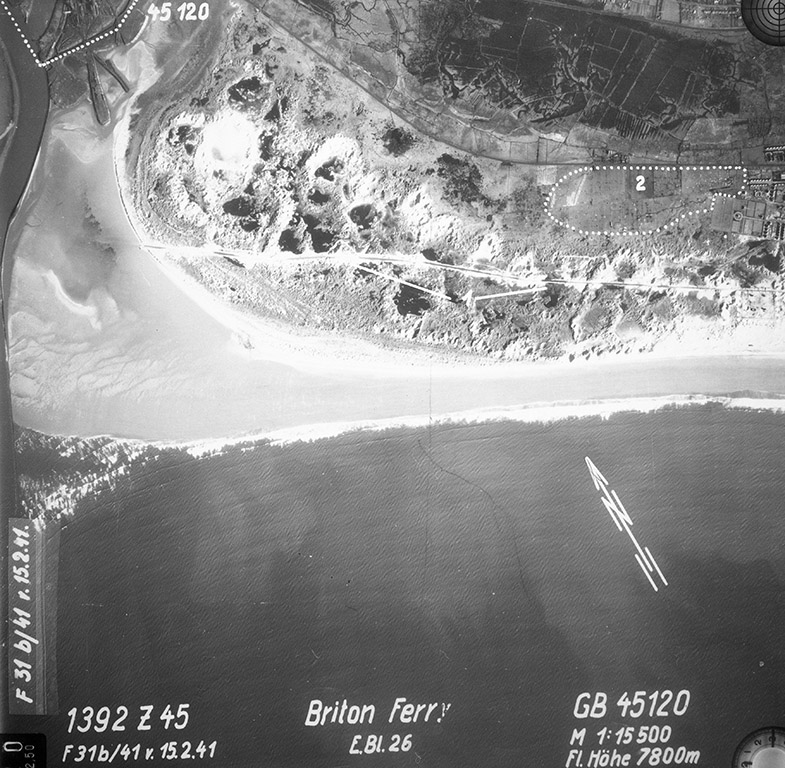
Below: The river mouth of the Afon Nedd and Briton Ferry in February 1941. The burrows had a road used since medieval times to allow travellers to cross the sands at low tides.
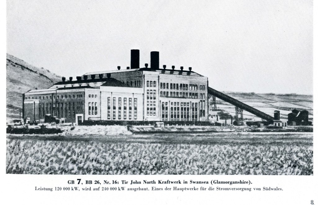
Before World War Two, the Luftwaffe intelligence assessment teams under Professor Dr. Heinrich Steinmann were interested in electricity supply. Steinmann believed that the vulnerabilities of the electricity generation and supply industries made extremely valuable strategic targets. Swansea’s power stations were particularly interesting due to their importance in the South Wales power generation network.
Swansea had two power stations, the Strand Power Station (opened in 1900) and Tir John Northeast of Kilvey (opened in 1935).
As a very modern and efficient power station, Tir John was identified as a strategic target as part of the Study Blue research into conducting an air war against Britain. In the Luftwaffe target lists, Tir John was assigned Target number GB 50 56. The full story is in Eye of the Eagle: Luftwaffe Intelligence and the South Wales Ports 1939-1941.
Below: a 1930s illustration of Tir John North power station (Kraftwerk) from German intelligence records.
You can always contact me to buy the Cilfái books. Send me a message on FB or use WhatsApp or LinkedIn. Or you can email me at my Gmail address. Eye of the Eagle will be available at an illustrated Bo0k Launch talk at Swansea Central Library in early June. I will probably do some talks on the air war over Wales later in the summer.
You can also buy copies of the Cilfái books at the lovely little shop in Swansea Environment Centre. It’s the only shop in Swansea that stocks them.
If you want to buy the books online, the easiest way is to buy them direct from lulu.com because these are the people who print them. In fact if you use Amazon all they actually do is contact lulu. So cut out the middle man and go straight to lulu.
So you can buy Cilfái: Historical Geography on Kilvey Hill, Swansea. This is the history book of the trilogy and it covers the biggest topics in the history of the Hill. So that is Coal, Copper, Pollution, Restoration and Repair and the Nature Recovery. This one also includes Annexes covering the legal background to White Rock Copper Works from 1737, and the Geological history and the pioneering explorations of William Logan. 126pp, fully indexed and referenced.
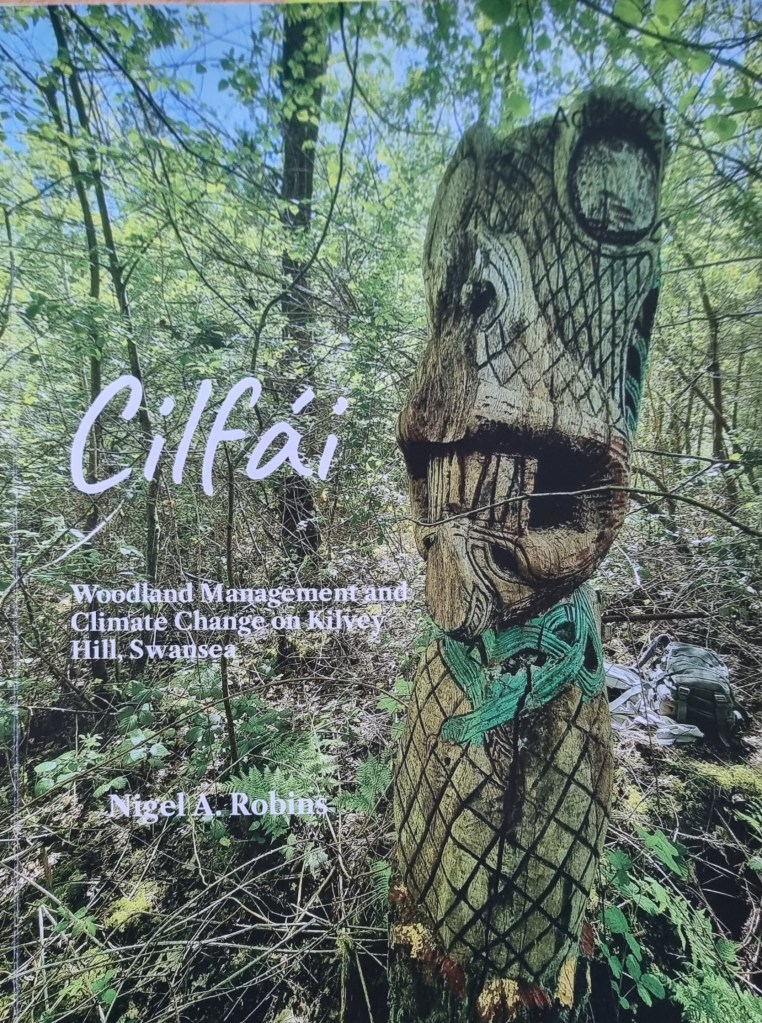
The second book of the trilogy is Cilfái: Woodland Management and Climate Change on Kilvey Hill, Swansea. This one covers the environmental issues faced by the hill and the woodlands. A lot of this one reflects my past government work as a programme reviewer for Defra, DCMS and Historic England, particularly where matters of the environment are concerned. I’m a qualified ecological surveyor and have been involved in a number of large environmental schemes since the 2010s. This book is built around my ecological surveys of the Hill and you will see a lot of Annexes here showing how we create Species and Habitat Action Plans for conservation, My records of everything I found within 1 km of The Glade (between 2010 and 2023) including Mammals, insects, Invasive Species and Reptilees and Amphibians. I also include my Open Mosaic Habitat plant list (including bombsite plants). I have produced a sample copy of a standard Woodland Management Plan to show people how to prepare a good conservation plan and I finish up with my discoveries and monitoring of bat populations on the Hill. This book also has discussions of landscape resilience and climate change issues as we saw them in UK Government.130 pp, fully indexed and referenced.
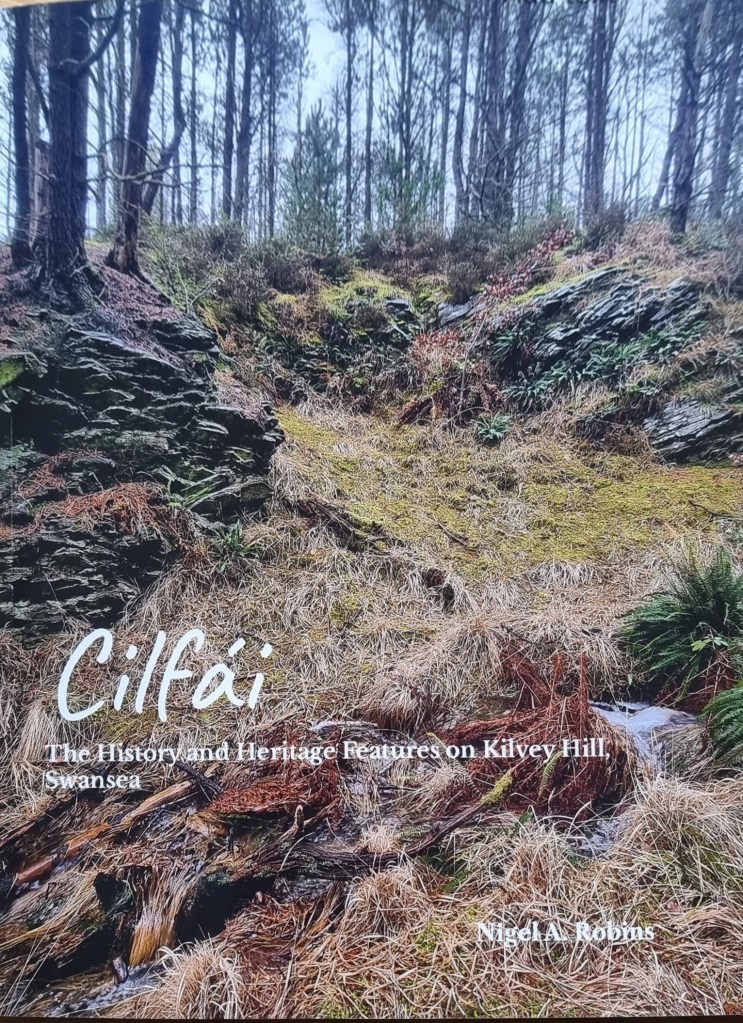
The final Cilfái book is Cilfái: The History and Heritage Features on Kilvey Hill, Swansea. This is based on my new surveys of all the heritage and historic features on the Hill. I spent a couple of years working for UK Parliament, chiefly as a heritage researcher so I picked up al ot of experience working with Parlamentary conservation departments, Historic England and Scottish Heritage. When I reviewed the current records of heritage and archaeology for the hill, I could see they were incomplete or needed updating. This book does that, and I’ve added maps and What3Words locations of all the heritage features on the Hill from the prehistoric sites, coal and copper industries up to the present day with The Green Man. I’ve also added a number of heritage featurews to the list that aren’t on the official lists. All this empasises the point about how special Cilfái actually is.
A lot of people know me as a historian specialising in World War Two and my latest book is a revised and much enlarged version of a book I originally published in 1993. Eye of the Eagle: Luftwaffe Intelligence and the South Wales Ports 1939-1941 takes me back to my original research field as a Historical Geographer investigating landscape history. Using Luftwaffe aerial photographs to study Gower landscape sent me in a different direction as I tried to understand the history behind German military intelligence activities in South Wales. Over many years I amassed a large collectionn of Luftwaffe intelligence which portays the reality of the war oiver Wales from the German viewpoint. It also provides a fantastic insight into the activities of the ports of Swansea, Cardiff, Barry and Llandarcy in their finest hour as they supported the nation’s defence and resilience. Using a combination of Luftwaffe intelligence documents and maps and local records from the 1930s, this book examines the reality of why the ports were bombed. A4 size, 170 pp, fully indexed and referenced.
My latest book will cover a bit about the history of the Luftwaffe intelligence of South Wales in the early years of World War Two. It’s been an interesting journey. The records have been mainly in German and it’s been great fun to work with old maps again as opposed to modern GIS systems which have taken up so much of my time looking at Cilfái.
Regardless of how much of a stupid idea it was, the German armed forces were ordered to prepare for an invasion of Britain in 1940. This they duly did in a thorough and orderly way. Some of the documents from that time have survived, although most were destroyed at the end of the War in 1945. I was able to get my hands on a series of Luftwaffe intelligence files and the portfolio of invasion plans of South Wales, which cover in detail why Swansea and Cardiff were bombed. They also show up the gaps in knowledge that often made bombing a waste of lives, money, and time. I can now explain the reasons behind the air attacks on Swansea and Cardiff, and what they were aiming for.
I’ll be doing a series of talks next month to launch the book. I’ll announce them here, but if you want to know more, you can always contact me.
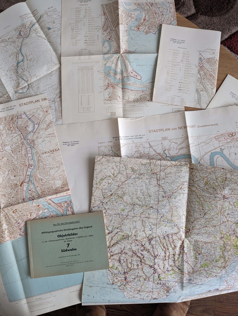
Below: A German military information pack covering South Wales from 1941.
My new book on the history of the Blitz bombing of Swansea and the other South Wales ports is now available from me.
This is the second edition of Eye of the Eagle, the first edition was published in 1993!
I’ve completely rewritten the history based on years of research in German Air Force sources and I’ve looked at the other ports the Luftwaffe attacked in 1940 and 1941. Over the years I’ve collected a large range of intelligence materials which are rarely seen because they were often destroyed at the end of the war.
In this history I have concentrated on Luftwaffe intelligence maps, photographs and other sources to give the real reasons why Swansea and the other ports were attacked and dispell some of the rumours from the past. I’ve also looked at the U-boat campaign against Swansea and Cardiff and included translations of key German war diaries and Luftwaffe intelligence records. I’ve described in detail the U-boat mining of the Scarweather lightship and the U-boat attack on Swansea.
Intelligence records are often difficult to understand so I’ve added a detailed examination of how photographs were taken in the preparation for invasion and the Blitz attacks on the ports.
I’ve made this book a big A4 size to take full advantage of the many maps and images that show Swansea and the ports as seen from the German point of view. Over 130 illustrations, many in colour.
Chapters: 1. Understanding Intelligence and Reconnaissance (The Munich Crisis, The decision to bomb Swansea, the bombs and the aftermath as seen by the Luftwaffe cameramen), 2. The history of the South Wales ports between 1933 and 1941 (The ports as targets, how they were selected, and how they fought their war). 3. Reconnaissance over Wales (the Units and aircraft), Detailed illustrated chapters on 4. Newport, 5. Cardiff, 6. Penarth, 7. Barry, 8. Port Talbot, 9. Llandarcy Oil Refineries, 10. Briton Ferry, and 11. Swansea, With Annexes on the U-boat mining of the Scarweather Lightship, Descriptions of the Luftwaffe intelligence records, and other information on the bombs that were dropped on the ports.
Eye of the Eagle: Luftwaffe Intelligence and the South Wales Ports 1939-1941, Nigel A. Robins, Size: A4, Paperback, 170 pages. Price £16.99.
Available from Nyddfwch Publishing, Swansea, or contact the author on nrcontact30@gmail.com. Or you can contact me here.
Some of you know I spend a lot of time researching the German Air Force (Luftwaffe) intelligence activities over South Wales in World War Two. Eventually, the Luftwaffe bombed several towns, including many attacks on Swansea. The images the Luftwaffe took in preparation for the bombing attacks are often the earliest quality photographic surveys of industrial landscape we have. The main reason I collected such a large archive of photos is because of the landscape history in them. The fact I needed to understand fully the reasons behind the images was just a part of that original journety to understand the records. I’ll be publishing a large book on Swansea and the intelligence war in May. My original Eye of the Eagle book from 1993 is here in PDF.
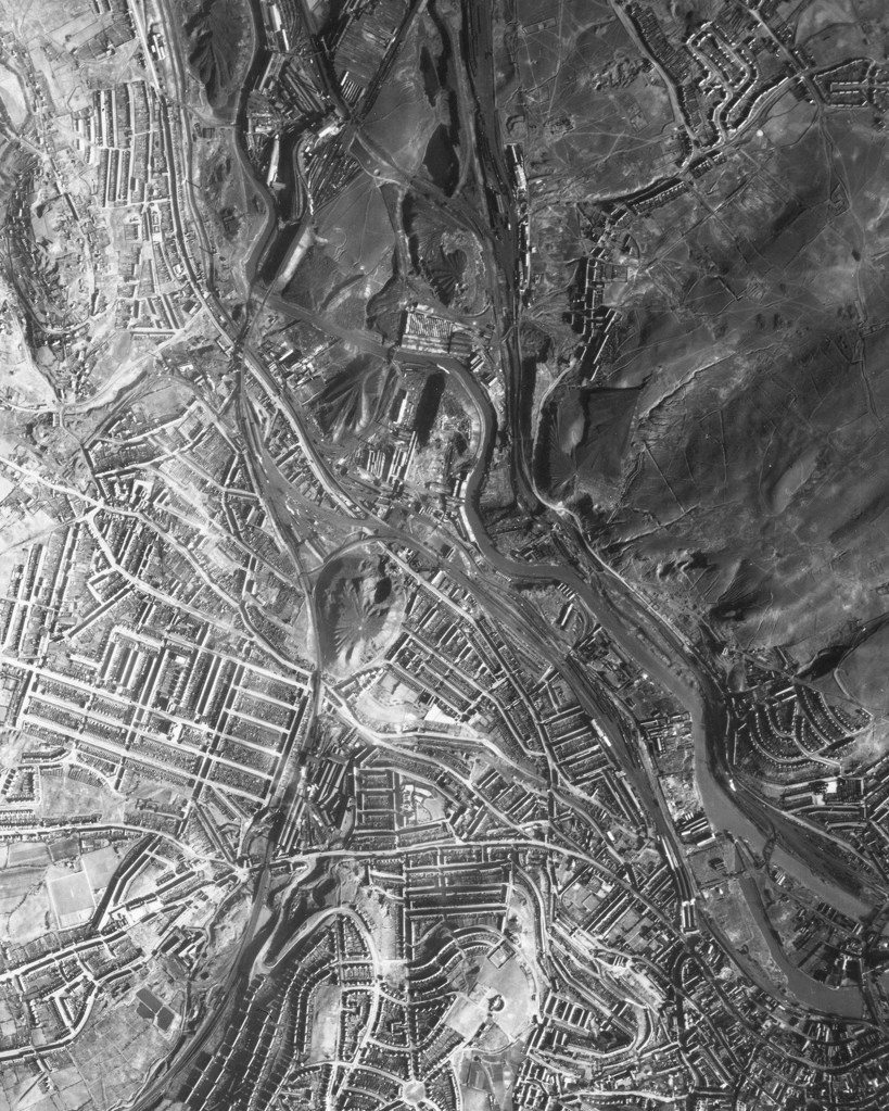
Anyway, the pictures of the Lower Swansea Valley taken in 1940 and 1941 are an incredible record of the pollution and devastation of the industries in the valley. Eventually, the terrible pollution was ackowledged and a cleanup started in the early 1960s as part of the world-famous Lower Swansea Valley Project. I talk about the Cilfái part in the Project in Chapter Five of Cilfái: Historical Geography .
Below is one of the images in my collection from February 1941 when Luftwaffe airmen took photos of the whole town in preparation for the three nights of air attacks between 19 to 21 February 1941. In the middle of this image you can see the massive Hafod tip created by the Vivians industries. Further right are the even larger tips of the valley industries which destroyed the ecology of Cilfái and North-East Swansea. The White Rock tips are just right of centre. I don’t think there is a single tree in the upper half of this image.