The concept of quick and cheap photogrammetry is now proven, and simple work like this can be comparable to expensive archaeological surveys, which cost far more, often a hundred times more than current archaeological firms charge.
As I said earlier, the purpose of this project was a proof of concept on using photogrammetry as cheaply as possible to allow quick and accurate reconnaissance and survey of small features that generally would not be investigated or be too expensive to survey using current high-cost photogrammetry, drone and lidar techniques.
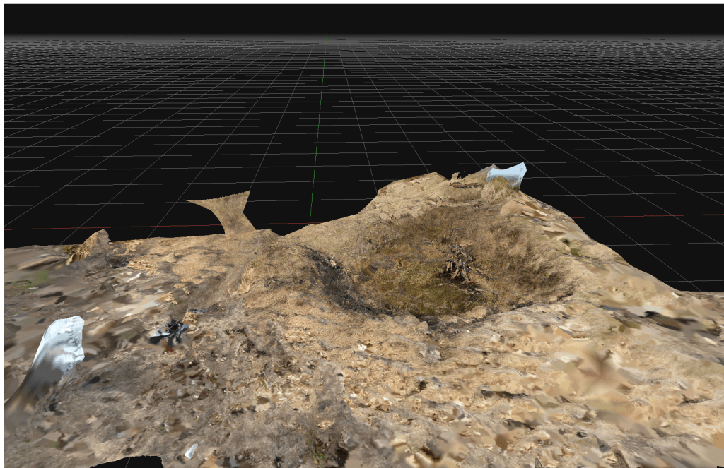
This example is a bomb crater on Kilvey Hill. The crater was most likely created in the January 1941 attack on the town. The crater is from a large calibre bomb (possibly 250kg) that has penetrated some way into the soft, marshy ground and then detonated.
In the 84 years since the detonation, the crater has softened with the crater lip mostly eroded. The crater frequently fills with water and has a different botanical nature to the surrounding grassland. This crater is a local biodiversity hotspot, allowing moisture to be present all year round and providing better protection from excessive temperatures. A large pine in the centre of the crater has died providing a reservoir of dead wood.
Above an extract from an initial 3D model of one of the Kilvey bomb craters, 2025.
The concept of quick and cheap photogrammetry is now proven, and simple work like this can be comparable to expensive archaeological surveys, which cost far more, often a hundred times more than current archaeological firms charge.
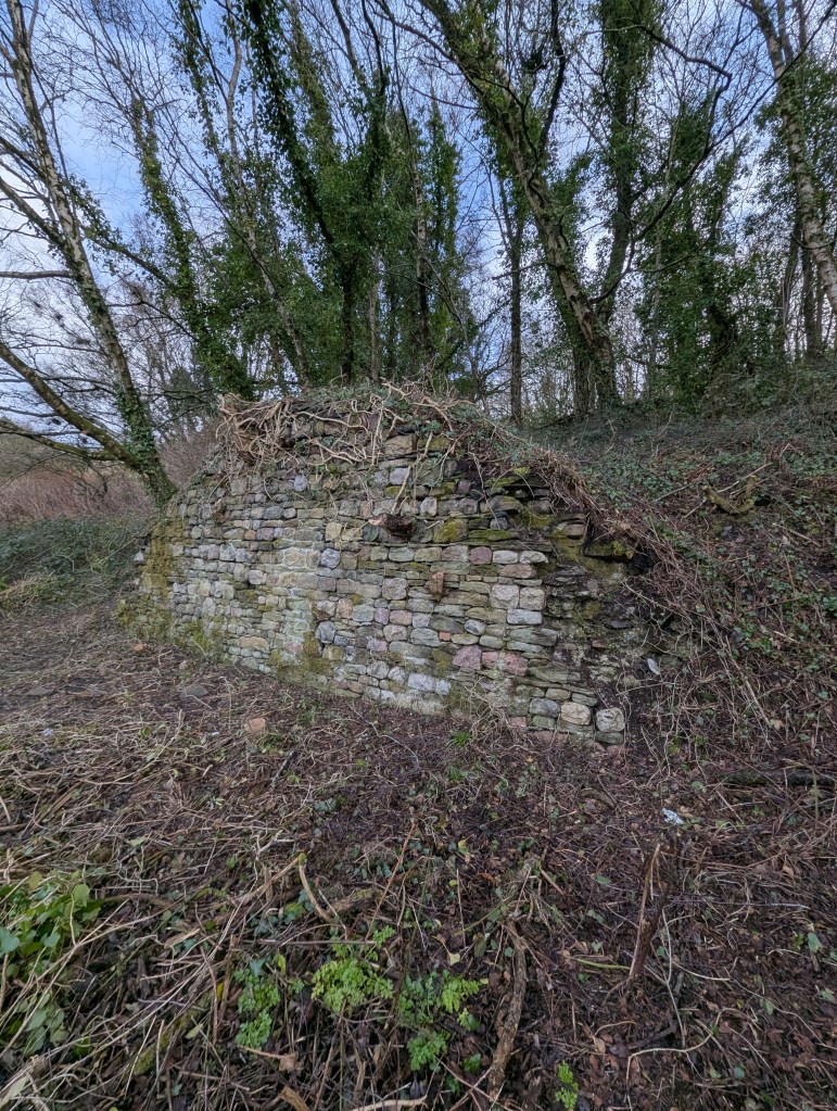
I’ve got some funding to run a small Heritage BIM project. I’m running a photogrammetry project on a few small and less well-known industrial remains in the Swansea Valley. The proposal is to explore how effective and cost-effective cheap photogrammetry can be in surveying and analysing small structures and supplement statements of significance. With reference to CIDOC and ISO 19650.
I’ve got some funding to run a small Heritage BIM project. I’m running a photogrammetry project on a few small and less well-known industrial remains in the Swansea Valley. The proposal is to explore how effective and economical cheap photogrammetry can be in surveying and analysing small structures and supplement statements of significance. With reference to CIDOC and ISO 19650.
I worked on several Heritage BIM projects whilst an analyst on the Restoration and Repair of the Palace of Westminster. The technologies are evolving fast, and the extortionate costs of older photogrammetry are now being superseded by new technologies and approaches. I remember the original photogrammetry of the Palace was eye-wateringly costly, but once captured, hardly anyone knew how to effectively leverage the data into applied and valuable information. The result was old data that quickly went out of date and used before it could benefit the programme.
This will be an opportunity to explore revised workflows, effective use of low-cost technology, and output into usable heritage information for a few neglected monuments. It also provides an opportunity to revise old and outdated information, review the significance of the monuments in light of more recent viewpoints on heritage and interpretation, and maybe look at ontology and some standardisation and interoperability issues in HBIM. All with a view to convert data into valuable knowledge effectively and for a reasonable cost.
I’m looking forward to getting back into HBIM and a heritage project!
Above: A prime candidate: a significant structure from eighteenth-century coal mining history. It is mainly unprotected and needs modern interpretation.
Now working on the final shortlist of appropriate monuments and structures for the project. Down to a shortlist of three. The final selection will depend on the extent of the current knowledge and interpretation of the selected structure. A poorly documented structure will score higher.
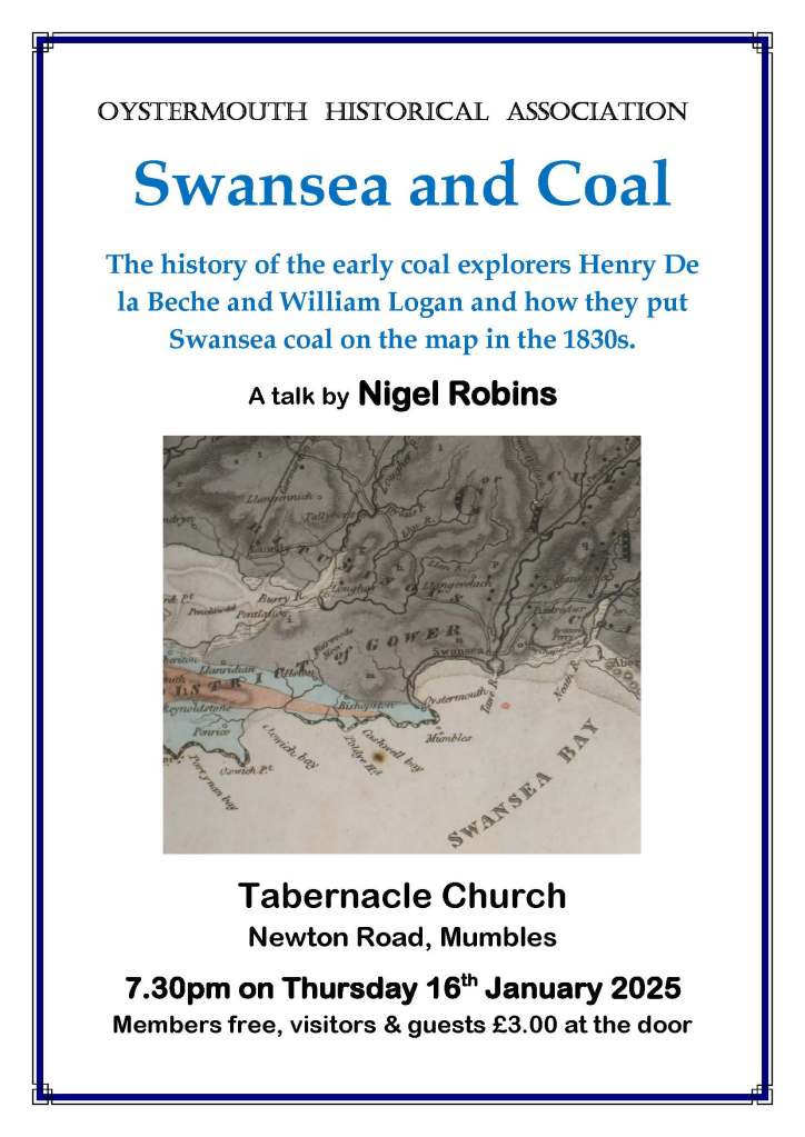
This will be at the Local Studies Room at Swansea Central Library on Saturday, 22 February 2025 at 2.00 pm. This will be one of Gwilym’s local studies talks in the afternoons. (https://www.swansea.gov.uk/centrallibraryevents).
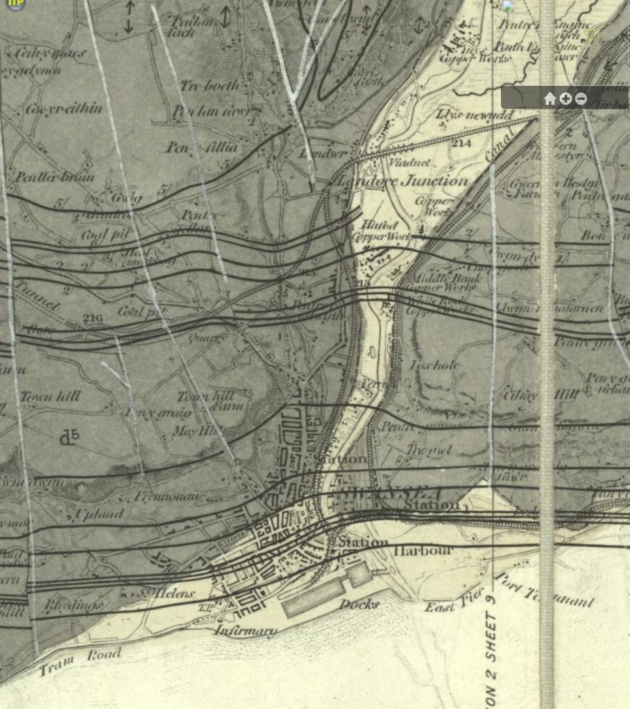
Above: The Lower Swansea Valley as seen by German bomber cre3ws in February 1941
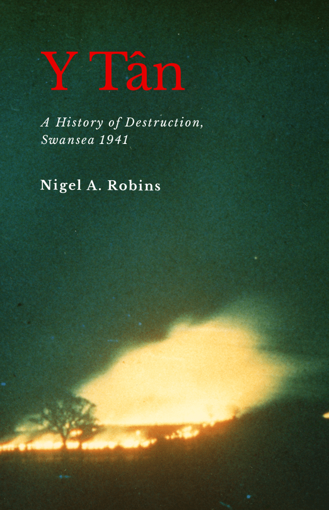
I’ll talk about the three nights of air attack that transformed the town centre. Based on my research for my Y Tân: A History of Destruction, Swansea 1941.
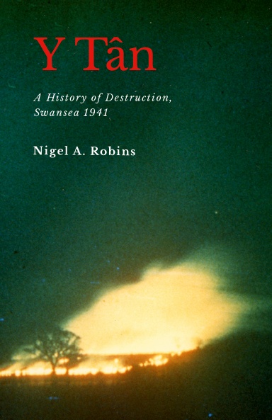
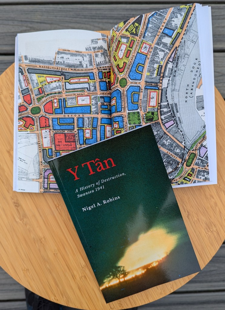
In World War Two, Swansea was regularly attacked by the German Air Force. The worst attacks were over three nights in February 1941. The bombs and fires transformed the centre of the town, and the author’s grandfather was killed as a volunteer firefighter. This book explores the events of the three nights, the loss of the author’s grandfather, how the fire was used to destroy the town and the consequences of the raids for the future of Swansea. Swansea Blitz was an early example of a firestorm and became a template for attacks on many European towns and cities in 1942 and 1943. The author reconstructs the events of the three nights and includes eyewitness descriptions from some of the people who worked to save lives and property. The book also includes an analysis of the loss of the Ben Evans department store and the detailed history of the land we call Castle Gardens. With technical details of the bombs and explosives that were used to attack the town and the history of the bomb disposal teams that worked to save Swansea. Based on meticulous research this fully referenced book examines the vulnerability of the town to air attacks, the technical background of the incendiary bombs, the events of the three nights of terror, the ecology of the devastated town centre and the aftermath of rebuilding.
I’ll have both Y Tân and Eye of the Eagle books for sale at a discount price of £10.00 each. The new editions won’t be available on Amazon or local bookshops.
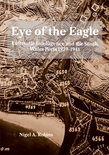
History of the Luftwaffe Reconnaissance and Intelligence during the air war over South-Wales 1939-1941. Over 130 maps, illustrations, and images, many in colour. Individual biographies of the Luftwaffe intelligence of Newport, Cardiff, Penarth, Barry, Port Talbot, Llandarcy Oil Refinery, Briton Ferry, and Swansea. Explanatory text and translation of original Luftwaffe intelligence records. Annex describing intelligence records, U-boat operations off Swansea and Magnetic Mines. Explanatory text covering the role of intelligence and reconnaissance and explanations of why the Welsh ports were bombed in the Blitz attacks of 1941. Illustrated with Luftwaffe intelligence maps and documents gathered from over 10 years of research. Fully academically referenced.
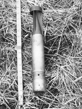
The incendiary bomb used to attack Swansea was known as the ‘Elektron’. a slim tube of aluminium and magnesium with an incendiary filling. The little bomb had a hard nose designed to penetrate a slate roof and settle in the attic, where it would gradually start a fire. The Swansea Civil Defences and auxiliary firemen learned various ways to deal with the bomb, but it was civilians, including women and children, who tackled most of the burning bombs.
Incendiary bombs were heavily used by all World War Two air forces to attack civilians. Swansea was attacked on several occasions with large numbers of incendiary bombs, which eventually caused complete destruction of most of the town centre.
Incendiary bombs to specifically attack houses were a German invention from World War One. Still, it was in the middle years of the Second World War that they really became a favourite weapon of air forces.
The incendiary bomb used to attack Swansea was known as the ‘Elektron‘. a slim tube of aluminium and magnesium with an incendiary filling. The little bomb had a hard nose designed to penetrate a slate roof and settle in the attic, where it would gradually start a fire. The Swansea Civil Defences and auxiliary firemen learned various ways to deal with the bomb, but it was civilians, including women and children, who tackled most of the burning bombs.
Below is a page from Y Tân: A History of Destruction, Swansea 1941, with pictures from a civil defence manual showing how to tackle a burning Elektron bomb. It was important for morale to show a woman dealing with the bomb and hundreds of bombs in Swansea were extinguished by women with sandbags and stirrup pumps.
The full story of Swansea dealing with incendiary bombs during the Three Nights’ Blitz is told in the book.
My new work is uncovering the history of the early geologists and explorers of the Welsh coalfields.
Although coal mining has been ongoing in the Swansea area for at least a thousand years, the uncertainty about what coal actually is lasted until the 1920s.
In Swansea, the exploration of our coal seams began in the eighteenth century, but it was in the 1830s that pioneer geologist William Logan first started to examine the coal and sandstone layers on Kilvey and Town Hill to understand the physical arrangement of coal seams. When Logan met Henry De la Beche (sometime in 1833), the quality of Logan’s research was instantly recognised as being central to the geological mapping of the Swansea district and the wider Welsh coalfields.
The debates over whether coal was a rock or a mineral continued throughout the early 1800s, and early geologists struggled to understand what coal was and how it was created.
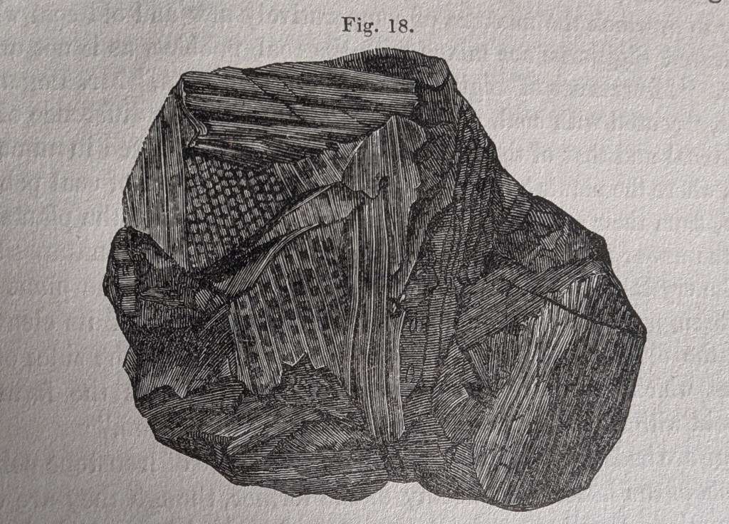
Below is a drawing from 1841 showing the complex plant structures within a piece of local bituminous coal. Close examination of coal gradually revealed the incredible numbers of plants and ferns that make up the millions of tons of coal that were exported from Swansea docks.
Above: A wonderful illustration of a piece of coal showing the plant structures inside the seemingly black mass. A closer examination of coal unveiled the rich plant life that existed over 300 million years ago. This piece was drawn in 1840 by a ‘Miss Woods’ and included in the landmark geological paper by Henry De la Beche that described coal and sandstone in the Swansea area.Above: A similarly-sized piece of coal from the veins on Kilvey Hill above White Rock.Above: The first map of the coal seams of Swansea from 1842. The white lines are the faults and cracks in the rock mapped by William Logan in the 1830s.
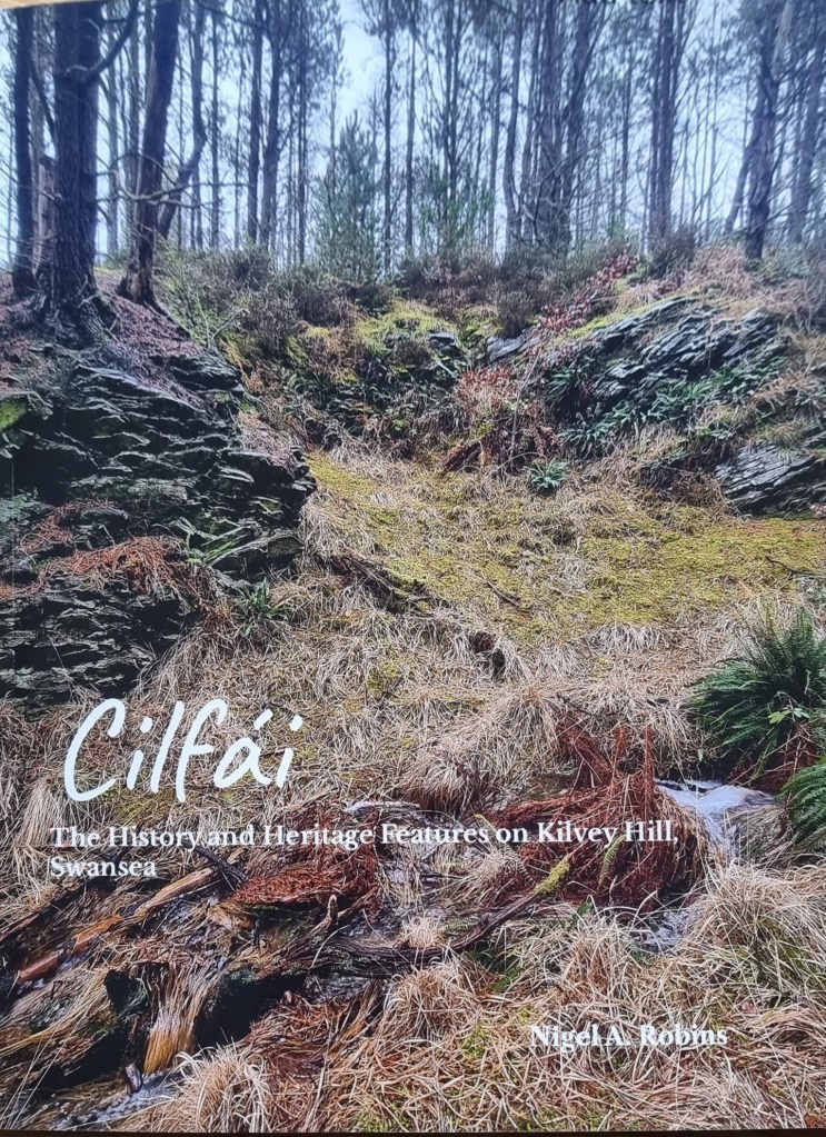
The surviving coal-related heritage features are listed in the third Cilfái book. Available here.
In Swansea, as the anniversary of the February 1941 bombing raids approaches, interest in the Blitz always increases.
Kilvey Hill has many bomb craters across its southern part and into the woodlands near Pentrechwyth. Most craters date from September 1940 to February 1941. The German Air Force didn’t aim at Kilvey Hill; it’s just that the bombs that were intended for the docks missed and ended up on the hill. Bomb craters in town were quickly filled in, but craters on the hill were left and still survive today. A few have filled with water and have become biodiversity hotspots.
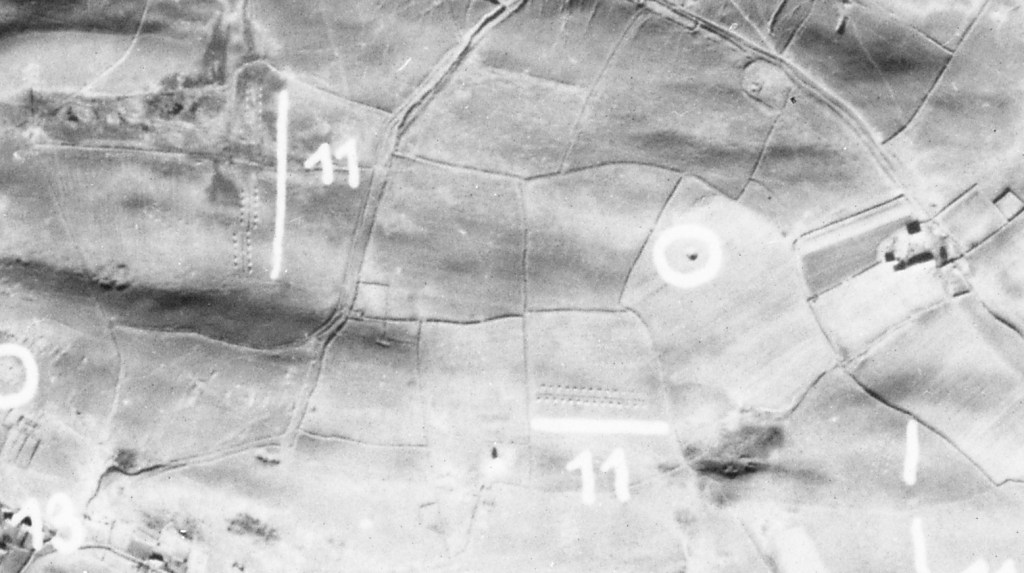
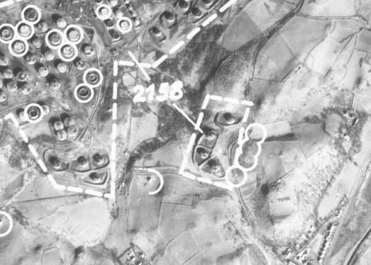
Above: bomb craters and anti-landing defences on the top of Kilvey Hill as identified by German bomber aircraft in February 1941. The anti-landing trenches are marked with ’11’ and a white line.
Kilvey also has a series of ditches and banks across the top, which were hastily constructed to prevent German soldiers from landing on the Hill in gliders. It was a definite threat, and my reconnaissance research confirms that the Germans had evaluated the usefulness of the Hill as a landing ground if they ever invaded. They survive as a poignant reminder of how real the threat was in 1940. The Council/Skyline development will destroy some of the banks, breaking a remarkable historical link between the darkest days of World War Two and our present day. It is ironic how so much is made of the disappeared Swansea copper industry in Landore is revered, but so much more recent and relevant history is ignored by Swansea Council.
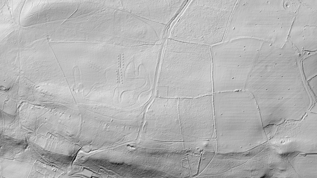
Above: A modern Lidar image of the top of Kilvey Hill showing the anti-landing trenches as they exist today as little square hillocks either side of deep trenches. They would have made landing by glider very dangerous or impossible. The flat part of the hill top was particularly attractive as a landing ground.. Morris Lane runs from the top to the bottom of the image and is seen as a series of earth banks.
Above: The top of Kilvey Hill today. Bomb craters in red, Glider defences in Red.
If you want to know more about all of the archaeological features on Kilvey Hill, they are listed and described in the third Cilfái book available here.
Cilfái: The History and Heritage Features is a 100-page illustrated book of all the historic features on the hill.
Henry De la Beche and William Logan, between 1836 and 1841, conducted considerable research on the hills of Town Hill and Kilvey (Cilfái) in Swansea. Understanding the dip of the sandstone beds and the coal veins that ran through the rock helped both men understand the relationship between the Pennant Sandstone and the coal seams that Swansea was built upon. Kilvey has a coal mining history extending back at least a thousand years.
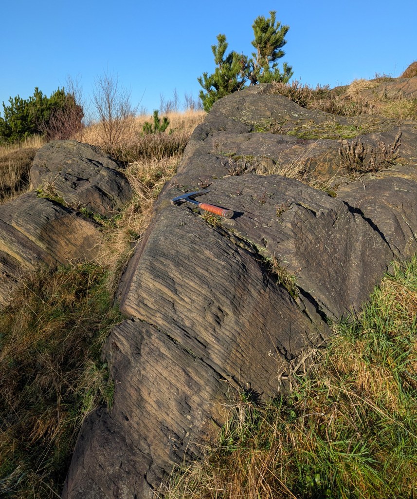
Above: A rock exposure on the southern slope of Kilvey last week. I took some record shots of the geology because this lies within the Swansea Council Skyline threatened area and it may be destroyed.
This exposure of weathered sandstone would have been examined by William Logan and both men would undoubtedly have discussed it as they worked to understand the more complex geology of Town Hill and northern Swansea. You can see the rock here dips down. In fact, it dips at about forty degrees to the north, which means that coal seams exposed on the surface on Kilvey would be hundreds of metres underground by the time you reached Morriston. Beche and Logan were trying to understand how and where to find those deep coal veins to allow better locations for new coal mines.
The layers of sandstone and siltstone are very thin here, and centuries of atmospheric pollution have highlighted the separate layers. Other parts of Kilvey have thick beds of stone used to build the Prince of Wales Dock and the Port Tennant houses.
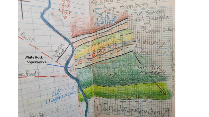
Above is my sketch map of Kilvey showing the sandstone and coal veins as De la Bech and Logan would have seen them. The rocks in the picture above are part of the ‘Brithdir Beds’.
My next book is about the work of these two men and how they worked to understand the veins of coal that were so important to Swansea in the nineteenth century.
This has now been reprinted as a 2025 Second Edition with some updates. I’ve also updated the copyright for AI constraints and EU product compliance details.
The first edition was an incredible success and I’d like to thank everyone who attended the illustrated talks and came on the blitz tours in 2024. I’ll be doing more walks and talks in 2025.
This book started with me trying to make sense of a part of my family’s history, so in many ways it is a work of years. I grew up as a child of the inner city of Swansea, a point that came home to me when I eventually realised that both my mother’s and father’s families lost relatives in the bombing.
The story of the loss of Jack Bowers was something I grew up with but the true significance didn’t really hit me until I became a parent myself and I lost the older members of the family. I heard stories of the war from Florence and Ethel (my grandmothers), but they were never overly keen to talk about those years. I’m grateful for the things they shared with me.
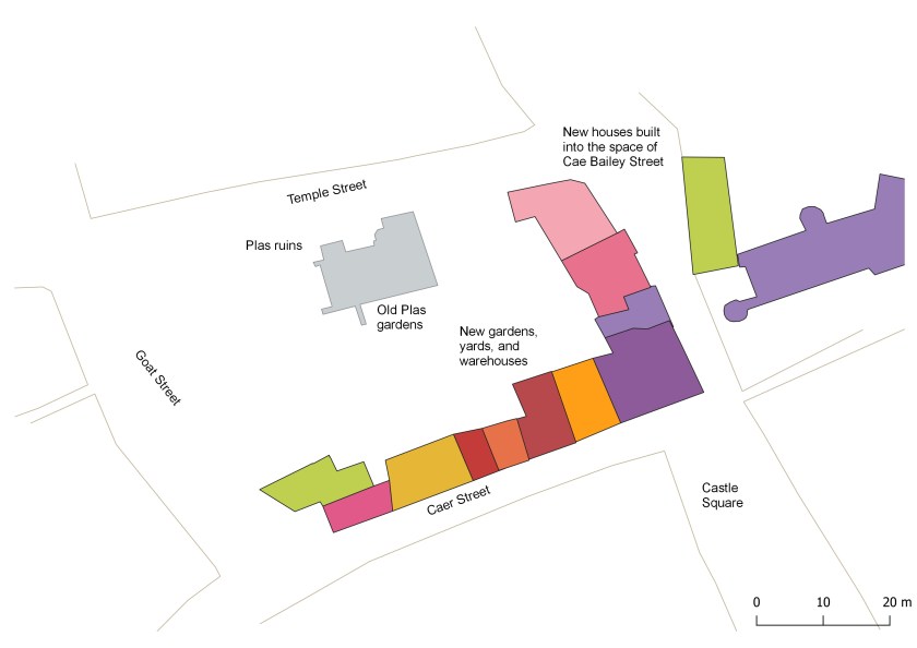
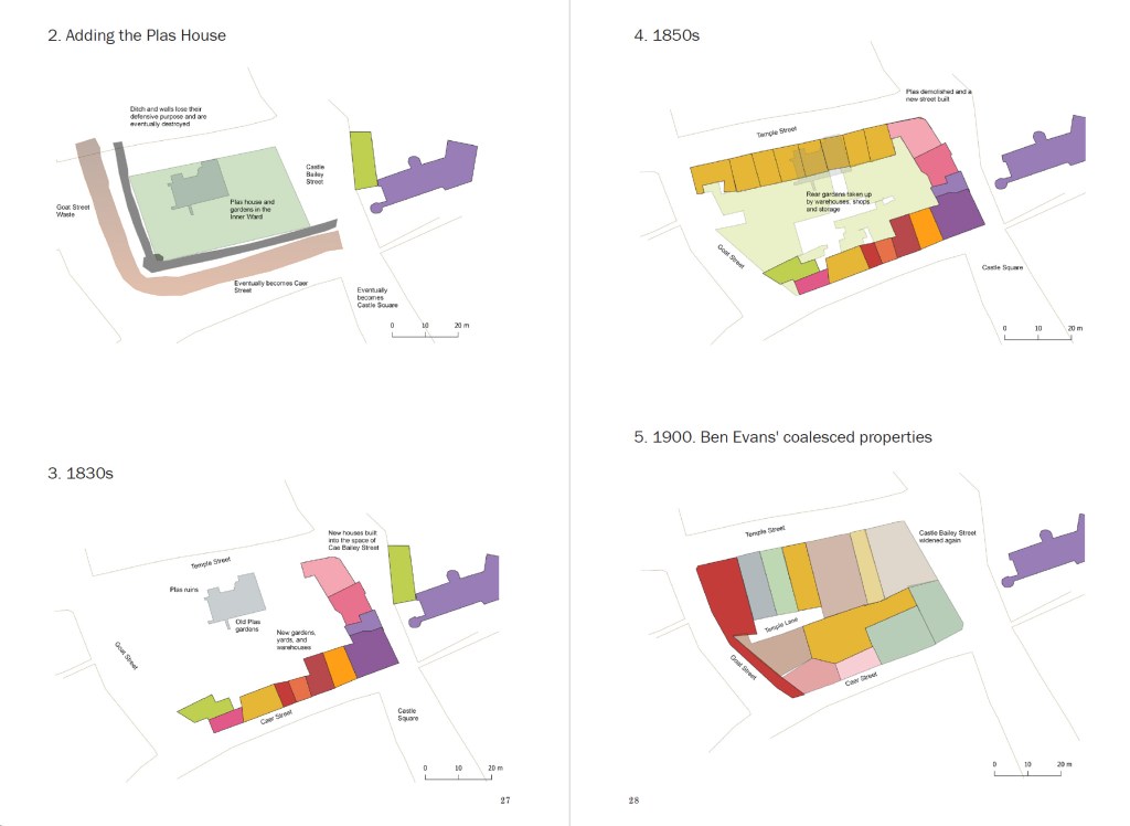
The history of the town centre, later known as Castle Gardens, is central to understanding how Swansea was destroyed.
I am so grateful to my friend Dr John Alban for his expert knowledge of the period and the many discussions we have had over the years. John’s generosity and support has been significant for so many of us as Swansea historians. I gained a deeper understanding of fire whilst working on the restoration of the Palace of Westminster (which has a unique relationship with fire itself), and I learned much from working with fire engineers on the Parliament restoration, although none of my colleagues realised I was busy applying what I was learning to the destruction of Swansea in the blitz. My lifelong friend John Andrew was particularly supportive and our long conversations so productive.
I was very privileged to be able to talk with Tony Kilmister about the courageous exploits of his mother and father, who were central to the Teilo Crescent tragedy. The Royal Engineers Association were incredibly helpful and friendly and I remember with great affection spending evenings in the Drill Hall listening to the old soldiers’ stories that put faces and personalities into the painful history of the time.
Also the wonderful support of my wife Alison who does so much to inspire and improve my writing and provide background knowledge on so many things.
This has now been reissued as a 2025 Second Edition. I’ve also updated the copyright and EU product compliance details.
The first version of Eye of the Eagle was published in 1993. At that time, the research was to look at local landscape history, and British government aerial photographs were prohibitively expensive for such research, whereas, with a bit of effort, the Luftwaffe aerial surveys were freely available albeit via the record offices of the USA. As a geographer, my first instinct was to look for photographs and maps that give a first impression of a landscape before experiencing the land by walking. Since those days, a revolution in information sciences has changed so much. British record offices are far easier to engage with, and online and digital sources provide a wealth of resources and historical riches that were undreamed of in the 1990s. Combining the images with appropriate GIS/GPS systems has provided spectacular insights into ancient woodland and post-industrial recovery of land.
However, what has not changed is the research and writing techniques that underpin our discipline. This book has been written several times, only to be rewritten when new sources become available or are revealed in the improved access or digitisation of various records. Some of the many images and sources you will see here were rescued from rubbish dumps as organisations sought to ‘become digital’ in the early 2000s by throwing away ‘old’ records. Which explains their rather ‘worn’ looks.
Llandarcy showing destroyed oil tanks and near misses after the 1940 bombing raids.
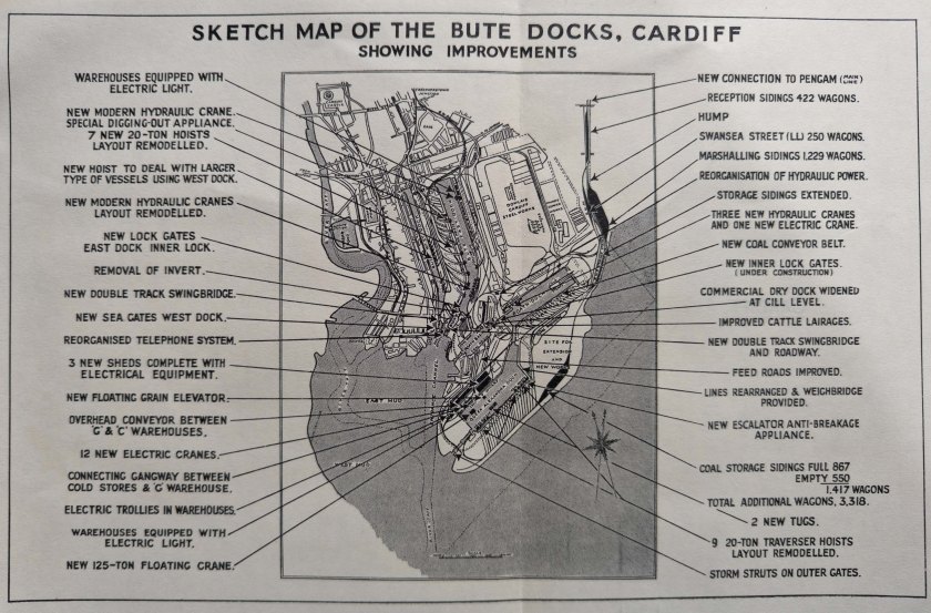
One of the GWR plans of Cardiff used by thew Luftwaffe to plan their air attacks in September 1939.