Geoheritage is now becoming a broader term for our geographical and geological features that have significant scientific, educational, cultural, or aesthetic value. Swansea has an important place in the history of geological exploration and the development of the Welsh coal industry.
People who have participated in my many guided walks on Kilvey will already be aware of the value of the Kilvey Geoheritage sites and the contribution they make to the Biodiversity and Geodiversity of Swansea.
Globally, October is a month of celebrating and recognising the importance of the rocks and landscape underneath our feet. Swansea has more than most towns to be mindful of, as it is built on over a thousand years of coal mining history.
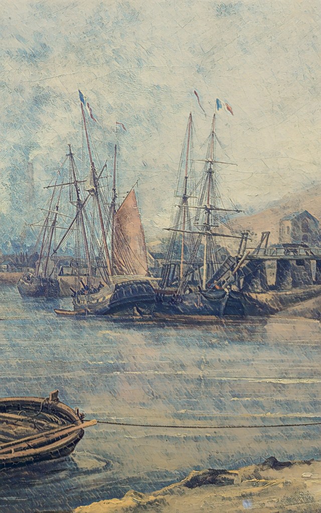
Above: Foxhole Coal Staithes in the 1840s.
Following on from my recent book on Foxhole and the history of Swansea Coal, I’ll be giving a few guided walks and talks on broader aspects of Swansea’s incredible Geoheritage and Geodiversity.
On 4 October, I’ll be talking about the history of Swansea coal and the special place Foxhole on Kilvey has in the history of Welsh coal mining. My talk will be at Swansea Museum as part of the RISW and the Historical Association’s History Day 2025. I’ll also have copies of the Foxhole history book at a discounted price.
On 6 October, as part of UNESCO’s # InternationalGeodiversityDay, I’ll be leading a walk around the geological features of Kilvey Hill and explaining the unique place in Swansea’s history that Kilvey holds. The geological features of Kilvey have long been regarded as obscured or destroyed, but many have survived against all odds. Come with me and walk the land that was explored by Geology’s most famous local coal pioneers, William Logan and Henry De la Beche. Tickets will be available shortly. I’ll advertise them via Facebook and Eventbrite.
On 8 October, I’ll be at the Friends of Penllergare monthly meeting at Llewellyn Hall in Penllergaer. I’ll be talking about ‘Penllergare, Henry De la Beche, and early Geology in Swansea’. Lewis Weston Dillwyn was often at the centre of scientific and cultural events in Swansea. He was particularly prominent in the recognition of Swansea as a centre of research in the emerging science of Geology and the first understanding of the South Wales coalfields.
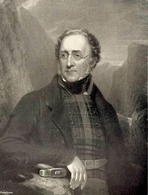
Above: Henry De la Beche. Pioneer geologist.
I’ll be doing a few more walks and talks throughout the month, and I’ll post here to let people know. If you want to know more contact mew for details.
I’ll also have my bookshop of all my current books in print at the History and Heritage Fair at the National Waterfront Museum on 27 September 2025.
I was particularly struck by a recent opinion piece in The Lancet Planet Health on the links between human health and wellbeing and diverse nature.2 It’s an approach that remains at the centre of my use of Kilvey/Cilfái as a landscape for teaching. Early on, I could see that an overemphasis on biodiversity to the exclusion of other aspects of the environment would inevitably lead to a partial appreciation of the landscape.
Subscribe to continue reading
Subscribe to get access to the rest of this post and other subscriber-only content.
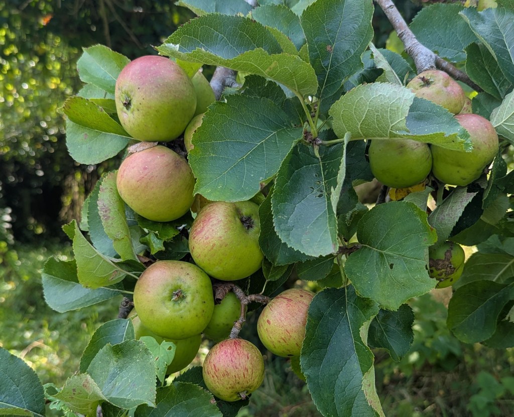
I’m just about to begin a data refresh of our local traditional orchard database. My original work was in 2012 as a contribution to the England and Wales survey that collected a massive amount of data about surviving orchards. For ~Swansea and Gower, that original data is now outdated and in need of revision. This is particularly significant for the Gower National Landscape (formerly the AONB).
I’m just about to begin a data refresh of our local traditional orchard database. My original work was in 2012 as a contribution to the England and Wales survey that collected a massive amount of data about surviving orchards. For ~Swansea and Gower, that original data is now outdated and in need of revision. This is particularly significant for the Gower National Landscape (formerly the AONB).
Above: A culinary apple crop from a tree that is over a century old in Swansea, August 2025.
Back in 2012, it was a hot summer, and I remember walking North Gower roads and lanes, ground-truthing previously identified potential survivals from satellite photos. It will be interesting to see what has changed. Originally, the oldest trees I saw in my surveys were culinary or cooking varieties, as in previous centuries, most apples were cooked in various forms in cakes, puddings, pies, pasties, and even soups. I saw dessert varieties start to appear as transport links to bigger markets became easier. The orchards of Northern Gower seem to have their origins in the arrival of the railway, allowing trouble-free transport to Llanelli and Swansea.
Although some academics have suggested that it is very rare to see apple trees older than a hundred years, I felt this may need correction, as I have seen some trees that, because of their location and size, are older than assumed. Much of Glamorgan’s apple industry was irreversibly damaged by massive imports of cheap Canadian apples via Cardiff and Swansea in the 1920s. The industry never recovered. In more recent decades, I see younger trees of dessert apples as people want to plant something easily consumed, and the recipes and practices of handling cooking apples have fallen out of fashion.
Equally, a new generation of consumers equate apples to cider, and I’d expect to see some ambitious investment in recently planted trees for juicing and cider. However, the data I collect will confirm the picture.
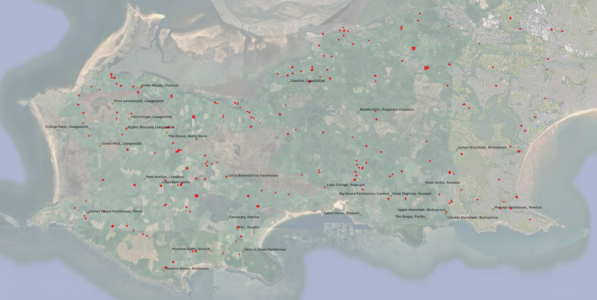
Above: Gower orchards from the 2012 data. This is mixed with historical house data. There may possibly be a loose correlation between the two, although much altered by subsequent property development. Something to investigate!
In the autumn of 2022, the local Council announced their plans to remodel the ancient Kilvey Hill landscape for a new tourism development, which would destroy the traces of thousands of years of human habitation and endeavour. The impending destruction led me to do what I could to record the history, ecology, biodiversity and Geoheritage of what is a significantly under-recorded landscape with considerable potential for education, well-being and climate change management.
Documenting the history and biodiversity was relatively straightforward, albeit a challenge to perceptions regarding a large area of land that many people see but few have experienced and even fewer understand. I remember one comment from the local authority about ‘there is nothing up there’. A comment I later understood as a self-serving phrase to make the destruction and loss more comfortable for planning permissions.
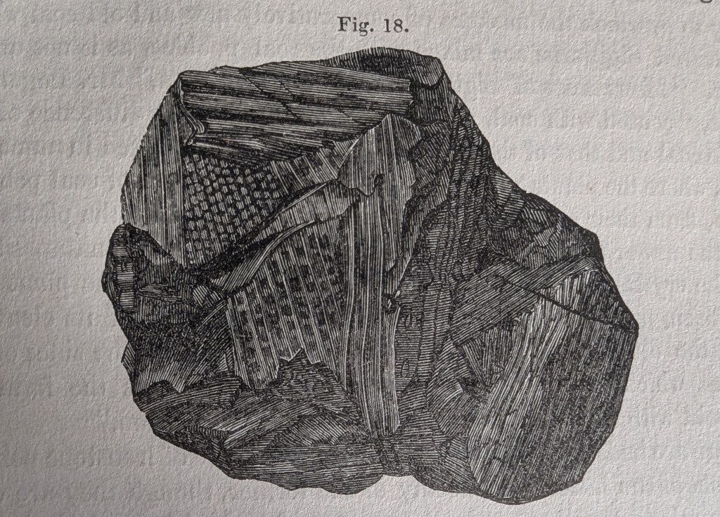
Above: The thinly bedded sandstones of sandstone on Kilvey are part of a broad range of types of structure on Kilvey, along with massive beds heavily used for building stone and the bituminous coal seams that were so important to early Medieval Swansea.
I suppose my perceptions were different, having had the advantage of a geological education at school and undergraduate level, including a hectic month of field mapping coastal regions of the Isle of Wight back in the day. I hadn’t appreciated how much of that had stuck with me until I needed to explore the Geodiversity of the Hill through documents, fieldwork and the wonderful archive of the British Geological Survey.
The fact that the natural heritage of any country includes its geological heritage is now slipping away from us. The wonderful naturalists’ clubs of the early twentieth century, such as the Swansea Scientific and Field Naturalists’ Society, were a broad church to all aspects of nature, including geology. But they have disappeared in the swing towards wildlife rather than general nature conservation, which has permanently obfuscated much of our wonderful Welsh geological heritage. The process accelerated as Naturalists’ Societies changed their names to Wildlife Trusts.
The collapse of geology as a subject deemed worthy of learning and the dissolution of the geological part of the National Museum for Wales have meant that describing the significance of geological sites has become challenging, as basic literacy in the nature of rocks and the landscape is in freefall.
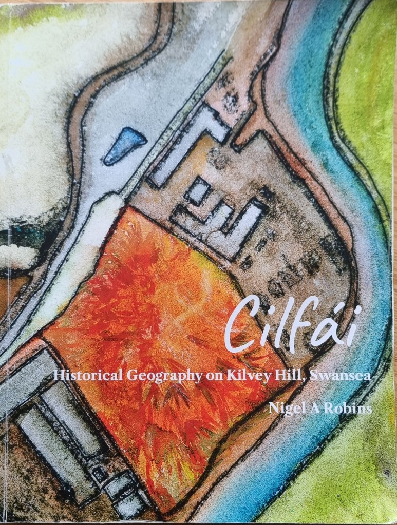
Geoheritage and Geodiversity featured strongly in my first book on the history of Cilfái, not least because it was good history as well as good geology (Robins 2023a). I sought to highlight the significance to local heritage of the geology by separating ecology, biodiversity and climate change into the second Cilfái book (Robins 2023b). However, I felt my treatment of Geoheritage in the first book was not enough. I included a more substantial piece on Swansea’s coal history in my book on the Swansea Foxhole Coal Staithes, but the rich history of William Logan, Hendry de La Beche and Aubrey Strahan clearly deserves more (Robins 2025).
‘Every outcrop has the potential to be great’ (Clary, Pyle, and Andrews 2024) was an opening line to a recent special publication from the Geological Society. It’s a great opening line, and it sets a very positive note for a lively discussion on Geoheritage on a landscape scale. It’s a sentiment that is less positively upheld in Wales where our process of listing or recording sites of geological interest is haphazard and starved of interest and funds.
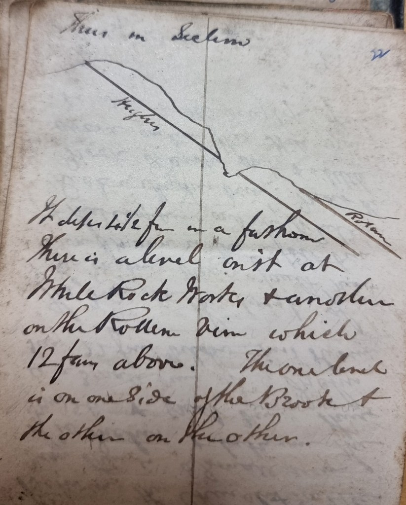
Above: An extract from one of William Logan’s many notebooks from the 1830s. Logan made regular visits to the outcrops above White Rock as he sought to understand stratigraphy and dip of the beds for coal exploration.
Nevertheless, the listing of a Kilvey site visit on the coming UNESCO International Geodiversity Day is a good opportunity to explore and reassess local Geoheritage. In preparing information for the International Geodiversity Day, I was particularly struck by a recent article linking Geoheritage and Cultural Heritage (Pijet-Migón and Migón 2022). The authors have introduced a model of themes at the Geoheritage-Cultural Heritage ‘interface’. It’s a very useful summary of what to explore or be aware of when revisiting geological sites. It helps move forward from traditional geological guides and texts (Owen 1973), which, although very useful, need to be modernised and broader in scope and engagement for a new generation.
Although the Pijet-Migón model doesn’t fit everything, for example, it can be broadened to explore the link between Biodiversity and Geodiversity, it is very useful. Here’s the Cilfái Geoheritage Landscape filtered through an amended model:
Clary, Renee M., Eric J. Pyle, and William Andrews. 2024. ‘Encompassing Geoheritage’s Multiple Voices, Multiple Venues and Multi-Disciplinarity’, Geology’s Significant Sites and Their Contributions to Geoheritage, no. Special Publication 543, pp. 1–7, doi:10.1144/SP543-2024-34
Owen, T.R. 1973. Geology Explained in South Wales (David & Charles)
Pijet-Migón, Edyta, and Piotr Migón. 2022. ‘Geoheritage and Cultural Heritage – A Review of Recurrent and Interlinked Themes’, Geosciences, 12.98, doi:10.3390/geosciences12020098
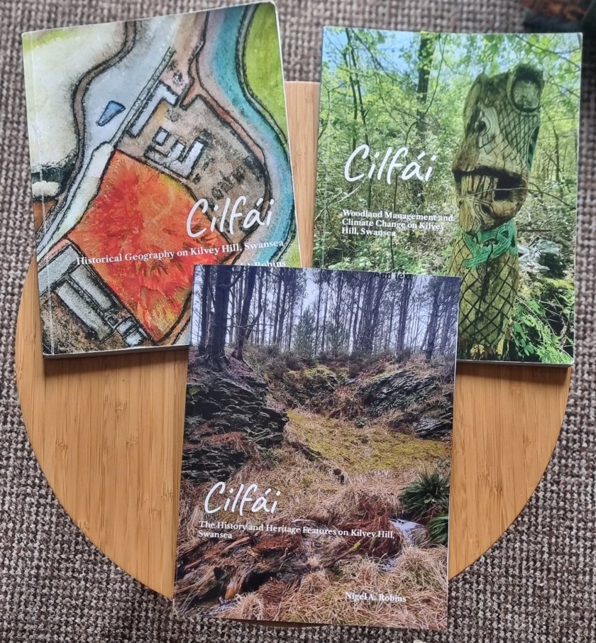
Robins, Nigel A. 2023a. Cilfái: Historical Geography on Kilvey Hill, Swansea (Nyddfwch)
——. 2023b. Cilfái: Woodland Management and Climate Change on Kilvey Hill, Swansea (Nyddfwch)
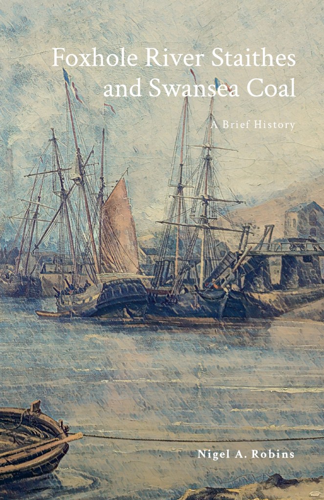
——. 2025. Foxhole River Staithes and Swansea Coal (Nyddfwch)
The theme for this year’s International Geodiversity Day, to be held on Monday 6th October 2025, will be ‘One Earth, Many Stories’. International Geodiversity Day was proclaimed by UNESCO in 2021, following a grassroots campaign by geoscience organisations around the world. Geodiversity is all around us, and includes the parts of nature that aren’t alive, like minerals, fossils, soils, and landscapes.
Geodiversity Day is a worldwide celebration to bring people together in promoting the many aspects of geodiversity, and its importance to society. This year’s theme is a chance for people to connect with geodiversity. Every landscape, every stone, and every fossil has a story to tell. Our planet is a record of history that dates back more than 4 billion years; one that can teach us about the origins of our natural environment and where we, as animals, came from.
As people, communities, and governments implement the Sustainable Development Goals, geodiversity provides a record of earth history that can help us prepare and respond to threats such as climate change. ‘One Earth, Many Stories’ encourages all of us to discover examples of geodiversity; in our landscape, in museums, in historic buildings; and delve deeper into the multitude of stories contained within planet Earth. It is hoped that geoscience groups around the world will organise events to make the stories of their local geodiversity more widely known.
As part of International Geodiversity Day, I’ll be leading a walk around the geological and historical treasures of Kilvey in Swansea. Kilvey played a central role in the pioneering work to understand the South Wales coalfield. The hill was the training ground of one of Geology’s most notable pioneers, William Logan, who was the first to map the Swansea coal veins and understand the arrangements of the coal beds and how they related to the surrounding Pennant Sandstone.
The hill has an incredible set of survivals from the early coal mining historry of Wales. The original coal face that Logan analysed and explored still survives, along with several medieval coal adits. There are also several fascinating sandstone rock exposures rich in plant remains, which gave the early coal prospectors of two thousand years ago the first clues that coal was present in these rocks.
Coal mining on Kilvey is a 1500-year-old industry and central to the history of Swansea.
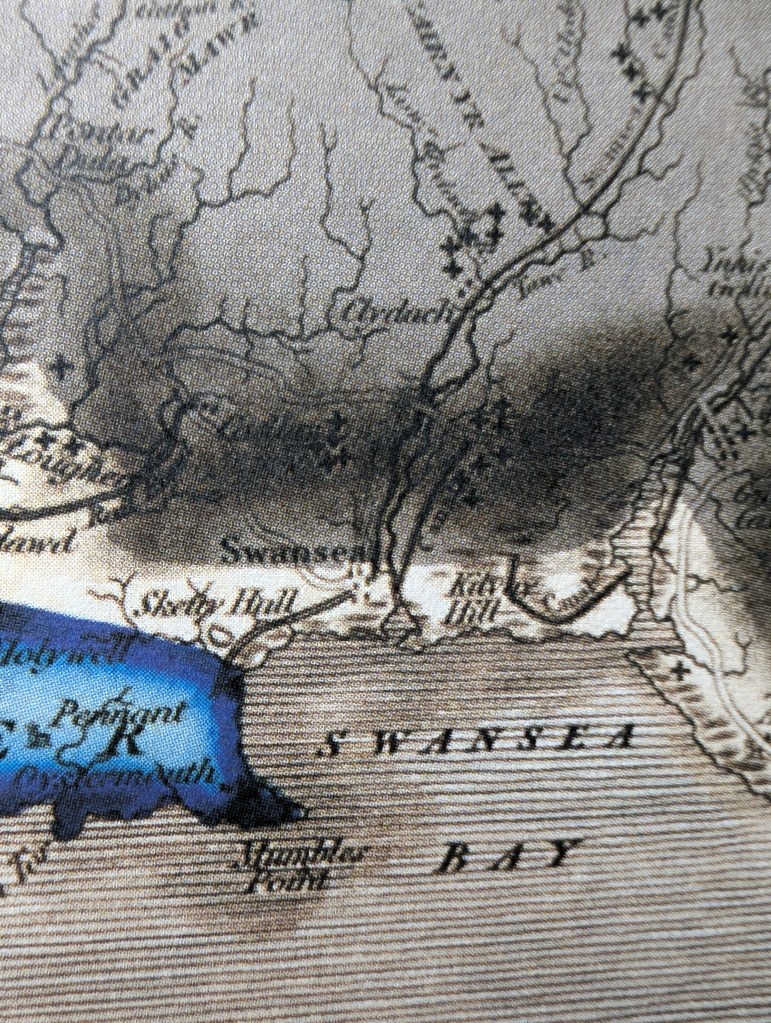
Above: An early geology map of Swansea with ‘Kilvay’ in the middle covered in coal mines.Above: A drawing of coal showing the intricate plant structures that can survive in our local bituminous coal. This drawing is from the original Memoir of Henry De la Beche (1841).
If you are interested in the history of Swansea coal, take a look at my recent bnook on the coal history of Foxhole on Kilvey
The Kilvey bombed landscape is unique in Wales, although bombs were dropped across the Welsh ports between 1940 and 1943, ther survival of any traces is rare. Several shrapnel-scarred buildings remain in Swansea, and a similar situation exists in other European towns and cities. What is unique in Wales is the survival of a landscape with craters that has been allowed to recover or develop naturally.
A look at the biodiversity contribution of the World War Two bomb craters on Cilfái.
I’ll be leading a couple of walks up the top of the hill soon. This year, I’m intent on looking at biodiversity and heritage. The bomb-damaged landscape of Kilvey Hill is now 84 years old, and a lot of it has survived or avoided being bulldozed, as often happens. Ironically, the heritage landscape of the Hill may soon be destroyed by Swansea Council as part of their Skyline tourism obsession.
The Kilvey bombed landscape is unique in Wales, although bombs were dropped across the Welsh ports between 1940 and 1943, the survival of any traces is rare. Several shrapnel-scarred buildings remain in Swansea, and a similar situation exists in other European towns and cities. What is unique in Wales is the survival of a landscape with craters that has been allowed to recover or develop naturally.
Many of you will know of my interest in bombsite botany via my lectures and articles, and one of the chapters in my book on the Three-Nights’ Blitz. Although formed in horrible acts of violence, the Kilvey bomb craters have been transformed by nature into essential wildlife refugia. Some hold small ponds, others are havens of warmer temperatures and protection from the wind, or even fire. The combustion of chemical explosives would have made the craters poisonous after their creation, and of course, the land is peppered with bomb fragments, which have become part of the archaeology of the hill. Nearly a century later, the craters have taken on a new role as centres of plant and wildlife.
I’ll explore this incredible mix of heritage and ecology on a couple of walks. I’ll advertise via Eventbrite, and I’ll let you know here as well.
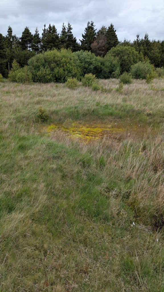
Above: One of the Kilvey bomb craters with a small mire. June 2025.
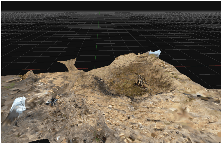
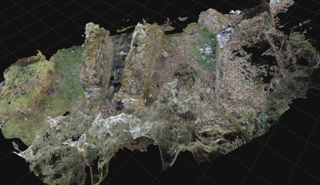
A photo-generated 3D model of one of the Kilvey bomb craters, March 2025.
Starting the new book project. I initially looked at the war diaries of Bristol Channel U-boats back in the 1990s. Research is now easier as more primary records have been released by US archives, at least until the latest President Trump directives close everything down. Modern technology in GIS and GPS has made map research much easier, and I am busy tracking down the original locations of magnetic mines originally planted in Swansea Bay and around the Scarweather Lightship. There have already been a few surprises as the mapping throws up all sorts of questions and new insights into the highly technical war of minelaying and minesweeping in the Bristol Channel.
Starting the new book project. I initially looked at the war diaries of Bristol Channel U-boats back in the 1990s. Research is now easier as more primary records have been released by US archives, at least until the latest President Trump directives close everything down. Modern technology in GIS and GPS has made map research much easier, and I am busy tracking down the original locations of magnetic mines originally planted in Swansea Bay and around the Scarweather Lightship. There have already been a few surprises as the mapping throws up all sorts of questions and new insights into the highly technical war of minelaying and minesweeping in the Bristol Channel.
The war against the U-boats is a complex subject to research thoroughly. There was considerable secrecy on both sides, and very often, the knowledge gap has been filled with wild speculation and inaccurate writing. This means I’ve had to reject a lot of secondary sources that continue to repeat what I’ve learned to call the ‘BBC History’ approach of ruthlessly clever Germans versus plucky eccentric Englishmen. There is also a surprising amount of rivalry and bias between British and US naval sources, both in the 1940s and in the present day. Again, I’ve learned to be scrupulous in testing opinions by viewing primary sources rather than derived history, often from writers who have not worked in the original German language sources.
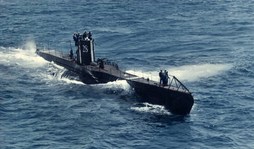
Above: U28 was one of the Bristol Channel U-boats. This is the boat as she looked just before the war began in September 1939.
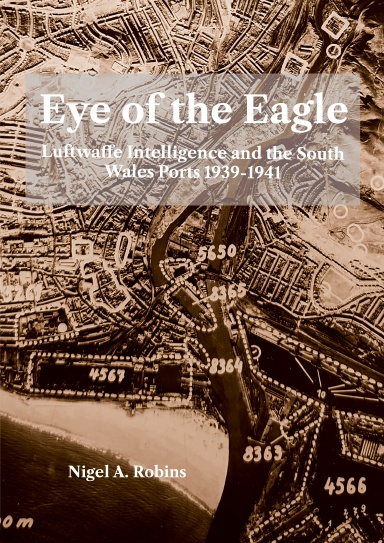
Some initial work was included as an Annexe in ‘Eye of the Eagle’ where I looked at the war diary of U32 as it laid magnetic mines near the Scarweather Lightship in 1939. The new work looks at all the other U-boats that came into Swansea Bay in the early years of the war. Again, it reinforces the crucial role Swansea had in the minds of the German naval staff.
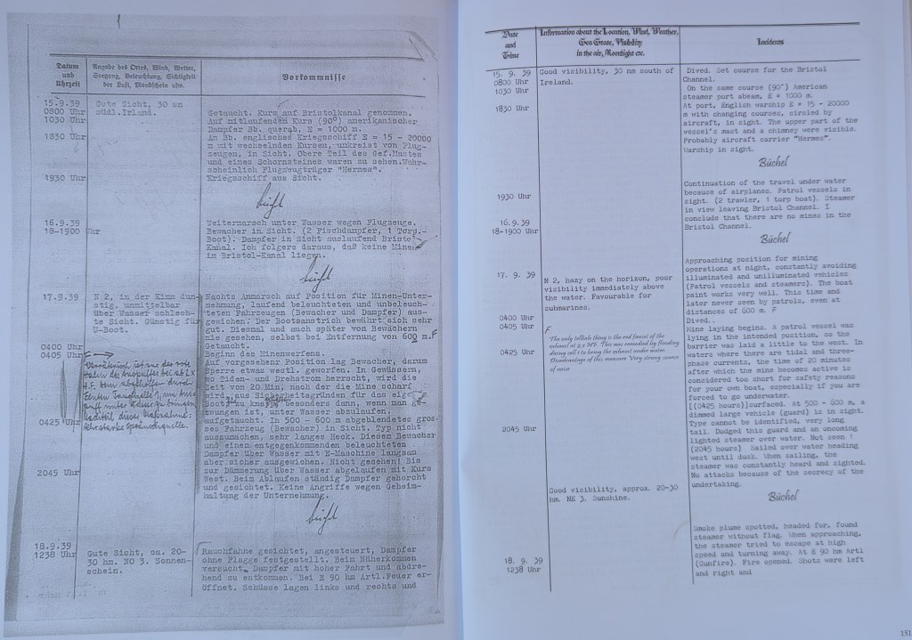
Above: An extract from a U-boat war diary, with my translation. From the Eye of the Eagle book.
The Foxhole River Staithes are a set of enigmatic structures on the banks of the River Tawe near the remains of the White Rick Copper Works. Although now hidden by trees and slowly deteriorating, they were once the centre of the incredible coal industry that dominated Kilvey and Foxhole in Swansea. This book describes the history of coal in early Swansea and explains the significance of the last remaining structures of the coal industry of early Swansea before the arrival of copper smelting in the 1730s
I completed my cheap photography project last month, and added it to my early Swansea coal history book.
The history of Swansea coal is being lost amongst all the noise and gravy train funding for the Hafod/Morfa Copperopolis story. My work on Swansea coal is meant to redress some of that imbalance and cast new light on a part of the Lower Swansea Valley that isn’t considered important.
The photogrammetry was a great success, completed for a few hundred pounds rather than the thousands claimed by local firms. The constraints were to use second-hand cameras and computers, and to provide imagery of a quality and level of detail that would prove useful. No drones were used as we found that they were adding a layer of costs and complexity that was distorting the value of what should be an extremely cheap and quick process.
After discussing the protocols with a couple of BIM colleagues, I looked at the protocols described in this 2011 paper (listed below). Despite being a little older than the average BIM work these days, the workflows were good, easily replicated, and I could learn how to use simpler, older cameras for the imagery.
There was a series of trials of various landscape and heritage features, ranging from riverside bollards, dock walls, and larger landscape features such as bomb craters and threatened landscapes. The larger subjects needed drone input, and so they were discarded, although some beneficial results were obtained for researching biodiversity and small-scale features which I’ll follow up in a later project.
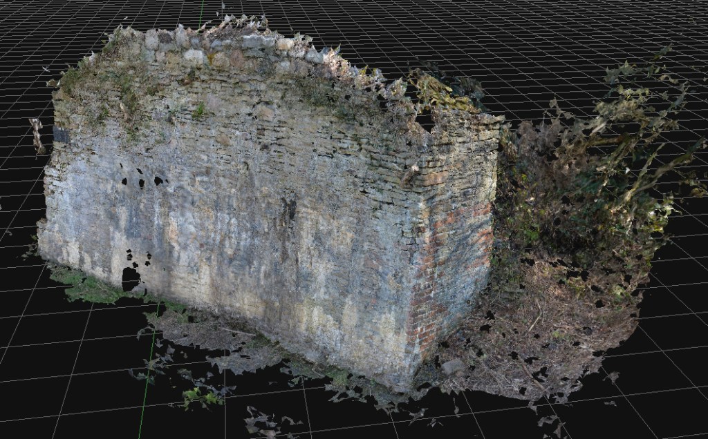
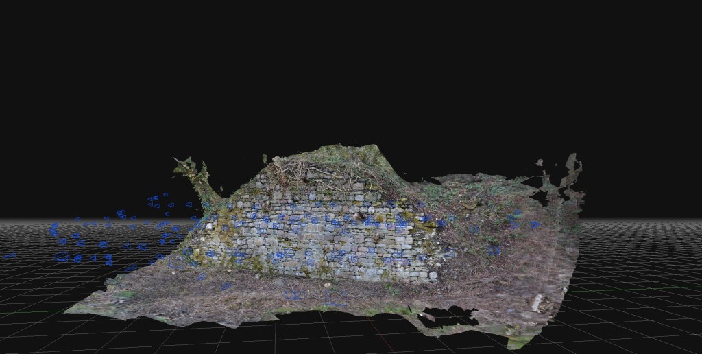
The study subjects were the Foxhole River Staithes, which were of good size (typically about 8m wide, 3m high) and interesting construction. The photographic survey took just over three days, with about four thousand images collected. Office processing of the imagery took about three days.
Above: An ‘aerial’ view of one of the Staithe Structures reconstituted from ground photogrammetry, no drones, merely ground camera work.Above: Another view of Foxhole Structure B. A series of stone retaining walls that originally had timber decking, allowing the loading of coal into various-sized river vessels. Built in the early eighteenth century, probably before extensive copper smelting had begun.Above: Some of the mines and coal veins of early Swansea, discussed in the book.
The photogrammetry was included in a book giving a brief history of coal in Swansea and the significance of the Foxhole area in pre-industrial Swansea.
Fai, Stephen & Graham, Katie & Duckworth, Todd & Wood, Nevil & Attar, Ramtin. (2011). Building Information Modeling and Heritage Documentation.
“The Foxhole River Staithes are a set of enigmatic structures on the banks of the River Tawe near the remains of the White Rick Copper Works. Although now hidden by trees and slowly deteriorating, they were once the centre of the incredible coal industry that dominated Kilvey and Foxhole in Swansea. This book describes the history of coal in early Swansea and explains the significance of the last remaining structures of the coal industry of early Swansea before the arrival of copper smelting in the 1730s. The story of the coal mines of Swansea, the coal export trade and the ships that visited eighteenth-century Swansea are all described. The book also includes the results of photogrammetric surveys of the surviving structures to give the story of the true significance of the Foxhole Staithes and their place in Welsh history.”
For many projects in restoration and landscape, there has been a tendency to overemphasise gee-whiz graphics at the cost of scholarly historical analysis. The project here puts the technology back where it belongs, in the background of support for investigation and analysis.
The rapid development and delivery of this project is almost complete. The proof of concept of quick and cheap photogrammetry is complete, and we explored various features of various sizes. Budget constraints in the broader London-based programme meant that the planned exploitation phase won’t take place there. The plan was to explore some large, immoveable sculptures and statues at risk of damage by surrounding building renovation. Instead, I’ll work in South Wales on a series of local history and geography projects.
Costs were remarkably low (which we believed they would be). It is satisfying to use new technologies to reduce costs and fight against the gradual cost inflation and scope creep of using these types of technologies in small history or geography projects. In researching the business case for this, I learned of several local authority projects where high costs for archaeological surveys, often incorporating expensive drone surveys and extraordinary labour costs, skewed project delivery budgets almost to the cancellation of the projects. I experienced the same issues working on the restoration of the Palace of Westminster, where incredible finances and resources were expended on expensive lidar and photogrammetry products that were who;;y unsuitable for the problems and frequently misled managers into thinking that such products were essential elements of the restoration at RIBA Stages 1 and 2 .
For many projects in restoration and landscape, there has been a tendency to overemphasise gee-whiz graphics at the cost of scholarly historical analysis. The project here puts the technology back where it belongs, in the background of support for investigation and analysis.
Above: A test scan of a significant rock exposure on Cilfái Hill in Swansea. Upper Carboniferous Pennant Sandstone with a forty-degree dip north. This is an exposure in an area where William Logan and Henry De la Beche discussed the general stratigraphic layout of the South Wales Coalfield. Some of the exposures have copper nails struck into the rock, which may have been part of Logan’s levelling work in the late 1830s. These exposures are at risk of destruction by Swansea Council’s tourism redevelopment of the area, so it is good to get a good scan of them before they are destroyed.
Above: An old coal loading dock in the Lower Swansea Valley, known as a ‘Staith’. Probably dating from the 1740s, this was built to make loading coal into ships in the river easier. The coal came down the east-side tramways and later the canal. This is a scheduled ancient monument but has been neglected by Swansea Council and is now deteriorating. Ironically, the monument’s destruction has been accelerating because of the encroaching woodland and the dumping of industrial waste. This structure is incredibly rare; there may only be two others in Wales, and they are also in the Lower Swansea Valley. Again, this is a low-cost photogrammetric scan taken as an emergency whilst extensive finances are expended elsewhere in the Valley on Council-led projects.
Costs are kept low by avoiding the use of drone technologies, using older and previously-used professional cameras bought cheaply on Ebay, and new software costing a few hundred Euros.
The next steps are researching the history of coal industry structures in the valley, followed by some investigation of some World War Two remains on Cilfái.
The work here was added to original surveys carried out in the 1980s, and a comparison with photographic records allowed a visual check of the structure’s deterioration and environmental changes. A review of the geology of the structure’s building materials could also be carried out, which revealed distinctive contrasts between this structure and other post-1737 structures and walls nearby.
I’m really pleased that this small project is now starting to yield results! The first delivery was a series of scans and interpretations of some rare dock structures on the banks of the River Tawe. Some of the structures are scheduled ancient monuments, but the oldest and rarest are not!
The brief for this structure was a cheap and accurate photogrammetric survey at the lowest cost, allowing for interpretation and enhancing the historical information from earlier work and new research. The requirement was cheap, quick and accurate, which meant no expensive drone or landscape surveys.
Above: An early eighteenth-century coal staith remains in the Swansea Valley.
The work here was added to original surveys carried out in the 1980s, and a comparison with photographic records allowed a visual check of the structure’s deterioration and environmental changes. A review of the geology of the structure’s building materials could also be carried out, which revealed distinctive contrasts between this structure and other post-1737 structures and walls nearby.
There is still much to do, including costing the project and leveraging the technology more effectively on little-known structures in the area.