Cilfái: Woodland Management and Climate Change on Kilvey Hill, Swansea ISBN 978-1-7393533-1-5

This has now been reprinted as a 2025 Second Edition with some updates I’ve also updated the copyright for AI constraints, and EU product compliance details.

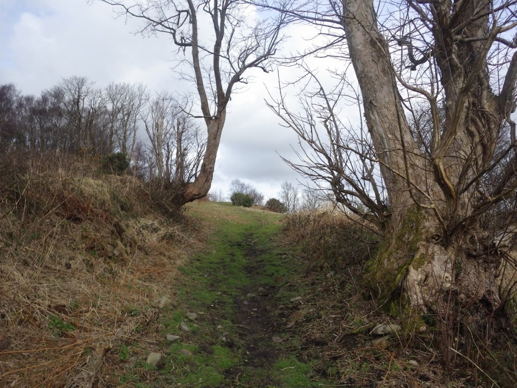
This book started out as a collection of notes made over more than a decade of surveys in Welsh woodlands. What started out as a historical investigation into industrial archaeology in woodlands transformed into a catalogue of what climate change, government policy and local politics is doing to our landscape. As I write this Cilfái is threatened once more with proposed transformation that increasingly looks like destruction.


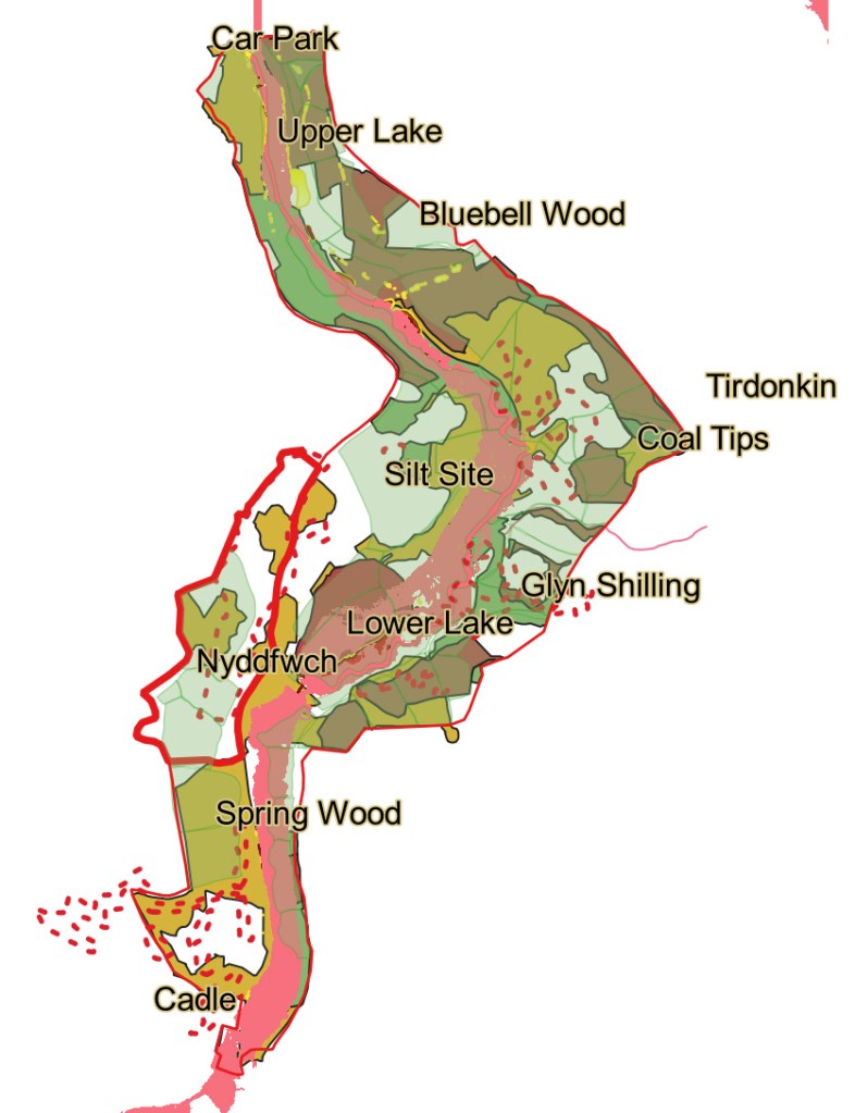
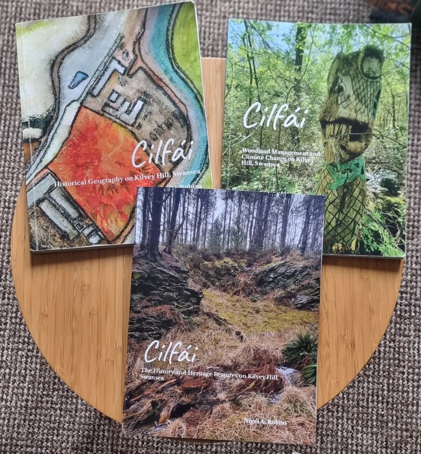
This is a companion volume to Cilfái: Historical Geography on Kilvey Hill, Swansea. But this one is more about the environment of the woods and the climate change that is already changing the nature of the land. Climate change is now part of life and the next generation will be challenged with adaptation to what is happening. This book is my chronicle of what some of that means for Cilfái (Kilvey), this most special part of Swansea’s character that has been abused, ignored and loved…depending on where you live and what your politics are. Some of this work is based on my government experience as a programme reviewer of many environmental and cultural projects across the UK where I experienced the good, the bad, and the ugly of politicians, the Civil Service and successive government policies or the lack of them.


Authors always have inspiration from somewhere and I am no different. My inspiration has been in the conversations and actions of many colleagues in my time working in UK Government in Defra, MOD, Cabinet Office, and Parliament. They all contributed, sometimes unwittingly. You can often learn a lot about a topic by listening to people who know very little about it but who never feel restricted in holding an opinion. Climate change is one of those topics.
I have been privileged to have had the company of experts in many conversations about the topics covered here. But notably, the Forestry Commission was laid bare to me by veteran forestry man David Connick. Equally, the passion of my friend Keith Clement in worrying about where we are going has constantly coloured my sense of urgency.
The commitment and enduring engagement of the Kilvey Woodland Volunteers never ceases to amaze and inspire, and I regularly see incredible generous acts of sharing and care for the Hill that should be an example to all volunteer groups.

I produced or maspped a lot of data (both historical and current) using QGIS. Here you can see the 1980s woodland compartments and their relationship with the original industrial waste tips.

Cilfái: Historical Geography on Kilvey Hill, Swansea ISBN 978-1-7393533-0-8

This has now been reissued as a 2025 Second Edition with some updates, minor amendments and some new illustrations. I’ve also updated the copyright and EU product compliance details.

This study has been heavily reliant on past teaching notes and lessons learned from students’ questions and discussions over many years. I am indebted to all of them. Grateful thanks to the staff of West Glamorgan Archives Service and the archivists at the British Geological Survey in Keyworth who allowed me to spend time with William Logan’s original notebooks. The help of experts such as Dr John Alban and Gerald Gabb has always been beyond value and they have helped me as a sounding board and unlocking further fields of expertise which ave been so valuable. The contributions and discussions with my oldest friend John Andrew on geology and the rocks of Townhill and Kilvey have been particularly inspiring. John passed away in August 2024 and I miss his help and support terribly.

The cover of Cilfái was part of a painting of White Rock I did a while ago, mainly to show the extent of the Cae Morfa Carw waste tip (the orange land). The Tawe is on the right, and the original long workhouse of White Rock is at the top.


I must also thank the staff and colleagues at Coed Cadw/Woodland Trust who, unwittingly perhaps, spurred me on to re-explore Kilvey some thirty years after I last surveyed the land in the late 1980s. All the modern mapping was completed using the open-source QGIS application which has become a central tool as a landscape historian over the past ten years. Finally, I must mention the help and support of Kilvey Woodland Volunteers. Without the passion and commitment of the volunteer body over many years, I doubt that Kilvey would be the special place it has become. As I write this, Kilvey is under more threats from the local council and developers, and I hope this little book records a few milestones in the ongoing Kilvey story rather than an ending.


The first edition of Cilfái was remarkably successful. The aim was to fill a gap in knowledge about the Hill in the constant challenge to take care of it in the face of threats of irreversible destruction from tourist developments and an uncaring local authority. There are now many more local environmental and residents groups aware of the current value of the land and the potential loss Swansea faces if the destruction begins. This book was the first of the Cilfái trilogy, the second book covered Woodland Management and Climate Change, and the third book covered the heritage features on the hill. This book was rushed into print to address claims from the Local Authority that there was ‘not much up there’. Since 2023, I’ve taken hundreds of people on walks to view the biodiversity, history, and heritage of Cilfái, and I’ve packed out numerous community centres and halls to talk about the history. Hundreds of people have been converted to the value of the landscape we may lose.

Above: A coal adit on Kilvey was left to regenerate after about 40 years of peace. Swansea Council may be seeking to destroy this land, which they consider ‘worthless’.

Coal in Swansea

Swansea’s history would have been totally different witthout it. Coal is now part of Britain’s past history although across the planet coal use is now larger than at any time in the past. Led by China and Australia, coal burning will exceed 8.7 billion tonnes this year resulting in the climate change we now experience.

Swansea has a unique place in the history of coal. Kilvey Hill and Townhill were both places where early geologists first learned about the relationships of coal seams and sandstones that eventually led to understanding the coal resources across the whole of the Glamorgan coalfield. Engineers like Edward Martin, and geologists like Henry de la Beche and William Logan learned about coal by exploring the coal veins of Swansea.

I’ll be talking about the history of Swansea coal at a lecture for the Oysterrmouth Historical Association on Thursday 16 January at Tabernacle Church, Newton Road, at 7.30pm.

Above is a lump of Kilvey coal from the Swansea Rotten Vein above White Rock. You can see the layers of hard, glassy carbon and the duller layers of carbonised charcoal that made this coal incredibly polluting when burned in massive quantities in the Lower Swansea Valley.

My books: latest…

I’ve now got a stock of my latest book Y Tân.

Y Tân: A History of Destruction, Swansea 1941 is about my history of the Three Nights Blitz in February 1941. The town suffered appalling damage, and many argue it has never recovered. My grandfather died fighting the fires on the last night of the Blitz in Castle Street which was the site of a number of tragedies on that dreadful Friday.

In Y Tân I examine the situation in Swansea in the month before the attacks and look at the vulnerability of Swansea to German bombs and incendiaries. I examine the history of the weapon that destroyed the town and explain why Ben Evans was so vulnerable to fire. I examine the history of Castle Gardens and the reasons it became so dangerous. I also reconstruct the events of the three nights with eyewitness testimony from local people, war diaries and German air force sources. A chapter explains what happened to the piles of rubble in the town that eventually gave way to the redevelopments we see today—copiously illustrated with photos, maps and archive records from the author’s collections. Fully academically referenced.

Y Tân complements the groundbreaking examination of Luftwaffe intelligence maps and plans published earlier this year, Eye of the Eagle: Luftwaffe Intelligence and the South Wales Ports 1939-1941.

Y Tân is £16.99, easily available from the author, or you can buy it online here.

Also available from me or online:

Eye of the Eagle: Luftwaffe Intelligence and the South Wales Ports 1939-1941: A4 170 pages with over a hundred illustrations and map extracts.

The Cilfái Trilogy

Cilfái: Historical Geography on Kilvey Hill, Swansea: £15.99, many colour illustrations and maps, 126 pages

Cilfái: Woodland Management and Climate Change on Kilvey Hill, Swansea: £15.99, many colour illustrations and maps, 130 pages.

Cilfái: The History and Heritage Features on Kilvey Hill, Swansea: £14.99, many colour illustrations and maps, 98 pages.

Contact me via email at nyddfwch@gmail.com or message me. All payments are made easily with Paypal.

Or you can order from my bookshop at Nigel A Robins: Geographer – Books and Publications Spotlight | Lulu

More on Swansea coal

I’m still working on the history of geological exploration in and around the Swansea area. Some of it was included in the first Cilfái book, where I wrote about the early work history of William Logan, who learned much of his early geology studying the coal veins of Cilfái.

Knowledge of every coal vein in the area was once the lifeblood of the Industrial Revolution. It is hard to believe now when we can walk through the lush green vegetation of Cilfái without seeing any evidence of the past unless we make an effort to dig to find some.

During our ITV filming on Monday, I was asked about the Tormynydd coal seam. This substantial coal layer, which extends from the seaward side of the hill to Neath and Port Talbot, played a pivotal role in the Industrial Revolution. Like all Cilfái coals, it is bituminous or binding coal that can burn with a cloud of thick black smoke and tends to stick in big lumps when it burns down. (Conybeare and Phillips 1822: 426). The Tormynydd vein is at the bottom of the sketch map and is marked today by a line of big quarries and tunnels across the front of the hill.

My sketch map of the coal veins across Cilfái. It has to be in pencil because I keep updating it as I find more sources and information.

Knowledge of the coal veins of Cilfái and wider Swansea was passed from father to son for generations and it wasn’t until the 1790s that people started to think seriously about understanding the nature and relationship of the underground coal veins.  The first map of coal in the area is William Smith’s map dated 1815 (but based on considerable local knowledge). There’s an extract of it below (Macfarlane 2020).

My sketch plan is based on diaries and memoirs from various times. It is incredible to think that Cilfái had about 10 coal veins providing coal for White Rock and Middle Bank in the 1790s

Above: This is an extract from the earliest map of the local Geology we have. This is dated 1815, but is based on lots of earlier information from the 1700s. This map pre-dates the Ordnance Survey plans for Swansea so gives us a different view of priorities for understanding the main features of Swansea. William Smith had to devise a set of colours to depict the different types of rock (or ‘Strata’ ) that he found. Smith decided on blue to depict limestone…a convention that we still honour today. The grey shading is the ‘coal measures’, the rocks of sandstone and mudstone that contained the precious coal seams (veins in Smith’s time). The fact that Kilvey has a place name shows how important the hill was as a landmark in Swansea’s coal geography. You can see the crosses that mark the location of Swansea’s biggest coal mines at the time of the Napoleonic Wars.

Conybeare, William Daniel, and William Phillips. 1822. Outlines of the Geology of England and Wales: With an Introductory Compendium of the General Principles of That Science, and Comparative Views of the Structure of Foreign Countries … (W. Phillips)

Macfarlane, Robert. 2020. STRATA: William Smith’s Geological Maps, 1st edition, ed. by Oxford University Museum of Natural History (London: Thames and Hudson Ltd)

Penllergare: The Ancient Trees

The latest press release from Welsh Government about the National Forest for Wales confirmed that Swansea’s Penllergare Valley Woods has been confirmed as a National Forest site. I think this makes it one of the hundred announced sites so far.

It is a clever bit of policy from Welsh Labour and throws a bit of recognition and identity branding the way of some struggling woodland sites. Creating a Welsh ‘network’, however fragmented, can only be a good idea.

The pre-medieval road to Nyddfwch in the Penllergare Valley Woods in 2018.

The name of Penllergare is as confusing as its location. It is probably an anglicisation of nearby Penllergaer. The lottery-funded restoration project adopted the name from the long-gone mansion owned by the Llewelyn family. The awkward anglicisation always makes me uncomfortable and I tend to refer to the area as the Llan Valley or Nyddfwch which were earlier locality names and are far more in keeping with modern sensibilities.

Above: The Penllergare woodlands are a complex mix of ancient woodland, garden planting, invasive non-natives and coal mining archaeology. An incredibly rich mix of history and environmment.

The valley woodlands thoroughly deserve inclusion in the National Forest list. I spent nearly ten wonderful years surveying and researching the landscape and woodlands until I felt compelled to leave in the face of the ugly politics and personalities that run the charity. Some of the staff and volunteers I worked with were some of the finest people I ever experienced in conservation circles, although all have been hounded out by the organisation, which is such a shame.

The original mission of the lottery-funded project was to recreate the nineteenth-century estate gardens of the Llewelyn family. It was centred on making something of the remaining walled garden and the paths and planting of the Llewelyns, a wonderful collection of exotic trees, native (1800s) planting, and a collection of Rhododendrons. The premise was ambitious in the early 2000s, and many of us were surprised that it got funding, as we knew the concept was challenging because of climate change and the lack of surviving substantive features. I think the charity running the place is now pressing for more money to keep the place going. Some of you who came to my Environment Centre lectures may remember I compared the limited effectiveness of money invested in Penllergare with the far better return on investment of money spent on Cilfái.

Above: The Nyddfwch Oak in Penllergare.

The wider area of woodland contains significant ancient trees, 1950s Forestry Commission planting and a spectacular collection of unusual and exotic tree species (the remnants of the nineteenth-century garden). Much is made of the links to the Llewelyn family, although they abandoned the site for a nicer house elsewhere. I imagine the family’s estate managers will be unhappy at this latest National Forest status as they were hell-bent on selling for housing; the land is on a short lease for the charity.

Above: Ancient tree stumps from the Penllergare valley. The area was cleared for timber in the 1940s although many trees and ther carcasses survive providing an excellent reservoir of dead wood. At one time the management wanted to sell the wood for firewood LOL.

The history of the nineteenth century is only of limited significance. Far more interesting is the history of the valley in the early 1700s, when it was devastated by coal mining. So, the land is a good example of early Welsh industrialisation and the recovery after that, when the coal was worked out in the 1790s. The ancient trees are an incredible survival from the coal mining devastation of the 1700s and were probably rejected for harvesting as timber because of their shape. I prepared a draft book on the woodlands a few years ago, and now may be the time to turn it into a real entity.

I used to take many groups into the woods to explore the woodland, let me know if you’re interested and I’ll put together a walk.

Above: My original manuscript. Maybe I’ll make it real.

Cilfái: The Importance of our History.

Who owns history?

Last Saturday, I talked about the history of Cilfái as part of our National Local History Month celebrations.

I had a packed room in the Central Library, not to see me… but to listen to the topic. Concern over losing our history and heritage is mounting as more threats from local Council plans get closer. I knew many of the audience, some of my old colleagues, heritage and environmental workers, and my past history teachers. There were a lot of local people as well who made an effort to come and sit in a warm teaching room on one of the hottest days of the year.

The combined years of experience in the room were amazing. People who had worked on the hill researched and cared for it, and a newer generation is taking on the challenge of future care. There was an unbroken chain of partnerships and friendships dating back to the pioneer historians Clarence Seyler and George Grant Francis.

The talk and the questions session afterwards led me to reflect on the history I was talking about. Much of the past fifty years of Cilfái history is not documented and runs a significant risk of being ‘reinterpreted’ by an unmindful local authority and a foreign tourism company. That risk of deliberate amnesia was one of the reasons I wrote the Cilfái volumes.

But who ‘owns’ the history? It is always an important question. In 1891, Oscar Wilde penned an often-quoted phrase, ‘The one duty we owe to history is to re-write it.’ Although Wilde was likely thinking more of fine art criticism, the statement holds up in modern times with the revision of colonialism and racism prominently featured in research and popular histories. I’m part of that process as I talk of the environmental pollution and ecocide that accompanied the explosion of industrialisation and exploitation in the Swansea Valley.

As good as the Wilde observation is, I felt I was always led by this statement from George Santayana in 1905…’ Those who cannot remember the past are condemned to repeat it.’ I suppose the ‘remembering’ or ‘forgetting’ can be both wilful and accidental. In the past month, I have had conversations with senior Council officers over Cilfái, where officials were adamant that records and land titles were entirely in order concerning the hill (and officially stating that was the case) whilst not checking anything about the truth and validity of those statements. The main reason behind their indolence was an intention to wilfully ignore the hill’s history. After my pushback, the senior planning officer had to retract those silly statements. The worst part of the episode was the inherent untruths and misrepresentation of vague facts advanced by Council employees who may be qualified but are rarely experienced. The injured parties are us as the public.

In books and talks about the history of Cilfái, I have tried to open ownership of our history to the broader public to combat the apparent desire of some to shut down debate, consultation, and knowledge. It is also important to remember that some of the most vocal Facebook warriors in unquestioning support for foreign tourism company plans have never been on the hill.

Above: Coal mine workings on Cilfái after 40 years of uninterrupted recovery. The Council and the foreign tourism company want us to believe this is worthless and they can do better. Really?

Understanding Luftwaffe bombing in South Wales: The GWR Ports

The Great Western Railway (GWR) ports of Souh Wales were vitally important in both world wars for the defence of Britain and hadling imports to support the war effort. Although the ports were mostly designed to export coal before World War One, the GWR invested a lot of money in the 1920s to redevelop some of the ports into general cargo import and export. So, Cardiff, Swansea, and Newport were all given better cranes and storage facilities which enabled a mioxed economy develop as coal exports slowly declined. Eventually, Penarth closed as it was too heavily engineered for coal handling to be of much use. Swansea ans Cardiff became important food import ports with good rail links and plenty of power for large grain and frozen food storage. The full story is covered in Eye of the Eagle: Luftwaffe Intelligence and the South Wales ports 1939-1941.

Below: A GWR plan from 1933 showing the improvements made to Cardiff Docks before the war.

Below: The GWR coal export rail network in 1933. An incredibly dense network of railways allowing bulk transport of coal from every part of the Glamorgan coalfield.

Ancient Woodland in Swansea

We don’t have any ancient woodland on Cilfái. The last of it was killed off in the 1750s by industrial pollution. The coal industry on the hill probably removed most of the bigger trees before that as coal mining consumed massive quantities of timber. Both Cilfái and Townhill were cleared of their natural woodland by the 1300s (Robins 1990: 4–8).

1970 marked the new beginning of woodland on the Cilfái woodland site. We know that the Scots and Monterey pines on the western side were planted alongside efforts by the Forestry Commission to reestablish forestry on the upper slopes of the west side (Robins 2023a: 62–77, 2023b: 55–58).

Although the landscape of ancient woodland has disappeared, Swansea does have some incredible surviving old trees in Singleton Park and Penllergaer (Penllergare) Country Park. The trees in Singleton survived being part of farmland in the 1600s and were incorporated into the estate of the Vivian family in the 1800s (Morris 1995: 5–26).

The Penllergaer Country Park has some incredible survivors who survived the devastation of the coal mining period between 1500 and 1790 and became incorporated into the private parklands of the Dillwyn Llewelyn family. I wrote about some of the trees in Swansea History Journal a while back (Robins 2021).

The trees of Cilfái are special because we know how old they are and what they have gone through to survive today. The trees of Nyddfwch are special because they are far older but have also survived the ravages of industrialisation and human interference.

Morris, Bernard. 1995. The Houses of Singleton: A Swansea Landscape and Its History (Swansea: West Glamorgan Archive Service)

Robins, Nigel A. 1990. The Enclosure of Townhill: An Illustrated Guide (Swansea: City of Swansea)

———. 2021. ‘The Landscape History of Nyddfwch (Penlle’rgaer)’, Minerva: The Swansea History Journal, 29: 121–34

———. 2023a. Cilfái: Historical Geography on Kilvey Hill, Swansea (Swansea: Nyddfwch)

———. 2023b. Cilfái: Woodland Management and Climate Change on Kilvey Hill, Swansea (Swansea: Nyddfwch)

Below: The Nyddfwch oak in the Llan Valley. Originally planted as a marker tree on a hedge guarding the Llan meadows.

The ‘lumpy veins’ of Cilfái

Although there is a publicity fanfare about Copper in Swansea, it is coal that is in the heart of Swansea’s history. There may be two thousand years of coal workings around the city and west to Crofty. Beyond that, the rocks of Gower change so there is no coal mining.

The mining of coal was a part of every farm and farmworker’s life before the Industrial Revolution in the 1750s. Coal often outcropped on the surface and small scrapes or pits still survive all across Swansea. The country park of Penllergare is an invention of the mid 1800s, before that the Llan valley was devastated by coal workings. The valley is still full of pits and collapsed tunnels. Cilfái’s coal was mined from medieval times, and Swansea’s earliest coal mining records are actually Cilfái coal mining above Foxhole. I discuss the early history of coal in Cilfái: Historical Geography.

Cilfái had three good coal seams running west-east across the hill. These were the Hughes Vein, Captains Vein, and the Foxhole Vein. The Hughes and Captains yielded a good-quality bituminous coal which was used in the copper smelters of White Rock and Middle Bank. The Foxhole Vein was more of a problem, it tended to vary in thickness and quality so mining it was often frustrating as it would disappear and then reappear further up the hill. The top of Cilfái is marked with excavations from the 1700s where men had dug to try and get a better access to good coal from the Foxhole. They never found it, so the Foxhole Vein was called ‘lumpy’…unreliable.

Local colliers on Cilfái knew all about the problems of mining on the hill and the knowledge was passed down the generations. It wasn’t until 1837 when William Logan started talking to the colliers and mapping their knowledge, that we begin to have detailed knowledge of the coalfield under Swansea and Morriston

Below: Coal from the Hughes Vein above White Rock. A lustrous black coal that shines like a jewel. You can see the layers of harder vitreous coal that were often the source of better quality fires. The nature of layers in the coal was only finally understood in the early 1900s by Dr Marie Stopes, Britain’s pioneering palaeobotanist.