Geoheritage is now becoming a broader term for our geographical and geological features that have significant scientific, educational, cultural, or aesthetic value. Swansea has an important place in the history of geological exploration and the development of the Welsh coal industry.
People who have participated in my many guided walks on Kilvey will already be aware of the value of the Kilvey Geoheritage sites and the contribution they make to the Biodiversity and Geodiversity of Swansea.
Globally, October is a month of celebrating and recognising the importance of the rocks and landscape underneath our feet. Swansea has more than most towns to be mindful of, as it is built on over a thousand years of coal mining history.
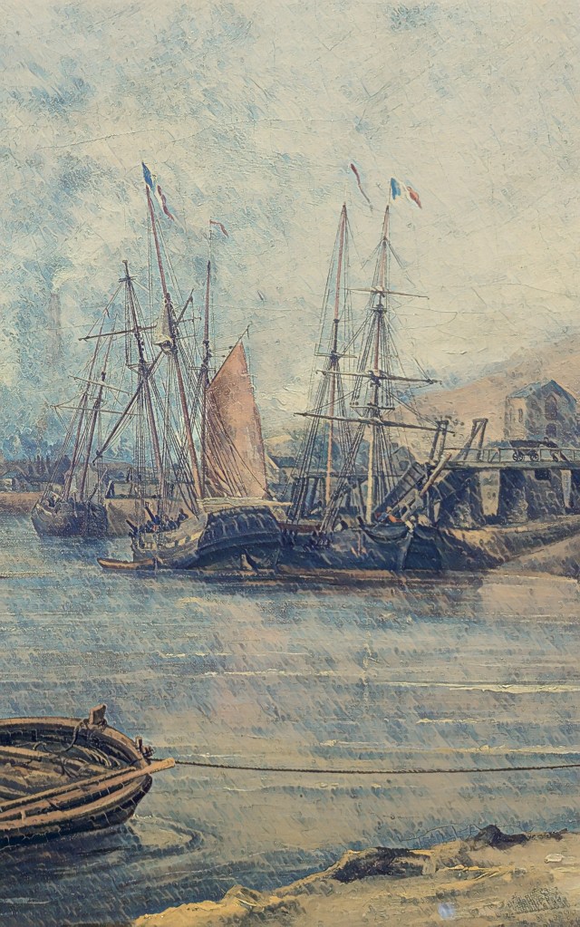
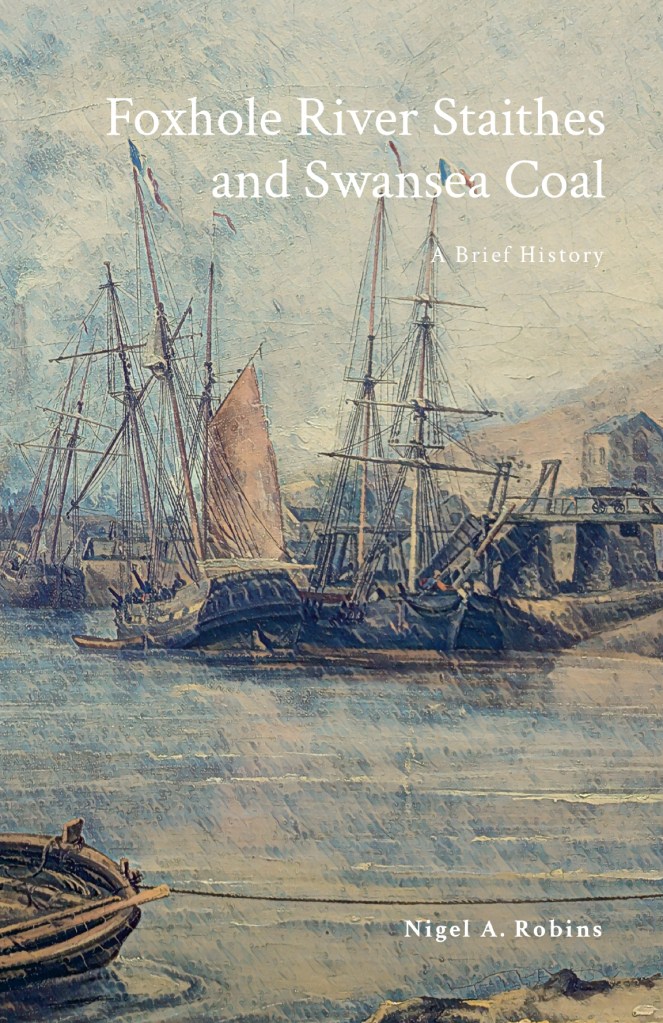
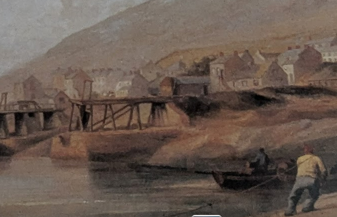
Above: Foxhole Coal Staithes in the 1840s.
Following on from my recent book on Foxhole and the history of Swansea Coal, I’ll be giving a few guided walks and talks on broader aspects of Swansea’s incredible Geoheritage and Geodiversity.
On 4 October, I’ll be talking about the history of Swansea coal and the special place Foxhole on Kilvey has in the history of Welsh coal mining. My talk will be at Swansea Museum as part of the RISW and the Historical Association’s History Day 2025. I’ll also have copies of the Foxhole history book at a discounted price.
On 6 October, as part of UNESCO’s # InternationalGeodiversityDay, I’ll be leading a walk around the geological features of Kilvey Hill and explaining the unique place in Swansea’s history that Kilvey holds. The geological features of Kilvey have long been regarded as obscured or destroyed, but many have survived against all odds. Come with me and walk the land that was explored by Geology’s most famous local coal pioneers, William Logan and Henry De la Beche. Tickets will be available shortly. I’ll advertise them via Facebook and Eventbrite.
On 8 October, I’ll be at the Friends of Penllergare monthly meeting at Llewellyn Hall in Penllergaer. I’ll be talking about ‘Penllergare, Henry De la Beche, and early Geology in Swansea’. Lewis Weston Dillwyn was often at the centre of scientific and cultural events in Swansea. He was particularly prominent in the recognition of Swansea as a centre of research in the emerging science of Geology and the first understanding of the South Wales coalfields.
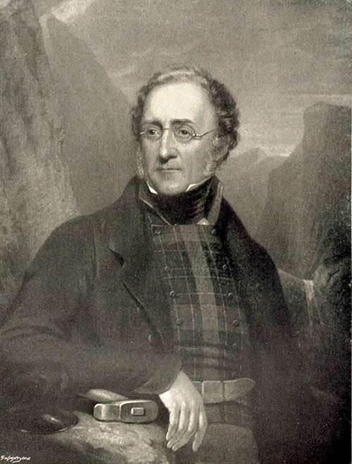
Above: Henry De la Beche. Pioneer geologist.
I’ll be doing a few more walks and talks throughout the month, and I’ll post here to let people know. If you want to know more contact mew for details.
I’ll also have my bookshop of all my current books in print at the History and Heritage Fair at the National Waterfront Museum on 27 September 2025.
In the autumn of 2022, the local Council announced their plans to remodel the ancient Kilvey Hill landscape for a new tourism development, which would destroy the traces of thousands of years of human habitation and endeavour. The impending destruction led me to do what I could to record the history, ecology, biodiversity and Geoheritage of what is a significantly under-recorded landscape with considerable potential for education, well-being and climate change management.
Documenting the history and biodiversity was relatively straightforward, albeit a challenge to perceptions regarding a large area of land that many people see but few have experienced and even fewer understand. I remember one comment from the local authority about ‘there is nothing up there’. A comment I later understood as a self-serving phrase to make the destruction and loss more comfortable for planning permissions.
Above: The thinly bedded sandstones of sandstone on Kilvey are part of a broad range of types of structure on Kilvey, along with massive beds heavily used for building stone and the bituminous coal seams that were so important to early Medieval Swansea.
I suppose my perceptions were different, having had the advantage of a geological education at school and undergraduate level, including a hectic month of field mapping coastal regions of the Isle of Wight back in the day. I hadn’t appreciated how much of that had stuck with me until I needed to explore the Geodiversity of the Hill through documents, fieldwork and the wonderful archive of the British Geological Survey.
The fact that the natural heritage of any country includes its geological heritage is now slipping away from us. The wonderful naturalists’ clubs of the early twentieth century, such as the Swansea Scientific and Field Naturalists’ Society, were a broad church to all aspects of nature, including geology. But they have disappeared in the swing towards wildlife rather than general nature conservation, which has permanently obfuscated much of our wonderful Welsh geological heritage. The process accelerated as Naturalists’ Societies changed their names to Wildlife Trusts.
The collapse of geology as a subject deemed worthy of learning and the dissolution of the geological part of the National Museum for Wales have meant that describing the significance of geological sites has become challenging, as basic literacy in the nature of rocks and the landscape is in freefall.
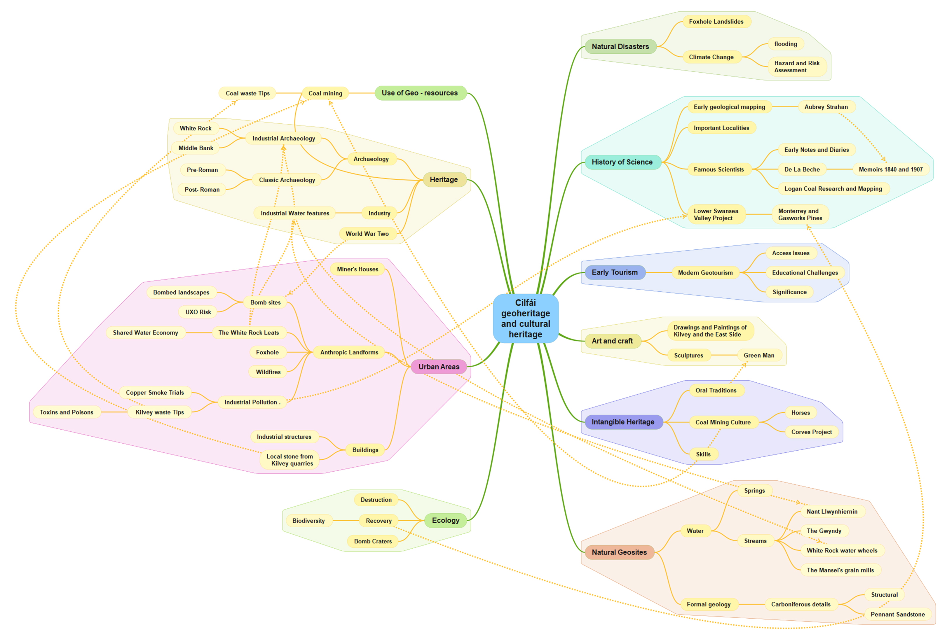
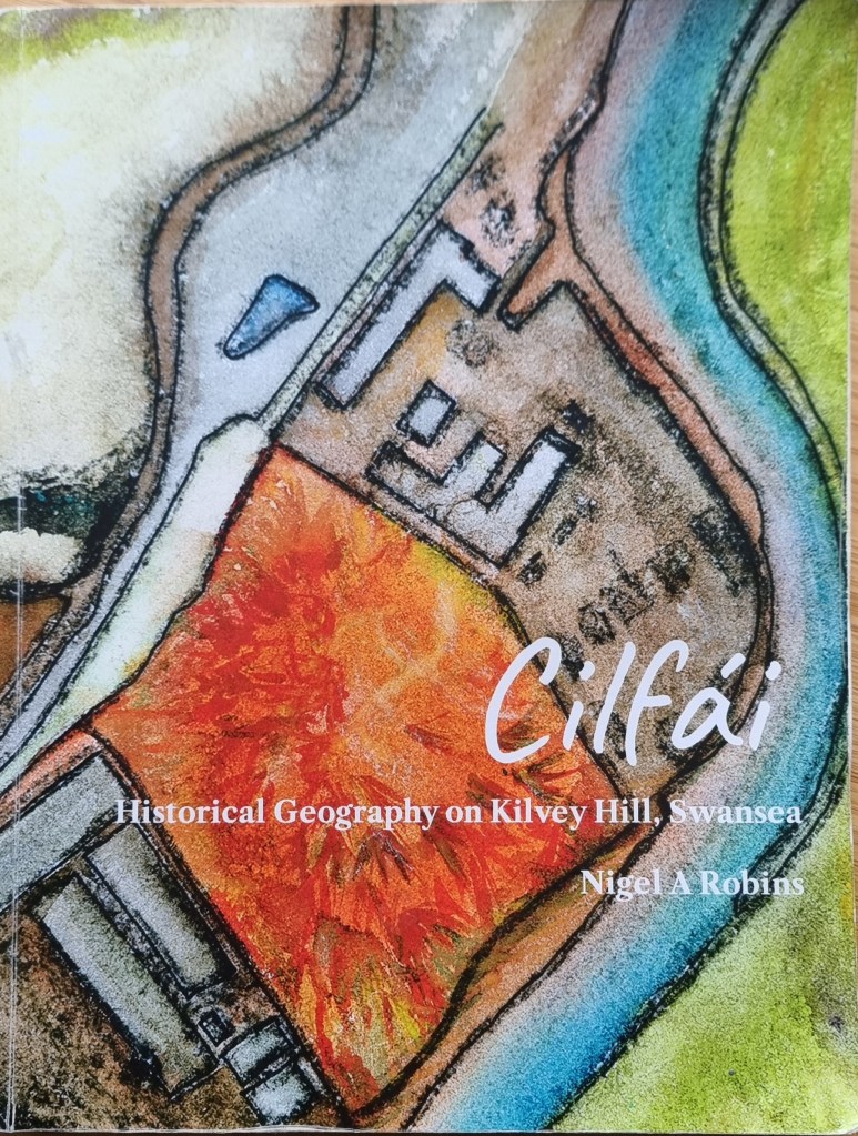
Geoheritage and Geodiversity featured strongly in my first book on the history of Cilfái, not least because it was good history as well as good geology (Robins 2023a). I sought to highlight the significance to local heritage of the geology by separating ecology, biodiversity and climate change into the second Cilfái book (Robins 2023b). However, I felt my treatment of Geoheritage in the first book was not enough. I included a more substantial piece on Swansea’s coal history in my book on the Swansea Foxhole Coal Staithes, but the rich history of William Logan, Hendry de La Beche and Aubrey Strahan clearly deserves more (Robins 2025).
‘Every outcrop has the potential to be great’ (Clary, Pyle, and Andrews 2024) was an opening line to a recent special publication from the Geological Society. It’s a great opening line, and it sets a very positive note for a lively discussion on Geoheritage on a landscape scale. It’s a sentiment that is less positively upheld in Wales where our process of listing or recording sites of geological interest is haphazard and starved of interest and funds.
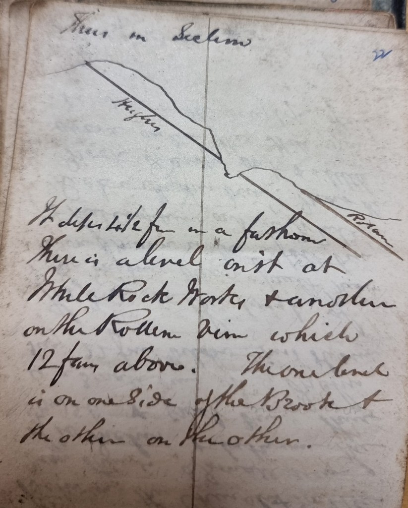
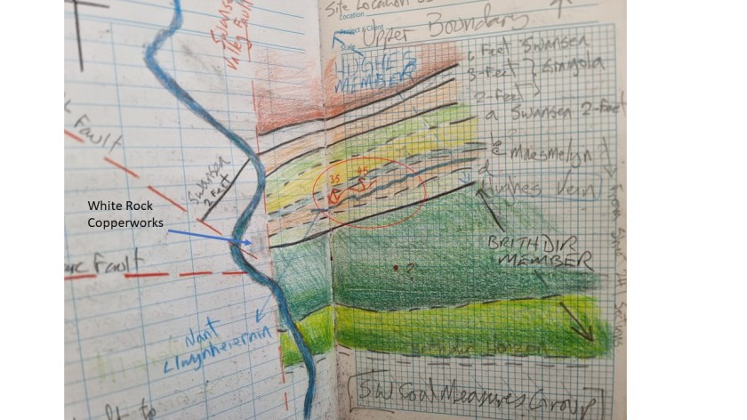
Above: An extract from one of William Logan’s many notebooks from the 1830s. Logan made regular visits to the outcrops above White Rock as he sought to understand stratigraphy and dip of the beds for coal exploration.
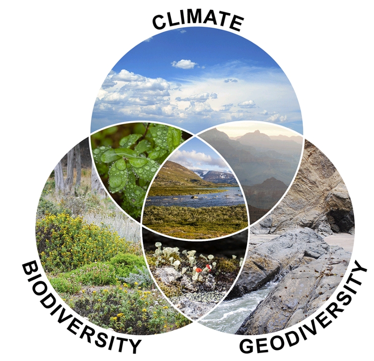
Nevertheless, the listing of a Kilvey site visit on the coming UNESCO International Geodiversity Day is a good opportunity to explore and reassess local Geoheritage. In preparing information for the International Geodiversity Day, I was particularly struck by a recent article linking Geoheritage and Cultural Heritage (Pijet-Migón and Migón 2022). The authors have introduced a model of themes at the Geoheritage-Cultural Heritage ‘interface’. It’s a very useful summary of what to explore or be aware of when revisiting geological sites. It helps move forward from traditional geological guides and texts (Owen 1973), which, although very useful, need to be modernised and broader in scope and engagement for a new generation.
Although the Pijet-Migón model doesn’t fit everything, for example, it can be broadened to explore the link between Biodiversity and Geodiversity, it is very useful. Here’s the Cilfái Geoheritage Landscape filtered through an amended model:
Clary, Renee M., Eric J. Pyle, and William Andrews. 2024. ‘Encompassing Geoheritage’s Multiple Voices, Multiple Venues and Multi-Disciplinarity’, Geology’s Significant Sites and Their Contributions to Geoheritage, no. Special Publication 543, pp. 1–7, doi:10.1144/SP543-2024-34
Owen, T.R. 1973. Geology Explained in South Wales (David & Charles)
Pijet-Migón, Edyta, and Piotr Migón. 2022. ‘Geoheritage and Cultural Heritage – A Review of Recurrent and Interlinked Themes’, Geosciences, 12.98, doi:10.3390/geosciences12020098
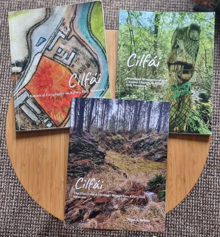
Robins, Nigel A. 2023a. Cilfái: Historical Geography on Kilvey Hill, Swansea (Nyddfwch)
——. 2023b. Cilfái: Woodland Management and Climate Change on Kilvey Hill, Swansea (Nyddfwch)
——. 2025. Foxhole River Staithes and Swansea Coal (Nyddfwch)
In researching the geology of Kilvey Hill, several issues quickly come to light.
The first is how little geology is actually being taught or even followed as a hobby any more. This is quite remarkable given the massive part Swansea’s geology has played in the history of the town. Swansea’s underlying coal resources were a massive factor in the development and growth of the eighteenth-century town. Without coal, there would have been no copper smelting, and Swansea would probably have remained the ‘Brighton of Wales’ (Boorman 1986). All the more remarkable when you consider that geology was an immensely popular subject for study in Swansea from the 1830s, and a century later, a large part of the University College of Swansea (Owen 1973; 1974). The geology of Kilvey became a training ground for William Logan when he taught himself about Swansea coal and rocks in the 1830s. Some of this will be a central theme in my guided walks for UNESCO Geodiversity Day in October.
The rocks of Kilvey contain a mass of plant and animal traces from the past. Understanding these past ecosystems and biodiversity allowed us to understand and exploit the coal reserves of under Swansea and the wider South Wales Coalfield. These rocks overlie the Tormynydd Coal Vein on the seaward side of the hill above Port Tennant.
Although people are now fully aware of the importance of biodiversity to our lives, less is appreciated about the non-living side of the equation — the Geodiversity of the underlying rocks and soils. Geodiversity is the foundation of the ecological life on the hill. The underlying soils, waste tips, streams, and geological features all influence the recovery of life after the cataclysmic pollution that killed everything on the hill in the nineteenth century.
The links between Geodiversity, Biodiversity, and Climate. Human activity has fundamentally altered the relationship between all three elements. (from an original in Tukiainen et al. 2023).
Biodiversity, Geodiversity and Climate are all interlinked to give us the environment we live within, or are responsible for (Tukiainen, Toivanen, and Maliniemi 2023). Kilvey’s ecosystem was destroyed by industry, coal mines destroyed the water table, and the recovery process has been long and uncertain, but in some places spectacular. It remains a tragedy that some of the recovered green areas of the hill will shortly be destroyed again by the local Council.
Boorman, David. 1986. The Brighton of Wales: Swansea as a Fashionable Seaside Resort, c.1780-1830 (Swansea Little Theatre Company)
Owen, T.R. 1973. Geology Explained in South Wales (David & Charles)
—— (ed.). 1974. The Upper Palaeozoic and Post-Palaeozoic Rocks of Wales (University of Wales Press)
Tukiainen, Helena, Maija Toivanen, and Tuija Maliniemi. 2023. ‘Geodiversity and Biodiversity’, in Visages of Geodiversity and Geoheritage, Special Publications, 530 (Geological Society of London), pp. 31–47
The theme for this year’s International Geodiversity Day, to be held on Monday 6th October 2025, will be ‘One Earth, Many Stories’. International Geodiversity Day was proclaimed by UNESCO in 2021, following a grassroots campaign by geoscience organisations around the world. Geodiversity is all around us, and includes the parts of nature that aren’t alive, like minerals, fossils, soils, and landscapes.
Geodiversity Day is a worldwide celebration to bring people together in promoting the many aspects of geodiversity, and its importance to society. This year’s theme is a chance for people to connect with geodiversity. Every landscape, every stone, and every fossil has a story to tell. Our planet is a record of history that dates back more than 4 billion years; one that can teach us about the origins of our natural environment and where we, as animals, came from.
As people, communities, and governments implement the Sustainable Development Goals, geodiversity provides a record of earth history that can help us prepare and respond to threats such as climate change. ‘One Earth, Many Stories’ encourages all of us to discover examples of geodiversity; in our landscape, in museums, in historic buildings; and delve deeper into the multitude of stories contained within planet Earth. It is hoped that geoscience groups around the world will organise events to make the stories of their local geodiversity more widely known.
As part of International Geodiversity Day, I’ll be leading a walk around the geological and historical treasures of Kilvey in Swansea. Kilvey played a central role in the pioneering work to understand the South Wales coalfield. The hill was the training ground of one of Geology’s most notable pioneers, William Logan, who was the first to map the Swansea coal veins and understand the arrangements of the coal beds and how they related to the surrounding Pennant Sandstone.
The hill has an incredible set of survivals from the early coal mining historry of Wales. The original coal face that Logan analysed and explored still survives, along with several medieval coal adits. There are also several fascinating sandstone rock exposures rich in plant remains, which gave the early coal prospectors of two thousand years ago the first clues that coal was present in these rocks.
Coal mining on Kilvey is a 1500-year-old industry and central to the history of Swansea.
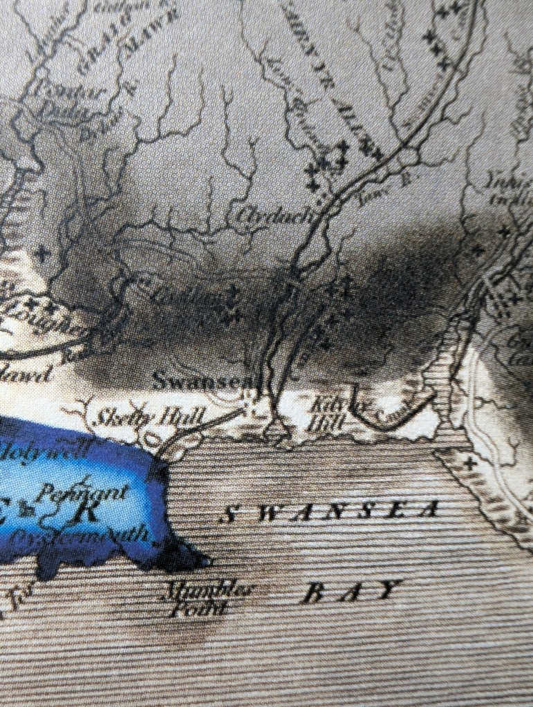
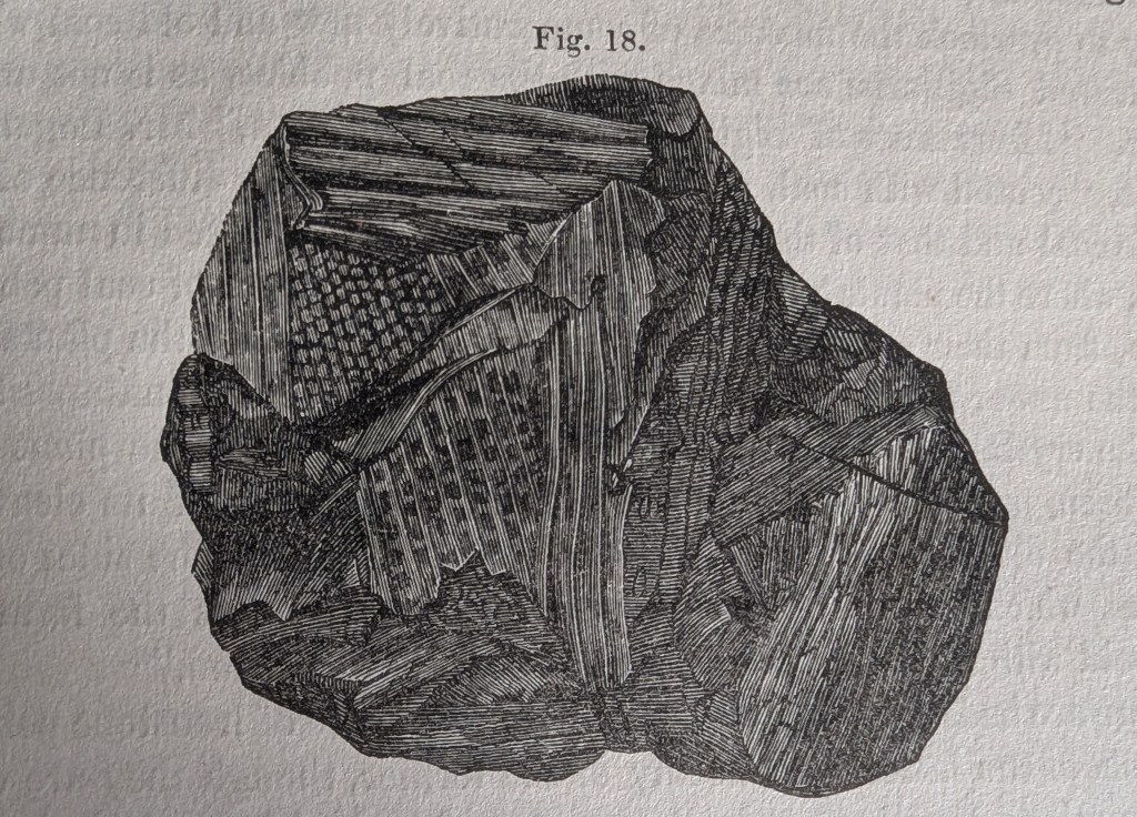
Above: An early geology map of Swansea with ‘Kilvay’ in the middle covered in coal mines.Above: A drawing of coal showing the intricate plant structures that can survive in our local bituminous coal. This drawing is from the original Memoir of Henry De la Beche (1841).
If you are interested in the history of Swansea coal, take a look at my recent bnook on the coal history of Foxhole on Kilvey
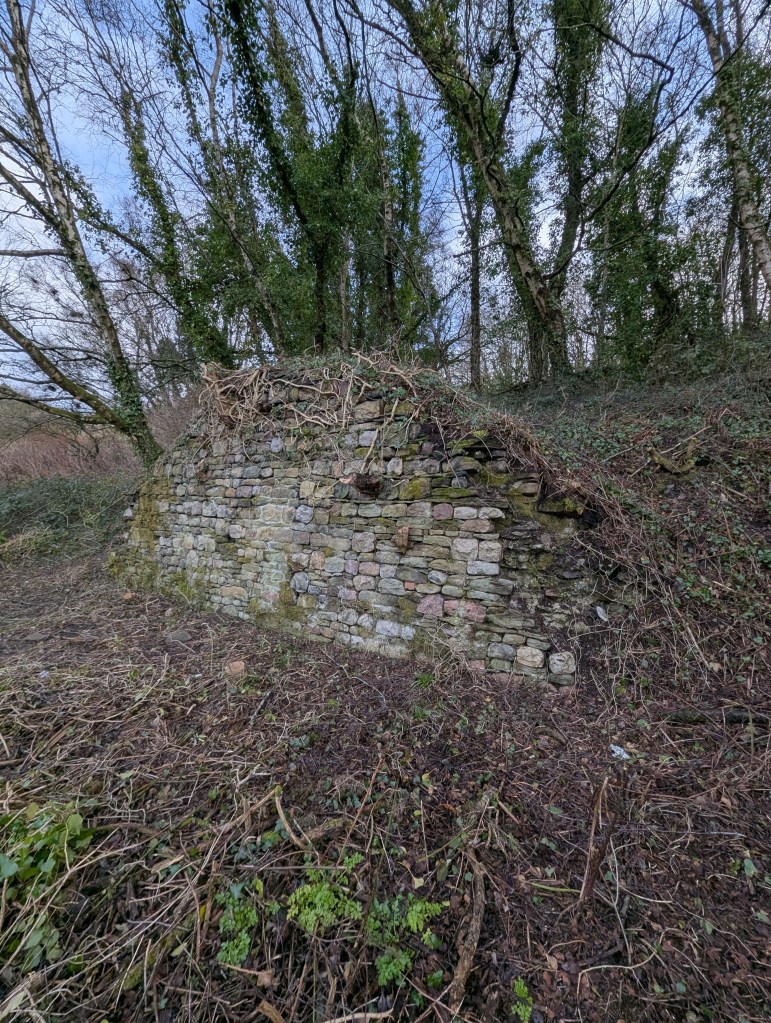
The Foxhole River Staithes are a set of enigmatic structures on the banks of the River Tawe near the remains of the White Rick Copper Works. Although now hidden by trees and slowly deteriorating, they were once the centre of the incredible coal industry that dominated Kilvey and Foxhole in Swansea. This book describes the history of coal in early Swansea and explains the significance of the last remaining structures of the coal industry of early Swansea before the arrival of copper smelting in the 1730s
I completed my cheap photography project last month, and added it to my early Swansea coal history book.
The history of Swansea coal is being lost amongst all the noise and gravy train funding for the Hafod/Morfa Copperopolis story. My work on Swansea coal is meant to redress some of that imbalance and cast new light on a part of the Lower Swansea Valley that isn’t considered important.
The photogrammetry was a great success, completed for a few hundred pounds rather than the thousands claimed by local firms. The constraints were to use second-hand cameras and computers, and to provide imagery of a quality and level of detail that would prove useful. No drones were used as we found that they were adding a layer of costs and complexity that was distorting the value of what should be an extremely cheap and quick process.
After discussing the protocols with a couple of BIM colleagues, I looked at the protocols described in this 2011 paper (listed below). Despite being a little older than the average BIM work these days, the workflows were good, easily replicated, and I could learn how to use simpler, older cameras for the imagery.
There was a series of trials of various landscape and heritage features, ranging from riverside bollards, dock walls, and larger landscape features such as bomb craters and threatened landscapes. The larger subjects needed drone input, and so they were discarded, although some beneficial results were obtained for researching biodiversity and small-scale features which I’ll follow up in a later project.
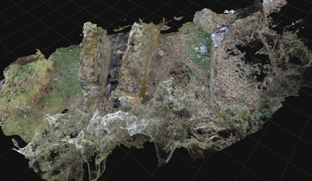
The study subjects were the Foxhole River Staithes, which were of good size (typically about 8m wide, 3m high) and interesting construction. The photographic survey took just over three days, with about four thousand images collected. Office processing of the imagery took about three days.
Above: An ‘aerial’ view of one of the Staithe Structures reconstituted from ground photogrammetry, no drones, merely ground camera work.Above: Another view of Foxhole Structure B. A series of stone retaining walls that originally had timber decking, allowing the loading of coal into various-sized river vessels. Built in the early eighteenth century, probably before extensive copper smelting had begun.Above: Some of the mines and coal veins of early Swansea, discussed in the book.
The photogrammetry was included in a book giving a brief history of coal in Swansea and the significance of the Foxhole area in pre-industrial Swansea.
Fai, Stephen & Graham, Katie & Duckworth, Todd & Wood, Nevil & Attar, Ramtin. (2011). Building Information Modeling and Heritage Documentation.
“The Foxhole River Staithes are a set of enigmatic structures on the banks of the River Tawe near the remains of the White Rick Copper Works. Although now hidden by trees and slowly deteriorating, they were once the centre of the incredible coal industry that dominated Kilvey and Foxhole in Swansea. This book describes the history of coal in early Swansea and explains the significance of the last remaining structures of the coal industry of early Swansea before the arrival of copper smelting in the 1730s. The story of the coal mines of Swansea, the coal export trade and the ships that visited eighteenth-century Swansea are all described. The book also includes the results of photogrammetric surveys of the surviving structures to give the story of the true significance of the Foxhole Staithes and their place in Welsh history.”
I’ve got some funding to run a small Heritage BIM project. I’m running a photogrammetry project on a few small and less well-known industrial remains in the Swansea Valley. The proposal is to explore how effective and cost-effective cheap photogrammetry can be in surveying and analysing small structures and supplement statements of significance. With reference to CIDOC and ISO 19650.
I’ve got some funding to run a small Heritage BIM project. I’m running a photogrammetry project on a few small and less well-known industrial remains in the Swansea Valley. The proposal is to explore how effective and economical cheap photogrammetry can be in surveying and analysing small structures and supplement statements of significance. With reference to CIDOC and ISO 19650.
I worked on several Heritage BIM projects whilst an analyst on the Restoration and Repair of the Palace of Westminster. The technologies are evolving fast, and the extortionate costs of older photogrammetry are now being superseded by new technologies and approaches. I remember the original photogrammetry of the Palace was eye-wateringly costly, but once captured, hardly anyone knew how to effectively leverage the data into applied and valuable information. The result was old data that quickly went out of date and used before it could benefit the programme.
This will be an opportunity to explore revised workflows, effective use of low-cost technology, and output into usable heritage information for a few neglected monuments. It also provides an opportunity to revise old and outdated information, review the significance of the monuments in light of more recent viewpoints on heritage and interpretation, and maybe look at ontology and some standardisation and interoperability issues in HBIM. All with a view to convert data into valuable knowledge effectively and for a reasonable cost.
I’m looking forward to getting back into HBIM and a heritage project!
Above: A prime candidate: a significant structure from eighteenth-century coal mining history. It is mainly unprotected and needs modern interpretation.
Now working on the final shortlist of appropriate monuments and structures for the project. Down to a shortlist of three. The final selection will depend on the extent of the current knowledge and interpretation of the selected structure. A poorly documented structure will score higher.
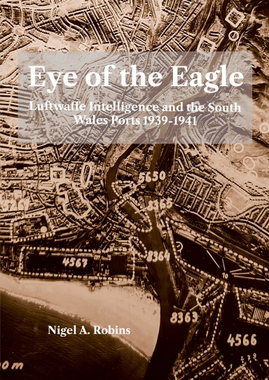
My new work is uncovering the history of the early geologists and explorers of the Welsh coalfields.
Although coal mining has been ongoing in the Swansea area for at least a thousand years, the uncertainty about what coal actually is lasted until the 1920s.
In Swansea, the exploration of our coal seams began in the eighteenth century, but it was in the 1830s that pioneer geologist William Logan first started to examine the coal and sandstone layers on Kilvey and Town Hill to understand the physical arrangement of coal seams. When Logan met Henry De la Beche (sometime in 1833), the quality of Logan’s research was instantly recognised as being central to the geological mapping of the Swansea district and the wider Welsh coalfields.
The debates over whether coal was a rock or a mineral continued throughout the early 1800s, and early geologists struggled to understand what coal was and how it was created.
Below is a drawing from 1841 showing the complex plant structures within a piece of local bituminous coal. Close examination of coal gradually revealed the incredible numbers of plants and ferns that make up the millions of tons of coal that were exported from Swansea docks.
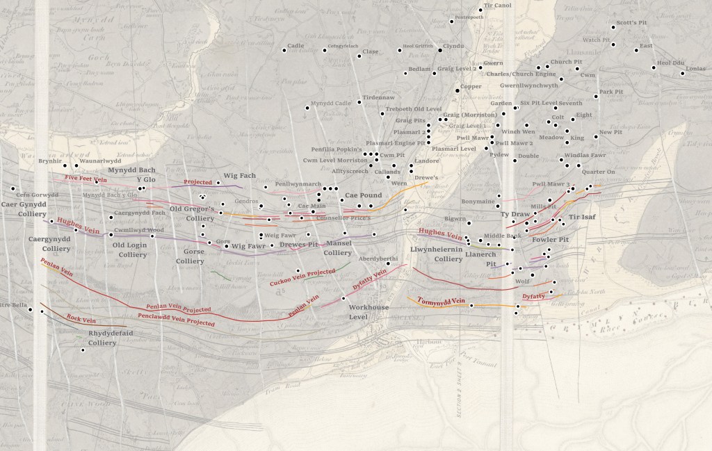
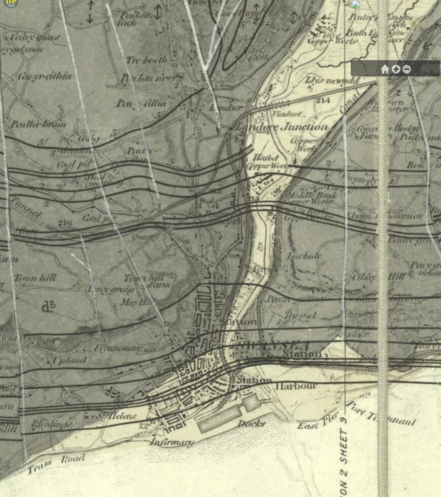
Above: A wonderful illustration of a piece of coal showing the plant structures inside the seemingly black mass. A closer examination of coal unveiled the rich plant life that existed over 300 million years ago. This piece was drawn in 1840 by a ‘Miss Woods’ and included in the landmark geological paper by Henry De la Beche that described coal and sandstone in the Swansea area.Above: A similarly-sized piece of coal from the veins on Kilvey Hill above White Rock.Above: The first map of the coal seams of Swansea from 1842. The white lines are the faults and cracks in the rock mapped by William Logan in the 1830s.
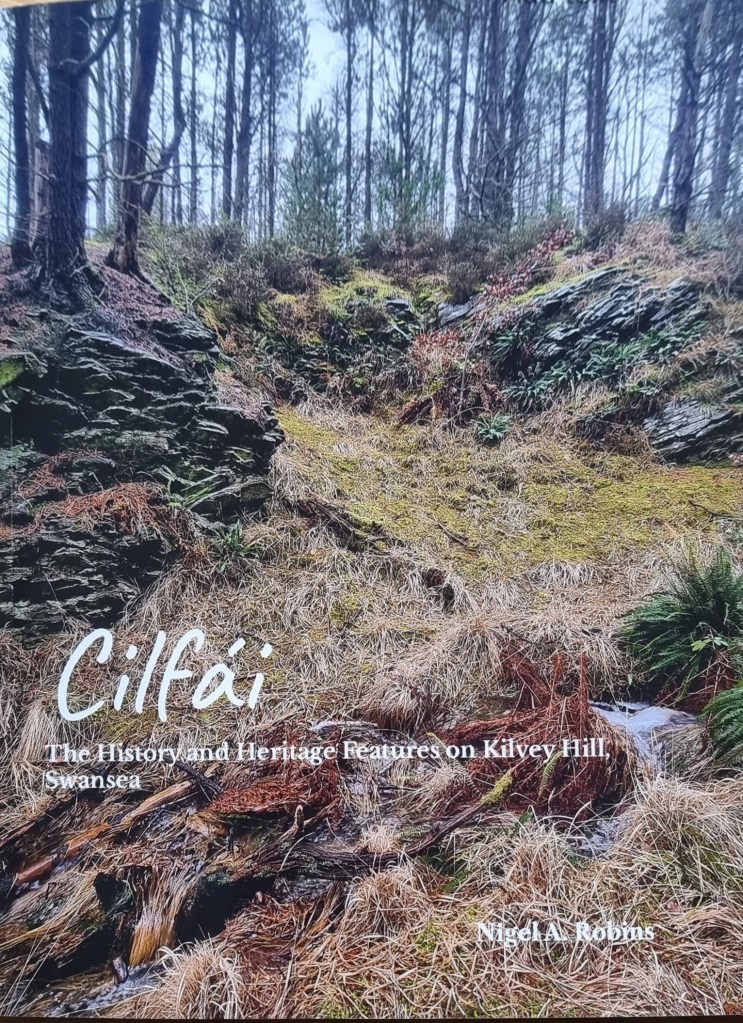
The surviving coal-related heritage features are listed in the third Cilfái book. Available here.
Henry De la Beche and William Logan, between 1836 and 1841, conducted considerable research on the hills of Town Hill and Kilvey (Cilfái) in Swansea. Understanding the dip of the sandstone beds and the coal veins that ran through the rock helped both men understand the relationship between the Pennant Sandstone and the coal seams that Swansea was built upon. Kilvey has a coal mining history extending back at least a thousand years.
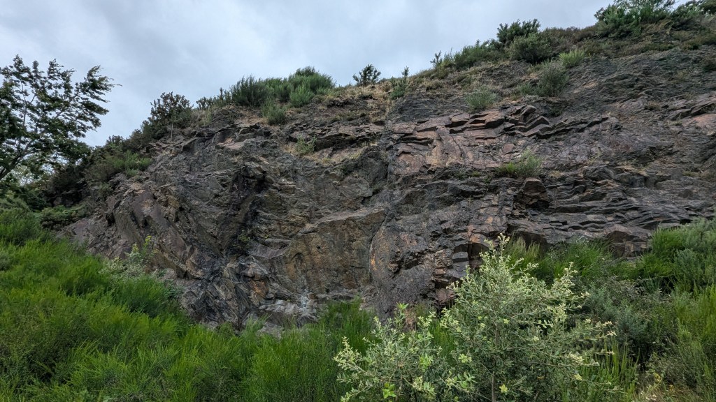
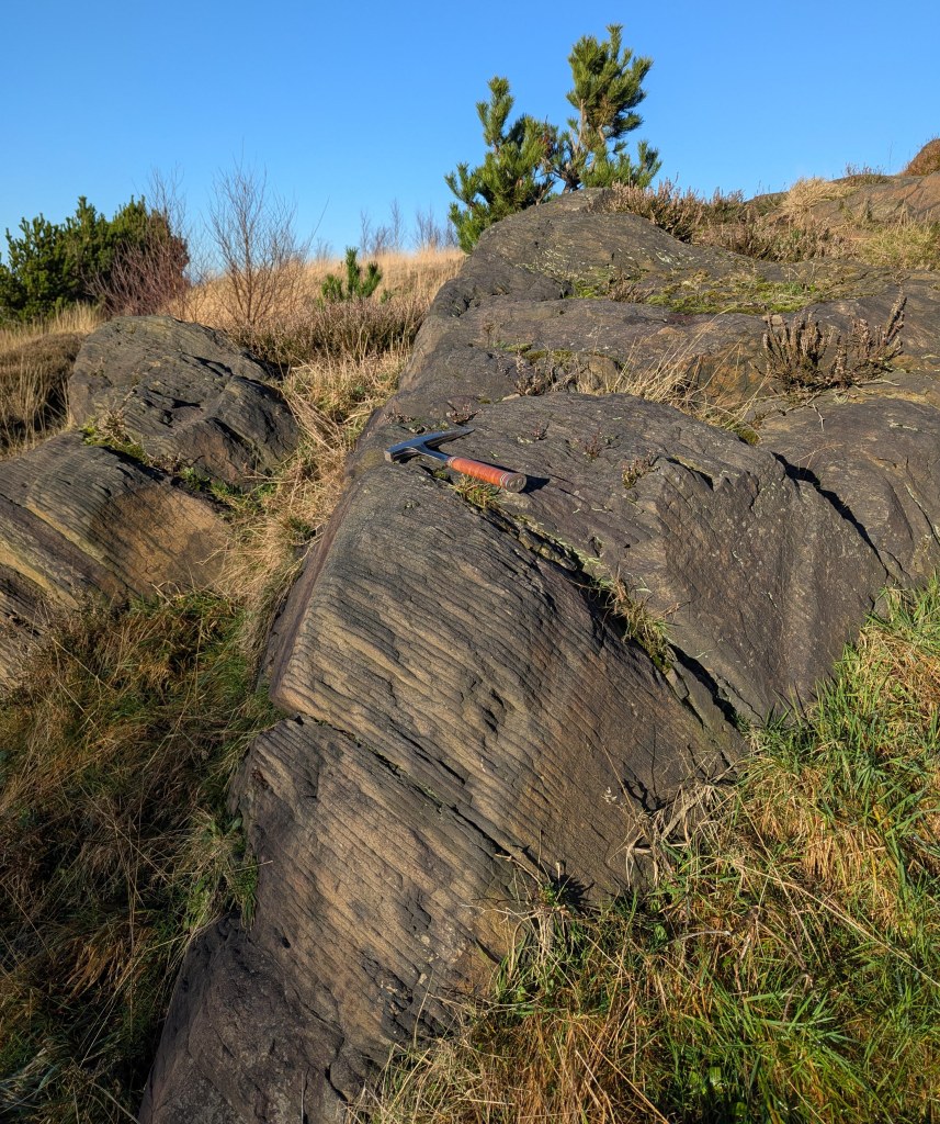
Above: A rock exposure on the southern slope of Kilvey last week. I took some record shots of the geology because this lies within the Swansea Council Skyline threatened area and it may be destroyed.
This exposure of weathered sandstone would have been examined by William Logan and both men would undoubtedly have discussed it as they worked to understand the more complex geology of Town Hill and northern Swansea. You can see the rock here dips down. In fact, it dips at about forty degrees to the north, which means that coal seams exposed on the surface on Kilvey would be hundreds of metres underground by the time you reached Morriston. Beche and Logan were trying to understand how and where to find those deep coal veins to allow better locations for new coal mines.
The layers of sandstone and siltstone are very thin here, and centuries of atmospheric pollution have highlighted the separate layers. Other parts of Kilvey have thick beds of stone used to build the Prince of Wales Dock and the Port Tennant houses.
Above is my sketch map of Kilvey showing the sandstone and coal veins as De la Bech and Logan would have seen them. The rocks in the picture above are part of the ‘Brithdir Beds’.
My next book is about the work of these two men and how they worked to understand the veins of coal that were so important to Swansea in the nineteenth century.
‘I don’t know why you all get worked up about it…there’s nothing up there’ (Swansea Council employee 2022)
This final Cilfái study was a bit more challenging than I first realised. I thought I had a good impression of the hill’s history and landscape. That was until I consulted the official records that were sadly inconsistent or often compiled with little knowledge or experience of the hill. This meant that this book and its lists were far more of a collaborative effort than the earlier books. This was no bad thing as I made or renewed friendships far and wide as spent more time on the hill connecting with the land and people. My grateful thanks and appreciation go out to all those who gave freely of their time to talk to me about their views and ambitions for the hill. This is particularly true of the features listed in the Modern History chapter, which, for many, is their whole experience of the hill. Unfortunately, the hill’s archaeological knowledge is poor, but that may be because there is more to discover, and we can be optimistic about that, as archaeologists frequently must be.
The Kilvey Woodland Volunteers are the lifeblood of the Cilfái community, and I’d like to thank Marian Francis for her support and commitment to all of us who work on the hill. Equally, the wider community who have planted so much and built The Glade and the Roundhouse and who contribute to so many well-being and craft activities on the hill have been truly inspiring in their unsung work on the hill for local people. Once again, I need to acknowledge the help of Gerald Gabb in some of the Gwyndy story for me, and the support of library and archive services has been invaluable. The conversations with my old archaeologist friend John Andrew are always supportive. At the time of writing, I have no idea when or if the destruction threatened by Swansea Council will occur. I hope the lists in this book guide and support everybody who wants to care for and preserve what is on the hill. And yes, in answer to that nameless person who I quoted at the top of this page, there is plenty up there. You just have to care enough to look, and talk to the local community.
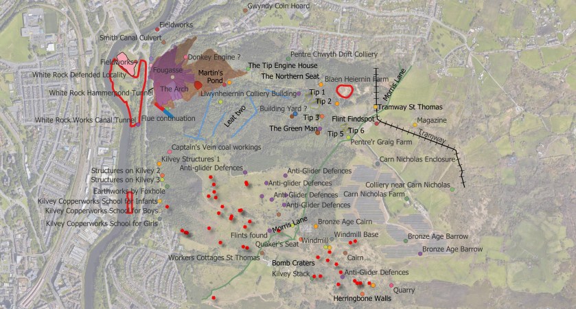
Above: Some of the heritage features of Kilvey, including some of the many bomb craters from World War Two.