Although we now know Castle Gardens as an ugly concrete space in the centre of town, that area of land has been central to Swansea’s history for centuries.
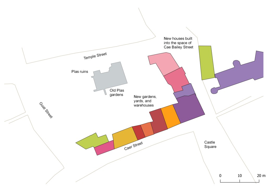
Originally part of the inner ward of Swansea Castle, the space has over the years held many buildings starting with the Plas House built in the 1300s. You can see a fantastic model of the area in Swansea Museum which was made in the 1820s. The streets that defined the Plas House block are part of Swansea’s long history. Temple Street to the north which once held the Three Lamps Inn, Goat Street to the west which held the original police station, and Caer Street to the south, which is (sort of) still there.
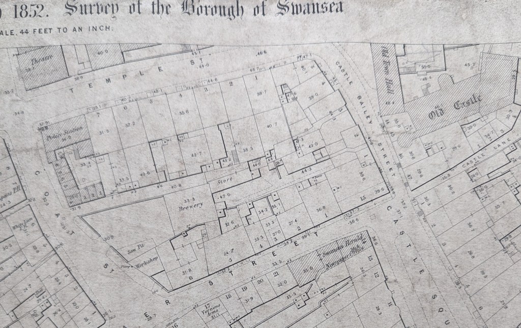
Pride of place has to go to Castle Bailey Street to the east which originally was a big space in front of the castle. By the 1890s, the site was the home of the various properties that made up the Ben Evans department store. Understanding the layout and contsruction of the store is an important part of understanding how it caught fire and burned so easily in February 1941.
For the book I reconstructed the various eras of building on the block to understand more about how the space was used. I used methods from the 1940s when architects and fire engineers were reviewing the incendiary attacks on Britain and looking to learn lessons to destroy German towns and rebuild Swansea after the war. Understanding Castle Gardens is a chapter in my book.
You can buy online here: Y Tân (lulu.com)