Geoheritage is now becoming a broader term for our geographical and geological features that have significant scientific, educational, cultural, or aesthetic value. Swansea has an important place in the history of geological exploration and the development of the Welsh coal industry.
People who have participated in my many guided walks on Kilvey will already be aware of the value of the Kilvey Geoheritage sites and the contribution they make to the Biodiversity and Geodiversity of Swansea.
Globally, October is a month of celebrating and recognising the importance of the rocks and landscape underneath our feet. Swansea has more than most towns to be mindful of, as it is built on over a thousand years of coal mining history.
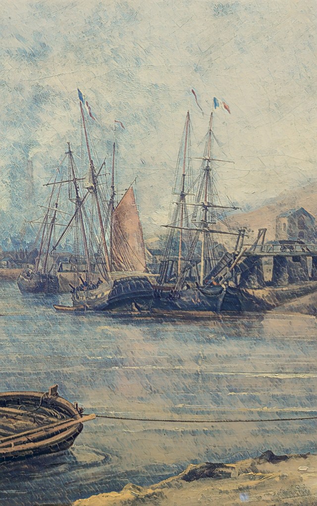
Above: Foxhole Coal Staithes in the 1840s.
Following on from my recent book on Foxhole and the history of Swansea Coal, I’ll be giving a few guided walks and talks on broader aspects of Swansea’s incredible Geoheritage and Geodiversity.
On 4 October, I’ll be talking about the history of Swansea coal and the special place Foxhole on Kilvey has in the history of Welsh coal mining. My talk will be at Swansea Museum as part of the RISW and the Historical Association’s History Day 2025. I’ll also have copies of the Foxhole history book at a discounted price.
On 6 October, as part of UNESCO’s # InternationalGeodiversityDay, I’ll be leading a walk around the geological features of Kilvey Hill and explaining the unique place in Swansea’s history that Kilvey holds. The geological features of Kilvey have long been regarded as obscured or destroyed, but many have survived against all odds. Come with me and walk the land that was explored by Geology’s most famous local coal pioneers, William Logan and Henry De la Beche. Tickets will be available shortly. I’ll advertise them via Facebook and Eventbrite.
On 8 October, I’ll be at the Friends of Penllergare monthly meeting at Llewellyn Hall in Penllergaer. I’ll be talking about ‘Penllergare, Henry De la Beche, and early Geology in Swansea’. Lewis Weston Dillwyn was often at the centre of scientific and cultural events in Swansea. He was particularly prominent in the recognition of Swansea as a centre of research in the emerging science of Geology and the first understanding of the South Wales coalfields.
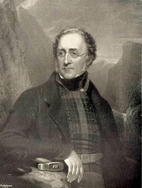
Above: Henry De la Beche. Pioneer geologist.
I’ll be doing a few more walks and talks throughout the month, and I’ll post here to let people know. If you want to know more contact mew for details.
I’ll also have my bookshop of all my current books in print at the History and Heritage Fair at the National Waterfront Museum on 27 September 2025.
In the autumn of 2022, the local Council announced their plans to remodel the ancient Kilvey Hill landscape for a new tourism development, which would destroy the traces of thousands of years of human habitation and endeavour. The impending destruction led me to do what I could to record the history, ecology, biodiversity and Geoheritage of what is a significantly under-recorded landscape with considerable potential for education, well-being and climate change management.
Documenting the history and biodiversity was relatively straightforward, albeit a challenge to perceptions regarding a large area of land that many people see but few have experienced and even fewer understand. I remember one comment from the local authority about ‘there is nothing up there’. A comment I later understood as a self-serving phrase to make the destruction and loss more comfortable for planning permissions.
Above: The thinly bedded sandstones of sandstone on Kilvey are part of a broad range of types of structure on Kilvey, along with massive beds heavily used for building stone and the bituminous coal seams that were so important to early Medieval Swansea.
I suppose my perceptions were different, having had the advantage of a geological education at school and undergraduate level, including a hectic month of field mapping coastal regions of the Isle of Wight back in the day. I hadn’t appreciated how much of that had stuck with me until I needed to explore the Geodiversity of the Hill through documents, fieldwork and the wonderful archive of the British Geological Survey.
The fact that the natural heritage of any country includes its geological heritage is now slipping away from us. The wonderful naturalists’ clubs of the early twentieth century, such as the Swansea Scientific and Field Naturalists’ Society, were a broad church to all aspects of nature, including geology. But they have disappeared in the swing towards wildlife rather than general nature conservation, which has permanently obfuscated much of our wonderful Welsh geological heritage. The process accelerated as Naturalists’ Societies changed their names to Wildlife Trusts.
The collapse of geology as a subject deemed worthy of learning and the dissolution of the geological part of the National Museum for Wales have meant that describing the significance of geological sites has become challenging, as basic literacy in the nature of rocks and the landscape is in freefall.
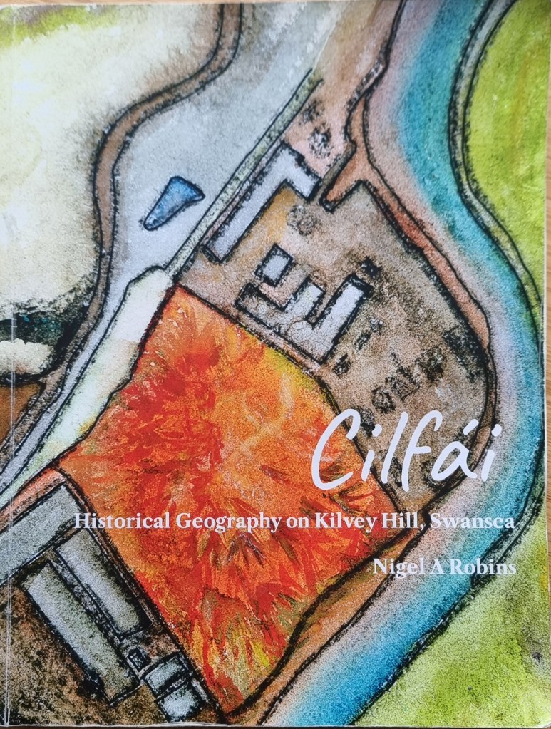
Geoheritage and Geodiversity featured strongly in my first book on the history of Cilfái, not least because it was good history as well as good geology (Robins 2023a). I sought to highlight the significance to local heritage of the geology by separating ecology, biodiversity and climate change into the second Cilfái book (Robins 2023b). However, I felt my treatment of Geoheritage in the first book was not enough. I included a more substantial piece on Swansea’s coal history in my book on the Swansea Foxhole Coal Staithes, but the rich history of William Logan, Hendry de La Beche and Aubrey Strahan clearly deserves more (Robins 2025).
‘Every outcrop has the potential to be great’ (Clary, Pyle, and Andrews 2024) was an opening line to a recent special publication from the Geological Society. It’s a great opening line, and it sets a very positive note for a lively discussion on Geoheritage on a landscape scale. It’s a sentiment that is less positively upheld in Wales where our process of listing or recording sites of geological interest is haphazard and starved of interest and funds.
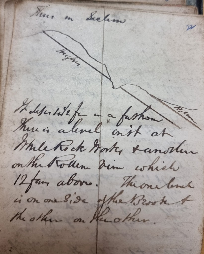
Above: An extract from one of William Logan’s many notebooks from the 1830s. Logan made regular visits to the outcrops above White Rock as he sought to understand stratigraphy and dip of the beds for coal exploration.
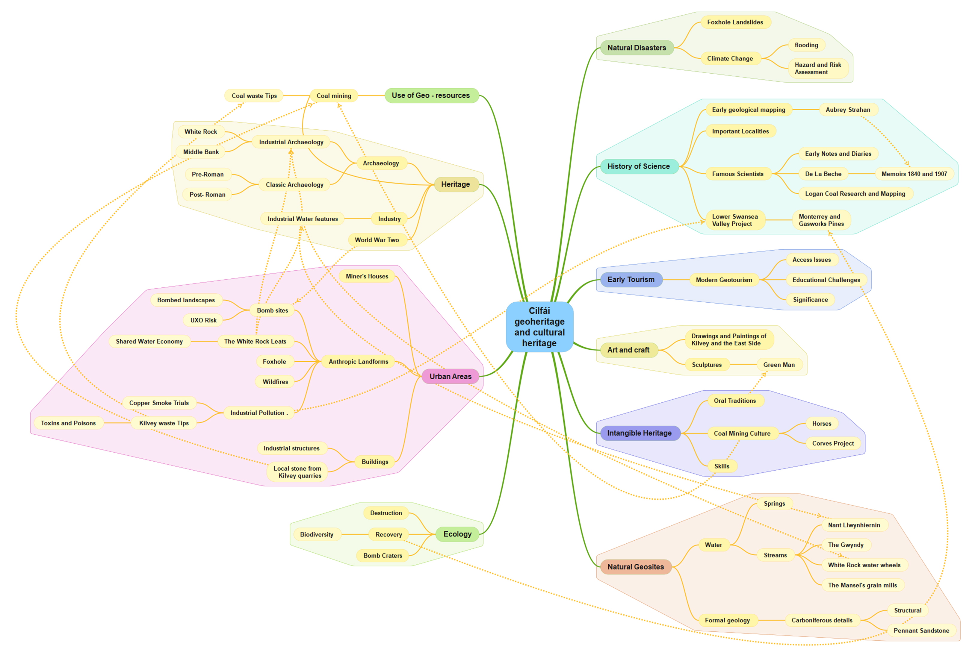
Nevertheless, the listing of a Kilvey site visit on the coming UNESCO International Geodiversity Day is a good opportunity to explore and reassess local Geoheritage. In preparing information for the International Geodiversity Day, I was particularly struck by a recent article linking Geoheritage and Cultural Heritage (Pijet-Migón and Migón 2022). The authors have introduced a model of themes at the Geoheritage-Cultural Heritage ‘interface’. It’s a very useful summary of what to explore or be aware of when revisiting geological sites. It helps move forward from traditional geological guides and texts (Owen 1973), which, although very useful, need to be modernised and broader in scope and engagement for a new generation.
Although the Pijet-Migón model doesn’t fit everything, for example, it can be broadened to explore the link between Biodiversity and Geodiversity, it is very useful. Here’s the Cilfái Geoheritage Landscape filtered through an amended model:
Clary, Renee M., Eric J. Pyle, and William Andrews. 2024. ‘Encompassing Geoheritage’s Multiple Voices, Multiple Venues and Multi-Disciplinarity’, Geology’s Significant Sites and Their Contributions to Geoheritage, no. Special Publication 543, pp. 1–7, doi:10.1144/SP543-2024-34
Owen, T.R. 1973. Geology Explained in South Wales (David & Charles)
Pijet-Migón, Edyta, and Piotr Migón. 2022. ‘Geoheritage and Cultural Heritage – A Review of Recurrent and Interlinked Themes’, Geosciences, 12.98, doi:10.3390/geosciences12020098
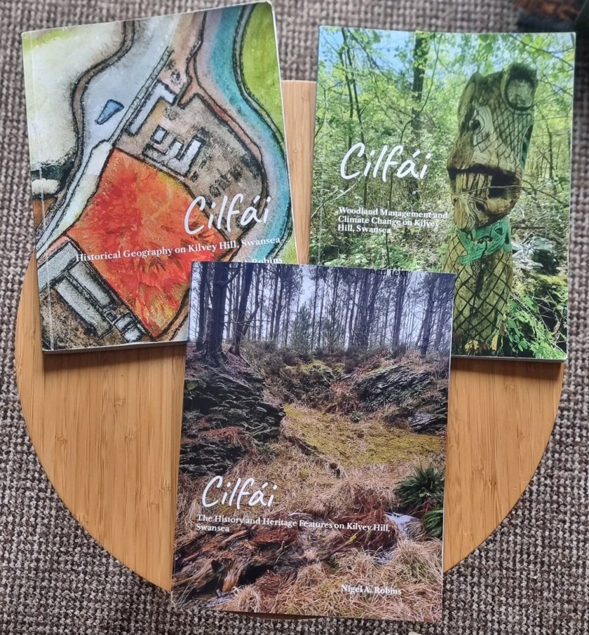
Robins, Nigel A. 2023a. Cilfái: Historical Geography on Kilvey Hill, Swansea (Nyddfwch)
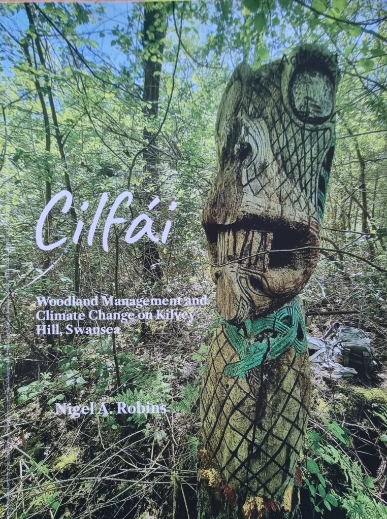
——. 2023b. Cilfái: Woodland Management and Climate Change on Kilvey Hill, Swansea (Nyddfwch)
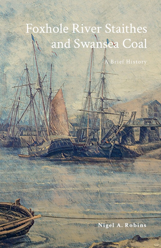
——. 2025. Foxhole River Staithes and Swansea Coal (Nyddfwch)
Starting the new book project. I initially looked at the war diaries of Bristol Channel U-boats back in the 1990s. Research is now easier as more primary records have been released by US archives, at least until the latest President Trump directives close everything down. Modern technology in GIS and GPS has made map research much easier, and I am busy tracking down the original locations of magnetic mines originally planted in Swansea Bay and around the Scarweather Lightship. There have already been a few surprises as the mapping throws up all sorts of questions and new insights into the highly technical war of minelaying and minesweeping in the Bristol Channel.
Starting the new book project. I initially looked at the war diaries of Bristol Channel U-boats back in the 1990s. Research is now easier as more primary records have been released by US archives, at least until the latest President Trump directives close everything down. Modern technology in GIS and GPS has made map research much easier, and I am busy tracking down the original locations of magnetic mines originally planted in Swansea Bay and around the Scarweather Lightship. There have already been a few surprises as the mapping throws up all sorts of questions and new insights into the highly technical war of minelaying and minesweeping in the Bristol Channel.
The war against the U-boats is a complex subject to research thoroughly. There was considerable secrecy on both sides, and very often, the knowledge gap has been filled with wild speculation and inaccurate writing. This means I’ve had to reject a lot of secondary sources that continue to repeat what I’ve learned to call the ‘BBC History’ approach of ruthlessly clever Germans versus plucky eccentric Englishmen. There is also a surprising amount of rivalry and bias between British and US naval sources, both in the 1940s and in the present day. Again, I’ve learned to be scrupulous in testing opinions by viewing primary sources rather than derived history, often from writers who have not worked in the original German language sources.
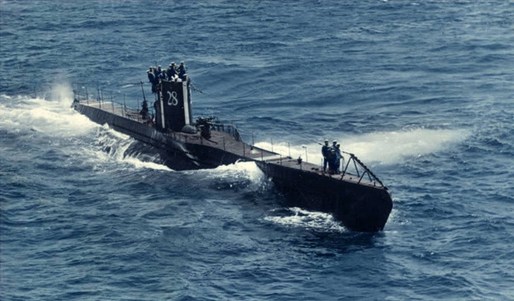
Above: U28 was one of the Bristol Channel U-boats. This is the boat as she looked just before the war began in September 1939.
Some initial work was included as an Annexe in ‘Eye of the Eagle’ where I looked at the war diary of U32 as it laid magnetic mines near the Scarweather Lightship in 1939. The new work looks at all the other U-boats that came into Swansea Bay in the early years of the war. Again, it reinforces the crucial role Swansea had in the minds of the German naval staff.
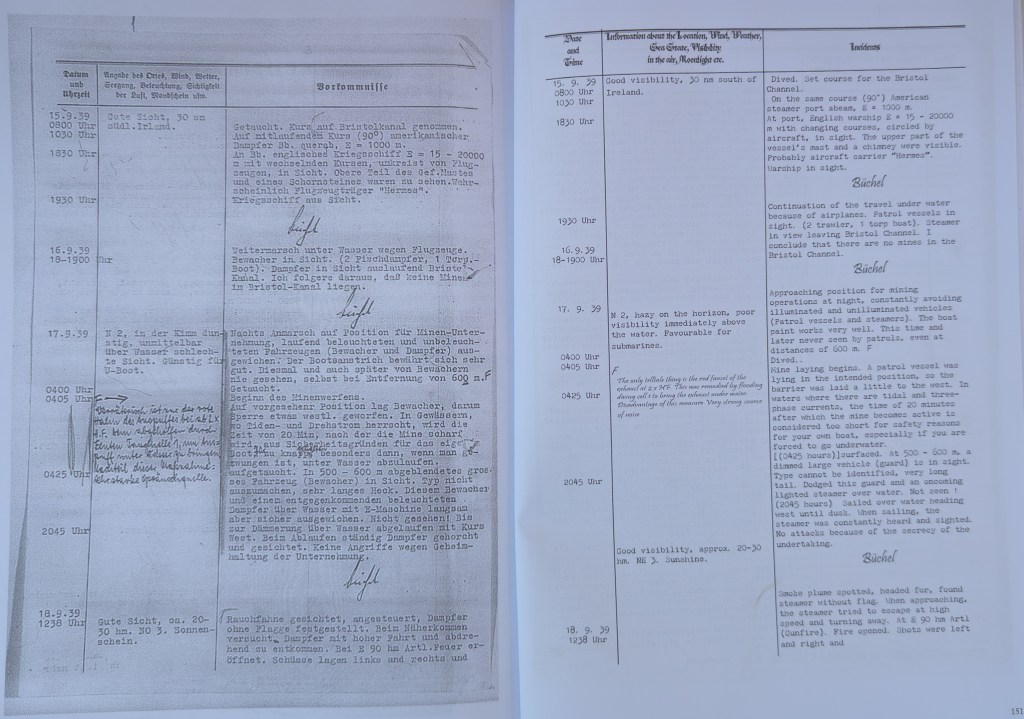
Above: An extract from a U-boat war diary, with my translation. From the Eye of the Eagle book.
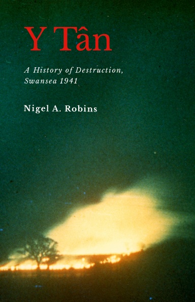
The Foxhole River Staithes are a set of enigmatic structures on the banks of the River Tawe near the remains of the White Rick Copper Works. Although now hidden by trees and slowly deteriorating, they were once the centre of the incredible coal industry that dominated Kilvey and Foxhole in Swansea. This book describes the history of coal in early Swansea and explains the significance of the last remaining structures of the coal industry of early Swansea before the arrival of copper smelting in the 1730s
I completed my cheap photography project last month, and added it to my early Swansea coal history book.
The history of Swansea coal is being lost amongst all the noise and gravy train funding for the Hafod/Morfa Copperopolis story. My work on Swansea coal is meant to redress some of that imbalance and cast new light on a part of the Lower Swansea Valley that isn’t considered important.
The photogrammetry was a great success, completed for a few hundred pounds rather than the thousands claimed by local firms. The constraints were to use second-hand cameras and computers, and to provide imagery of a quality and level of detail that would prove useful. No drones were used as we found that they were adding a layer of costs and complexity that was distorting the value of what should be an extremely cheap and quick process.
After discussing the protocols with a couple of BIM colleagues, I looked at the protocols described in this 2011 paper (listed below). Despite being a little older than the average BIM work these days, the workflows were good, easily replicated, and I could learn how to use simpler, older cameras for the imagery.
There was a series of trials of various landscape and heritage features, ranging from riverside bollards, dock walls, and larger landscape features such as bomb craters and threatened landscapes. The larger subjects needed drone input, and so they were discarded, although some beneficial results were obtained for researching biodiversity and small-scale features which I’ll follow up in a later project.
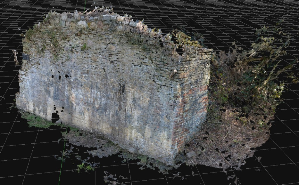
The study subjects were the Foxhole River Staithes, which were of good size (typically about 8m wide, 3m high) and interesting construction. The photographic survey took just over three days, with about four thousand images collected. Office processing of the imagery took about three days.
Above: An ‘aerial’ view of one of the Staithe Structures reconstituted from ground photogrammetry, no drones, merely ground camera work.Above: Another view of Foxhole Structure B. A series of stone retaining walls that originally had timber decking, allowing the loading of coal into various-sized river vessels. Built in the early eighteenth century, probably before extensive copper smelting had begun.Above: Some of the mines and coal veins of early Swansea, discussed in the book.
The photogrammetry was included in a book giving a brief history of coal in Swansea and the significance of the Foxhole area in pre-industrial Swansea.
Fai, Stephen & Graham, Katie & Duckworth, Todd & Wood, Nevil & Attar, Ramtin. (2011). Building Information Modeling and Heritage Documentation.
“The Foxhole River Staithes are a set of enigmatic structures on the banks of the River Tawe near the remains of the White Rick Copper Works. Although now hidden by trees and slowly deteriorating, they were once the centre of the incredible coal industry that dominated Kilvey and Foxhole in Swansea. This book describes the history of coal in early Swansea and explains the significance of the last remaining structures of the coal industry of early Swansea before the arrival of copper smelting in the 1730s. The story of the coal mines of Swansea, the coal export trade and the ships that visited eighteenth-century Swansea are all described. The book also includes the results of photogrammetric surveys of the surviving structures to give the story of the true significance of the Foxhole Staithes and their place in Welsh history.”
For many projects in restoration and landscape, there has been a tendency to overemphasise gee-whiz graphics at the cost of scholarly historical analysis. The project here puts the technology back where it belongs, in the background of support for investigation and analysis.
The rapid development and delivery of this project is almost complete. The proof of concept of quick and cheap photogrammetry is complete, and we explored various features of various sizes. Budget constraints in the broader London-based programme meant that the planned exploitation phase won’t take place there. The plan was to explore some large, immoveable sculptures and statues at risk of damage by surrounding building renovation. Instead, I’ll work in South Wales on a series of local history and geography projects.
Costs were remarkably low (which we believed they would be). It is satisfying to use new technologies to reduce costs and fight against the gradual cost inflation and scope creep of using these types of technologies in small history or geography projects. In researching the business case for this, I learned of several local authority projects where high costs for archaeological surveys, often incorporating expensive drone surveys and extraordinary labour costs, skewed project delivery budgets almost to the cancellation of the projects. I experienced the same issues working on the restoration of the Palace of Westminster, where incredible finances and resources were expended on expensive lidar and photogrammetry products that were who;;y unsuitable for the problems and frequently misled managers into thinking that such products were essential elements of the restoration at RIBA Stages 1 and 2 .
For many projects in restoration and landscape, there has been a tendency to overemphasise gee-whiz graphics at the cost of scholarly historical analysis. The project here puts the technology back where it belongs, in the background of support for investigation and analysis.
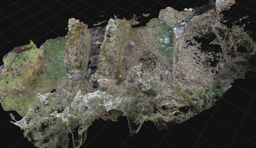
Above: A test scan of a significant rock exposure on Cilfái Hill in Swansea. Upper Carboniferous Pennant Sandstone with a forty-degree dip north. This is an exposure in an area where William Logan and Henry De la Beche discussed the general stratigraphic layout of the South Wales Coalfield. Some of the exposures have copper nails struck into the rock, which may have been part of Logan’s levelling work in the late 1830s. These exposures are at risk of destruction by Swansea Council’s tourism redevelopment of the area, so it is good to get a good scan of them before they are destroyed.
Above: An old coal loading dock in the Lower Swansea Valley, known as a ‘Staith’. Probably dating from the 1740s, this was built to make loading coal into ships in the river easier. The coal came down the east-side tramways and later the canal. This is a scheduled ancient monument but has been neglected by Swansea Council and is now deteriorating. Ironically, the monument’s destruction has been accelerating because of the encroaching woodland and the dumping of industrial waste. This structure is incredibly rare; there may only be two others in Wales, and they are also in the Lower Swansea Valley. Again, this is a low-cost photogrammetric scan taken as an emergency whilst extensive finances are expended elsewhere in the Valley on Council-led projects.
Costs are kept low by avoiding the use of drone technologies, using older and previously-used professional cameras bought cheaply on Ebay, and new software costing a few hundred Euros.
The next steps are researching the history of coal industry structures in the valley, followed by some investigation of some World War Two remains on Cilfái.
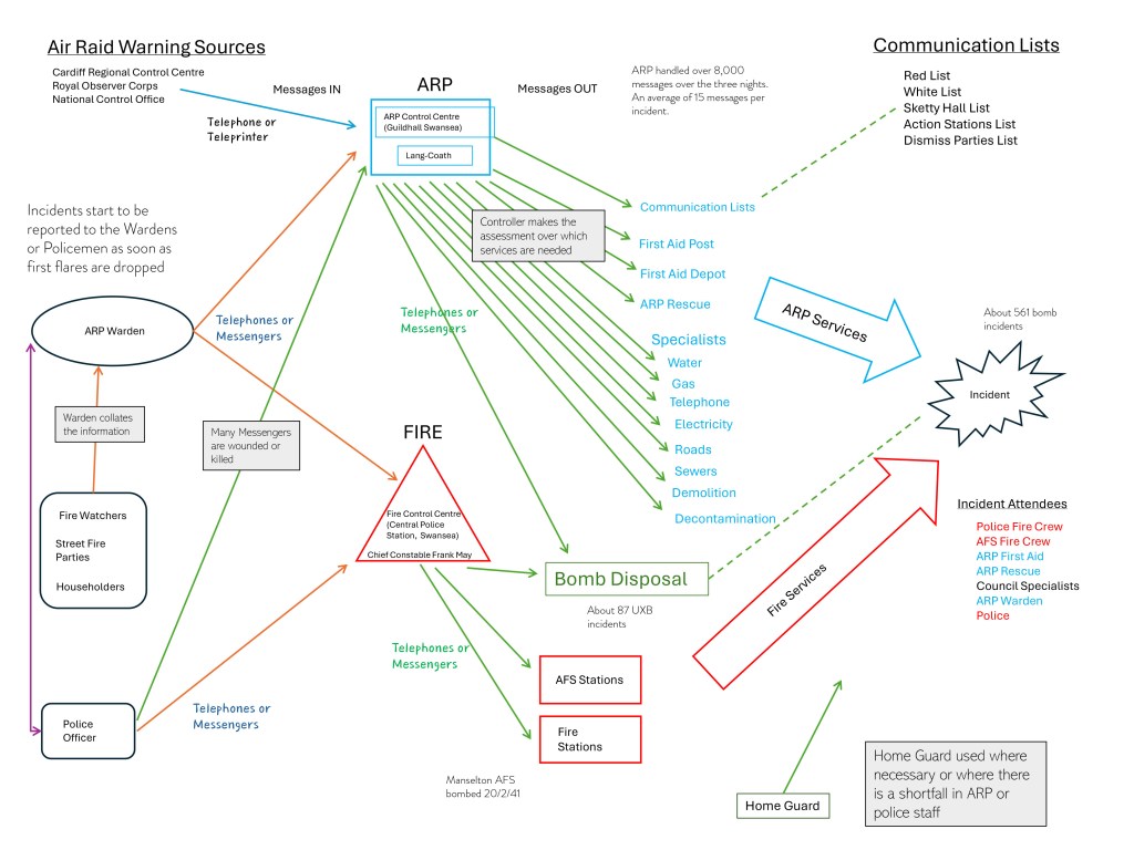
Most of the documents and other evidence about how Swansea coped during the war have not survived. As I said earlier, we have a lot of photographs, but understanding how people managed is harder to explore. My earlier post discussed the role of the ARP Controller Hywel Lang Lang-Coath. I looked through the available evidence to reconstruct the communication processes people needed to work through the awful problems the bombing caused.
One of the most important roles was the Air Raid Warden, who was expected to act as first-line help, assess the problems a bomb or fire had caused and ensure both the police and the ARP control knew about the problem. Wardens had to be special people, confident, capable, and able to prioritise problems on the spot. Nearly twenty per cent of wardens were women.
Below is my reconstruction of the communication flows between the warden and the fire control at Swansea Central Police Station and ARP Control in the Guildhall. You can see how complex the ARP role was and how many decisions Lang-Coath had to make. Once the telephone lines were destroyed, all messages were carried by teenagers on bikes or motorbikes, or even just running through the bombs and fires. A number of Messengers died trying to get their messages to the Guildhall.
Above: My reconstruction of the communications during the three nights’ blitz of February 1941. The blue shows the complexity of all the services that had to be sent to deal with a bomb explosion or fire.
There are several crucial books on the history of Cilfái and the Lower Swansea Valley that serve as invaluable references. These are the books that form the foundation of your understanding. Without them, comprehending the reasons behind certain actions, inactions, and unresolved issues can be a daunting task. As with any large organisation, Swansea Council grapples with a lack of corporate memory and knowledge, particularly concerning the valley. In fact, some of the current issues with disputed ownership and title of the hill stem from the lack of historical knowledge and records among younger or less-experienced staff.
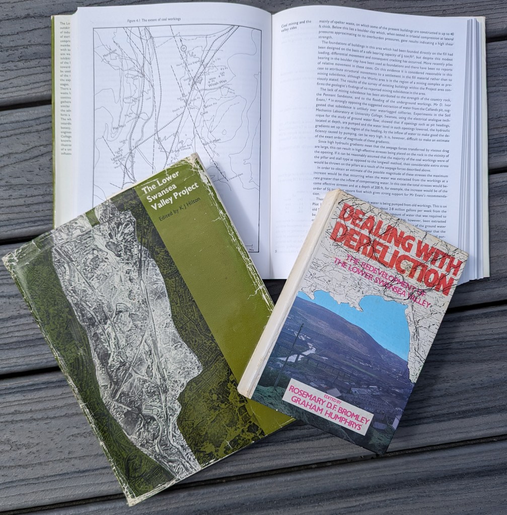
Perhaps the most famous book is the Lower Swansea Valley Project (Hilton 1967)This is the handbook summarising the scope and delivery of the Lower Swansea Valley Project. For decades, it has been a standard reference for environmental and ecological history. I used this book extensively to research the first Cilfái volume. The LSV Project remains a milestone in the history of government, local authority, and academic teamwork, and the work results have benefitted Valley residents immensely.
The Hilton volume documents, in thirteen chapters, the history, drainage, engineering, transportation, and social aspects of the LSV and the challenges involved in delivering change.
The second milestone book for the history of Cilfái and the Valley is Dealing with Dereliction. (Bromley and Humphrys 1979)This book came out over a decade after the Hilton volume and chronicles the challenges and changes the Project brought about. It is a wonderful example of a project closure report covering the benefits delivered and remaining issues. In my civil service days, I used it to illustrate how to manage the lifecycle of a large government programme or project.
Last but certainly not least, I’ve selected the City Archives Office booklet from 1991 describing some of the Archives Office holdings covering the LSV Project (Alban 1991). The cover notes were written by Dr J.R. Alban, who many will know as one of Swansea’s most significant historians. Dr Alban, who was our City Archivist at the time, wrote many such booklets. If you can get to see a copy, this is the quickest way to understand some of the archived records of Cilfái and the surrounding area.
You will find all these books easy to consult in Swansea Library and the West Glamorgan Archive Service on the big bookshelf!
Alban, J.R. 1991. ‘Rebuilding a Future: The Reclamation of the Lower Swansea Valley Exhibition Catalogue’ (Swansea City Council)
Bromley, Rosemary D. F., and Graham Humphrys (eds.). 1979. Dealing with Dereliction: The Redevelopment of the Lower Swansea Valley (Swansea: University College of Swansea)
Hilton, K. J. (ed.). 1967. The Lower Swansea Valley Project (London: Longmans)
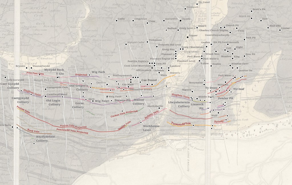
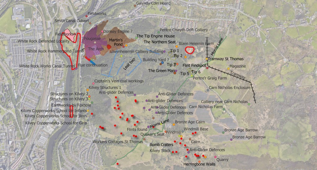
What was on the Archwilio site wasn’t really good enough for us to understand Cilfái, so I redid the surveys. I increased the heritage fetures count on the Hill from 35 to nearer 80. A lot of our Copper, Coal and modern history is not officially recognised by archaeologists…but it doesn’t make it unimportant. You can’t expect historians or achaeologists from elsewhere in England or Wales to understand the significance of our local history and culture. We are forced to do that for ourselves.
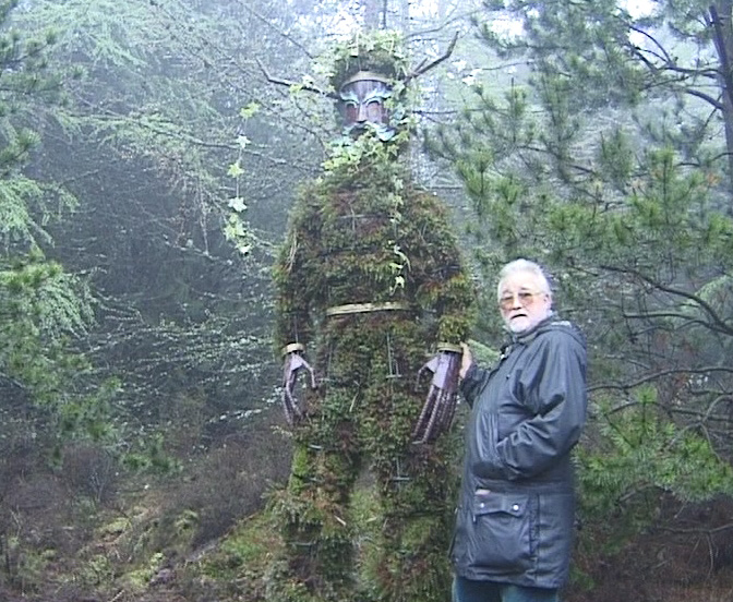
Below: Pete Thomas and Green Man in 1998 shortly after it was completed.
.
Below: A map of some of the heritage features on Cilfái.
You can always contact me to buy the Cilfái books. Send me a message on FB or use WhatsApp or LinkedIn. Or you can email me at my Gmail address. Eye of the Eagle will be available at an illustrated Bo0k Launch talk at Swansea Central Library in early June. I will probably do some talks on the air war over Wales later in the summer.
You can also buy copies of the Cilfái books at the lovely little shop in Swansea Environment Centre. It’s the only shop in Swansea that stocks them.
If you want to buy the books online, the easiest way is to buy them direct from lulu.com because these are the people who print them. In fact if you use Amazon all they actually do is contact lulu. So cut out the middle man and go straight to lulu.
So you can buy Cilfái: Historical Geography on Kilvey Hill, Swansea. This is the history book of the trilogy and it covers the biggest topics in the history of the Hill. So that is Coal, Copper, Pollution, Restoration and Repair and the Nature Recovery. This one also includes Annexes covering the legal background to White Rock Copper Works from 1737, and the Geological history and the pioneering explorations of William Logan. 126pp, fully indexed and referenced.
The second book of the trilogy is Cilfái: Woodland Management and Climate Change on Kilvey Hill, Swansea. This one covers the environmental issues faced by the hill and the woodlands. A lot of this one reflects my past government work as a programme reviewer for Defra, DCMS and Historic England, particularly where matters of the environment are concerned. I’m a qualified ecological surveyor and have been involved in a number of large environmental schemes since the 2010s. This book is built around my ecological surveys of the Hill and you will see a lot of Annexes here showing how we create Species and Habitat Action Plans for conservation, My records of everything I found within 1 km of The Glade (between 2010 and 2023) including Mammals, insects, Invasive Species and Reptilees and Amphibians. I also include my Open Mosaic Habitat plant list (including bombsite plants). I have produced a sample copy of a standard Woodland Management Plan to show people how to prepare a good conservation plan and I finish up with my discoveries and monitoring of bat populations on the Hill. This book also has discussions of landscape resilience and climate change issues as we saw them in UK Government.130 pp, fully indexed and referenced.
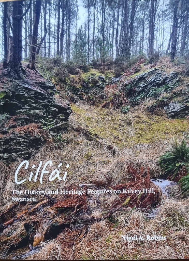
The final Cilfái book is Cilfái: The History and Heritage Features on Kilvey Hill, Swansea. This is based on my new surveys of all the heritage and historic features on the Hill. I spent a couple of years working for UK Parliament, chiefly as a heritage researcher so I picked up al ot of experience working with Parlamentary conservation departments, Historic England and Scottish Heritage. When I reviewed the current records of heritage and archaeology for the hill, I could see they were incomplete or needed updating. This book does that, and I’ve added maps and What3Words locations of all the heritage features on the Hill from the prehistoric sites, coal and copper industries up to the present day with The Green Man. I’ve also added a number of heritage featurews to the list that aren’t on the official lists. All this empasises the point about how special Cilfái actually is.
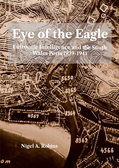
A lot of people know me as a historian specialising in World War Two and my latest book is a revised and much enlarged version of a book I originally published in 1993. Eye of the Eagle: Luftwaffe Intelligence and the South Wales Ports 1939-1941 takes me back to my original research field as a Historical Geographer investigating landscape history. Using Luftwaffe aerial photographs to study Gower landscape sent me in a different direction as I tried to understand the history behind German military intelligence activities in South Wales. Over many years I amassed a large collectionn of Luftwaffe intelligence which portays the reality of the war oiver Wales from the German viewpoint. It also provides a fantastic insight into the activities of the ports of Swansea, Cardiff, Barry and Llandarcy in their finest hour as they supported the nation’s defence and resilience. Using a combination of Luftwaffe intelligence documents and maps and local records from the 1930s, this book examines the reality of why the ports were bombed. A4 size, 170 pp, fully indexed and referenced.
My latest book will cover a bit about the history of the Luftwaffe intelligence of South Wales in the early years of World War Two. It’s been an interesting journey. The records have been mainly in German and it’s been great fun to work with old maps again as opposed to modern GIS systems which have taken up so much of my time looking at Cilfái.
Regardless of how much of a stupid idea it was, the German armed forces were ordered to prepare for an invasion of Britain in 1940. This they duly did in a thorough and orderly way. Some of the documents from that time have survived, although most were destroyed at the end of the War in 1945. I was able to get my hands on a series of Luftwaffe intelligence files and the portfolio of invasion plans of South Wales, which cover in detail why Swansea and Cardiff were bombed. They also show up the gaps in knowledge that often made bombing a waste of lives, money, and time. I can now explain the reasons behind the air attacks on Swansea and Cardiff, and what they were aiming for.
I’ll be doing a series of talks next month to launch the book. I’ll announce them here, but if you want to know more, you can always contact me.
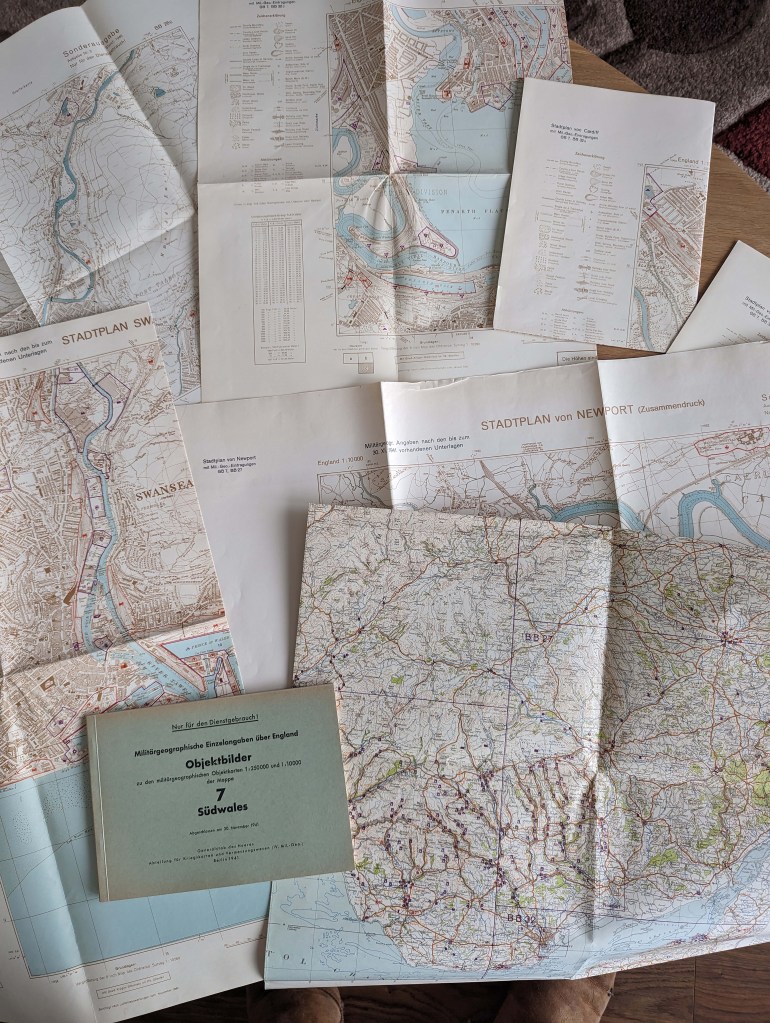
Below: A German military information pack covering South Wales from 1941.