This has now been reissued as a 2025 Second Edition. I’ve also updated the copyright and EU product compliance details.
The first version of Eye of the Eagle was published in 1993. At that time, the research was to look at local landscape history, and British government aerial photographs were prohibitively expensive for such research, whereas, with a bit of effort, the Luftwaffe aerial surveys were freely available albeit via the record offices of the USA. As a geographer, my first instinct was to look for photographs and maps that give a first impression of a landscape before experiencing the land by walking. Since those days, a revolution in information sciences has changed so much. British record offices are far easier to engage with, and online and digital sources provide a wealth of resources and historical riches that were undreamed of in the 1990s. Combining the images with appropriate GIS/GPS systems has provided spectacular insights into ancient woodland and post-industrial recovery of land.
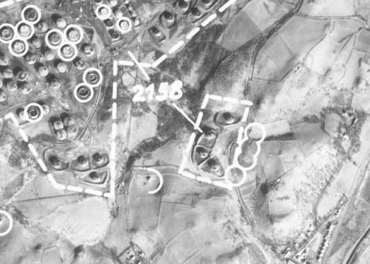
However, what has not changed is the research and writing techniques that underpin our discipline. This book has been written several times, only to be rewritten when new sources become available or are revealed in the improved access or digitisation of various records. Some of the many images and sources you will see here were rescued from rubbish dumps as organisations sought to ‘become digital’ in the early 2000s by throwing away ‘old’ records. Which explains their rather ‘worn’ looks.