These days we are often in a situation where we are forced to rely on the opinions of staff in various organisations to tell us what ‘history’ or ‘ecology’ or ‘biodiversity’ are. In and around Swansea, we have Cadw to judge what is ‘significant’ for heritage, an Archaeological Trust to tell us what is important under the ground, and a host of private companies employed by building developers to tell us what plants and animals are important. Unfortunately all these organisations can be flawed when it comes to understanding what matters to local communities. It is a deeply unsatisfactory situation. You’d expect local politicians to be more in tune with their communities, after all they were elected to do just that. However, the strong whipping of Swansea Labour Councillors over the Cilfái developments shows how impotent local politics actually is in the face of corporate ambitions.
Communities always change and their interests and viewpoints can also evolve. The toppling of the statue in Bristol shows what can happen when frustration with politics boils over. Closer to home, the issues with the General Picton memorials are an interesting response from the cultural sector who sometimes have strong impulses to react to changing community values.
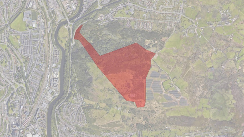
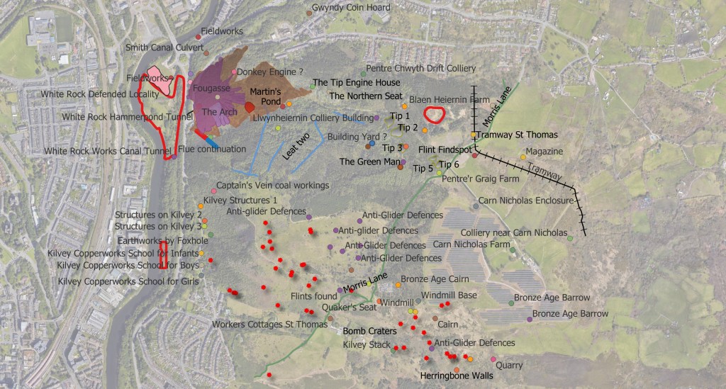
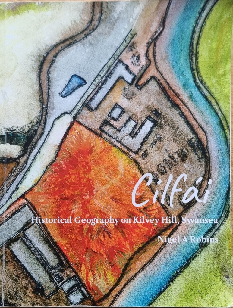
The identification of heritage and cultural features on Cilfái is clearly inconvenient to politicians and tourism developers. The neat packages of the Hafod-Morfa tourist attraction are predictable, grant-friendly, and a big hit with local builders. Not so much the ‘informal’ heritage of Cilfái. The hill is packed with history above and below ground but that won’t matter to Councillors. Features with the unfortunate characteristic of ‘being in the way’ will be dug up, destroyed or removed. It is ironic that a tourism firm from New Zealand (a country that is barely 100 years old) is leading the destruction of our heritage, much older than that little country.
What tends to get lost first are the little things, the things that people enjoy. They often get thrown away because we as residents are told they aren’t significant by the organisations that ironically are there to serve us.
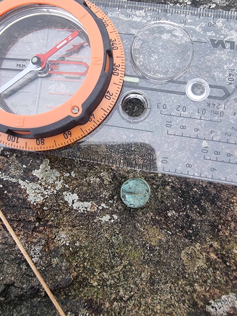
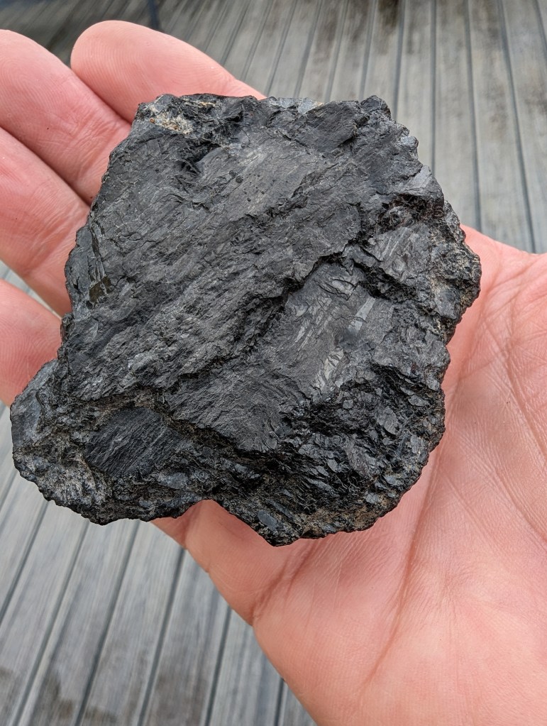
Here’s one that will probably be brushed away by a careless Skyline bulldozer. A little copper nail hammered into a rock in the danger zone. It was probably put there by William Logan as part of the early exploration of coal seams on the hill in the 1820s. I found his notebooks that told me about it. It remains as a little memorial to all the hard work and industry from pioneers in the past. The story is covered in Cilfái: History and Geography and Cilfái: Heritage Features