Some of you know I spend a lot of time researching the German Air Force (Luftwaffe) intelligence activities over South Wales in World War Two. Eventually, the Luftwaffe bombed several towns, including many attacks on Swansea. The images the Luftwaffe took in preparation for the bombing attacks are often the earliest quality photographic surveys of industrial landscape we have. The main reason I collected such a large archive of photos is because of the landscape history in them. The fact I needed to understand fully the reasons behind the images was just a part of that original journety to understand the records. I’ll be publishing a large book on Swansea and the intelligence war in May. My original Eye of the Eagle book from 1993 is here in PDF.
Anyway, the pictures of the Lower Swansea Valley taken in 1940 and 1941 are an incredible record of the pollution and devastation of the industries in the valley. Eventually, the terrible pollution was ackowledged and a cleanup started in the early 1960s as part of the world-famous Lower Swansea Valley Project. I talk about the Cilfái part in the Project in Chapter Five of Cilfái: Historical Geography .
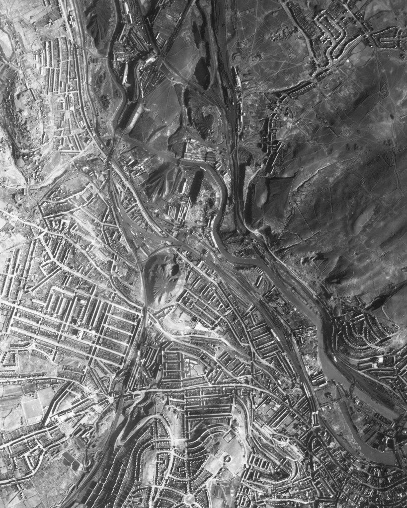
Below is one of the images in my collection from February 1941 when Luftwaffe airmen took photos of the whole town in preparation for the three nights of air attacks between 19 to 21 February 1941. In the middle of this image you can see the massive Hafod tip created by the Vivians industries. Further right are the even larger tips of the valley industries which destroyed the ecology of Cilfái and North-East Swansea. The White Rock tips are just right of centre. I don’t think there is a single tree in the upper half of this image.